Showing posts with label Big Pink. Show all posts

Sunday, June 12, 2016

Brian Libby walked the four-mile Grand Floral Parade route yesterday holding this sign. And my mini-rant about the Burnside Bridgehead's warp-speed-journey into modern ugliness. I cannot believe that years from now folks will find any on these new buildings worthy of preservation.


P6110429

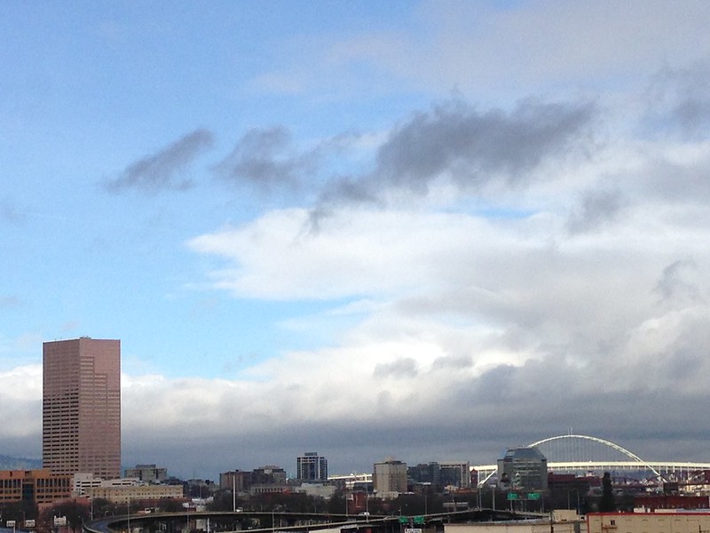
I don't know Brian Libby, but I know of him. He's behind Portland Architecture dot com. He's mightily involved with Friends of Memorial Coliseum. June 8, 2016--just days ago--that grand building was named a National Treasure by National Trust for Historic Preservation. All I can say is hooray! I hope this pronouncement helps save the building, helps it be taken care of for years to come. I've been inside several times since moving here in June, 2006, and find it amazing, fascinating, and well-deserving of living on for all to see and to take part in events held there.

From Portland Architecture published on June 9, an awesome statement that Libby quoted from Bill Walton, member of the NBA Championship Portland Trail Blazers:

Libby: . . .I'd like to share a statement from Trail Blazers legend Bill Walton, which was also read at the event yesterday:

"39 years ago this week, right here, on the banks of the powerful and majestic Willamette River, our beloved Portland Trail Blazers made history, changed the world and plotted a new path forward to the future…I was there then, as our Blazer team won the NBA championship at this magnificent shrine and temple—the Memorial Coliseum. I'll never forget that day, not only as a defining moment in Oregon sports history and my life, but also as a statewide explosion of joy, happiness and civic pride."

"Today most all of the other NBA arenas I played in have been torn down. But Veterans Memorial Coliseum still stands tall and proud because of its very special place in our lives and as a one-of-a-kind work of architecture."


"Today I'm happy to take this well-deserved and long-overdue moment to celebrate with the Friends of Memorial Coliseum, the National Trust for Historic Preservation, the Portland City Council, and all Oregonians as our wonderful Coliseum is officially named a National Treasure."

"Although basketball will always be the first thing I think of when I reflect on the significance of this building, it is so much more than that. Its world-class design with natural light pouring into the arena, is an important and enduring tribute to the brave veterans who gave their lives and everything else for us in both World War II and the Korean War."

"I'm a proud, loyal, passionate and grateful man—whether it's for the beautiful game we call basketball, the rapturous power of music, especially when created by the Grateful Dead, or the natural beauty of my second home Oregon. You can also add our Veterans Memorial Coliseum to that list: a landmark that continues to inspire each and every one of us, and a place where we can all come together in joyous harmony. The spirit of '77 lives on, in and with this spectacular Coliseum. And with the powerful actions and commitment that we display here right now, we know that that will thankfully be true for generations to come."

"And forever more, I will always be able to say, that yes—I was there … In the spring of 1977 … And also today—the day we saved our Glass Palace."

"Thank you Portland … Thank you Blazers … Thank you Oregon … Thanks for shining the light … Thanks for being the light … Thanks for making my dreams come true."


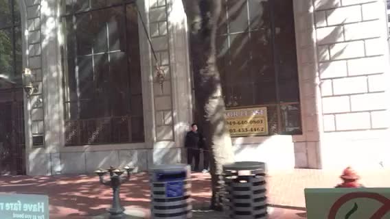
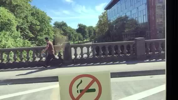
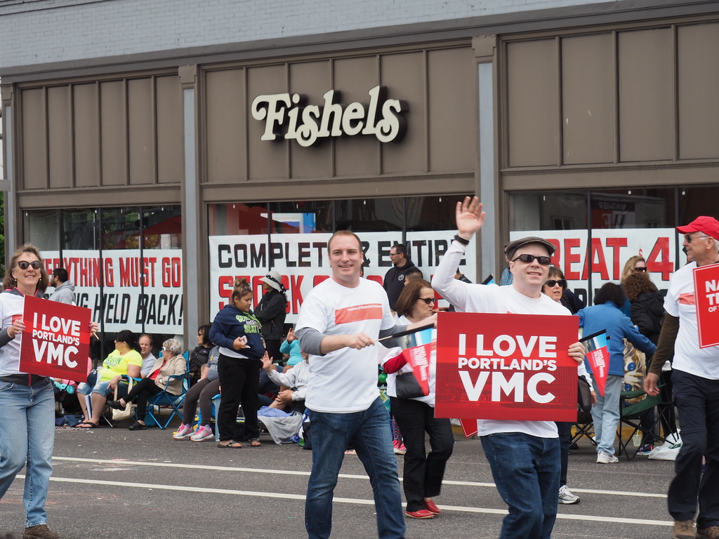
It's ironic that I had moved from my initial place watching the parade, around the corner and onto Burnside, and got to take this photo of Brian with Fishel's in the background.

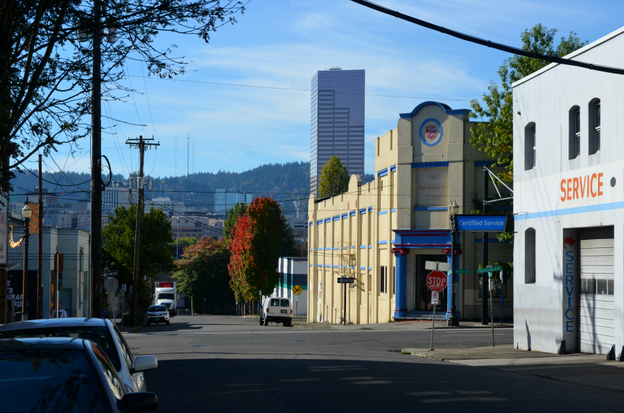
April 30 it was announced that the furniture store will close after 95 years in business. The 100-year-old building possibly breathes its last breaths now. The Oregonian reported on June 1 that it could disappear if plans are approved to build a 17-story mixed-use building there.

If you had been Rip-Van-Winkling the last year or so and just woke up, you wouldn't recognize the east end of the Burnside Bridge, known as the Burnside Bridgehead.

PA200032

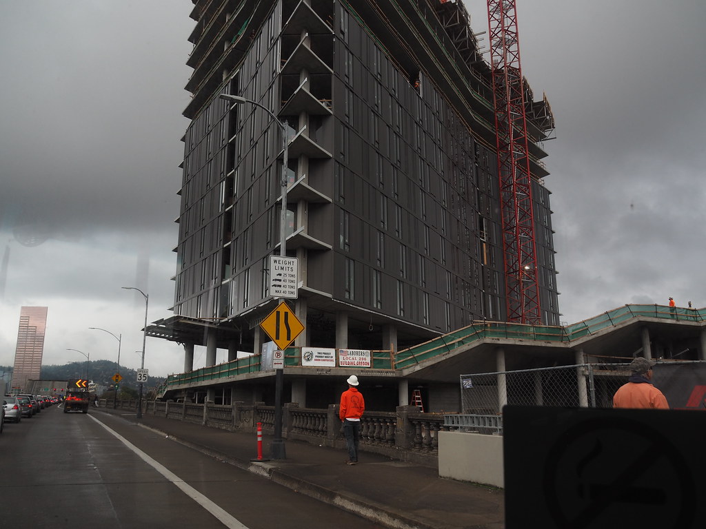
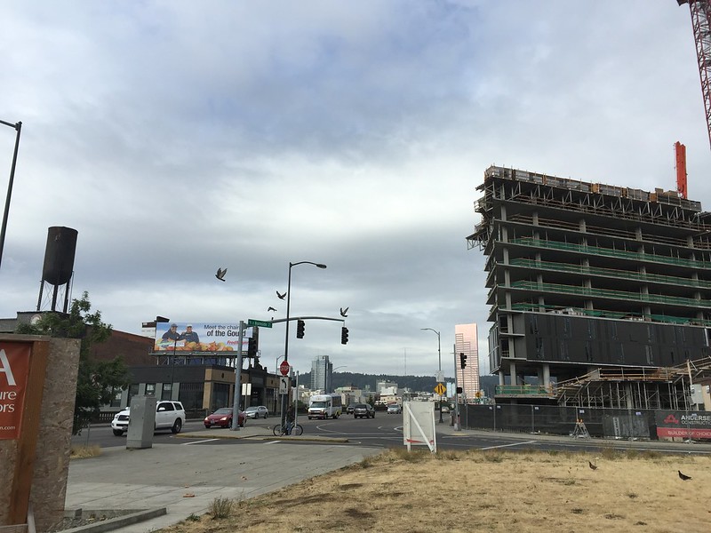
Yard is jammed up beside the north sidewalk on the Burnside Bridge.

PA140003

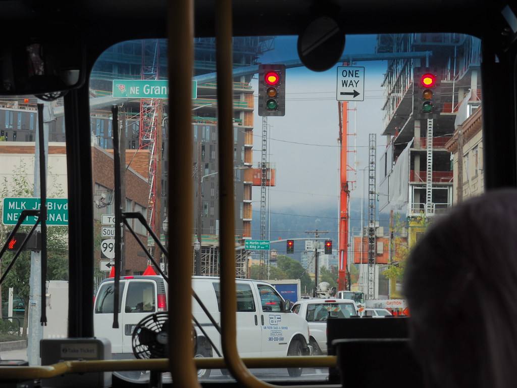
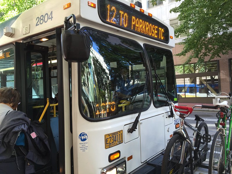
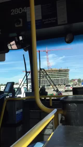
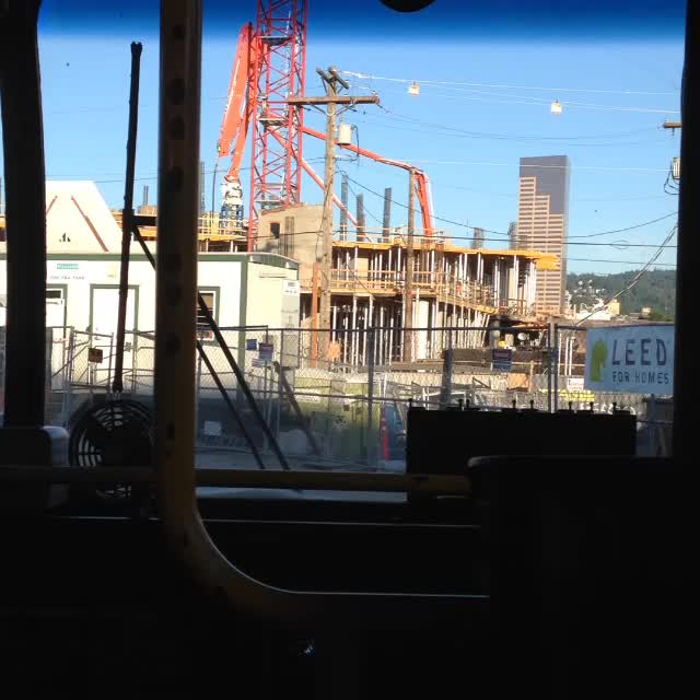
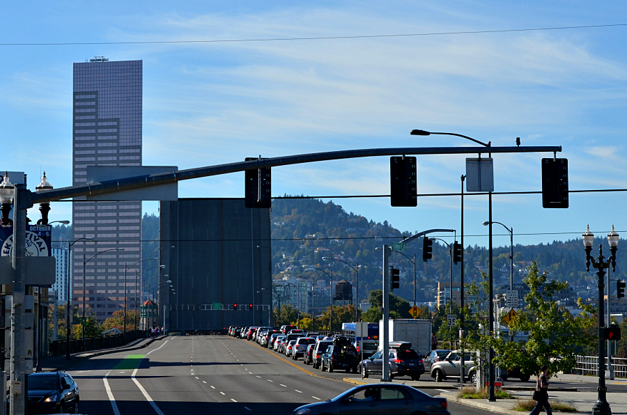
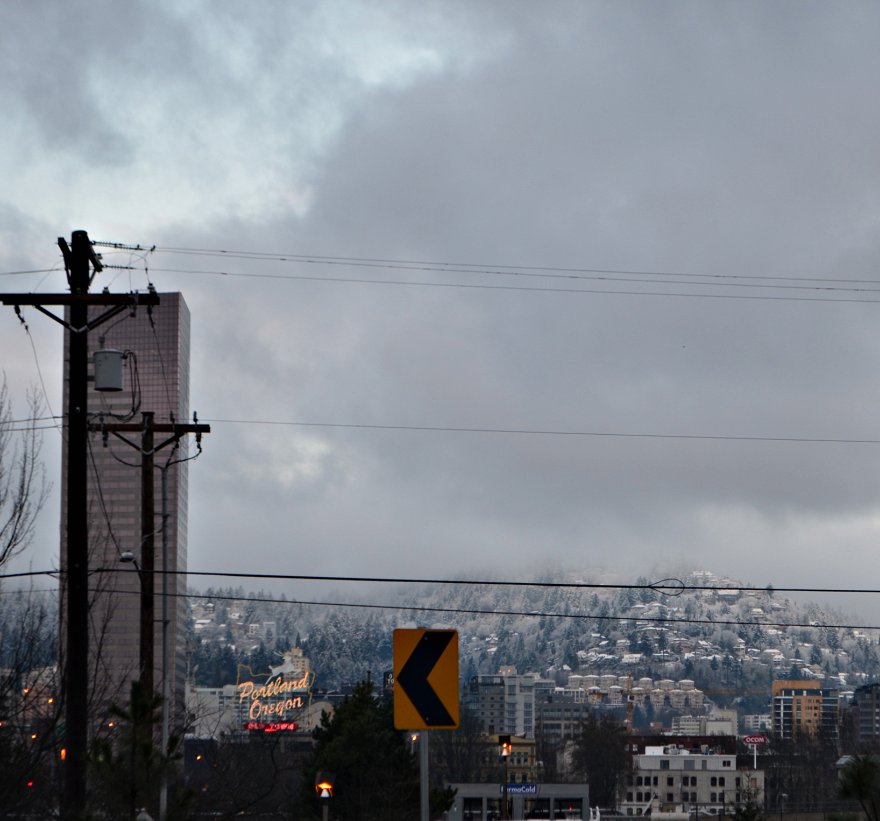
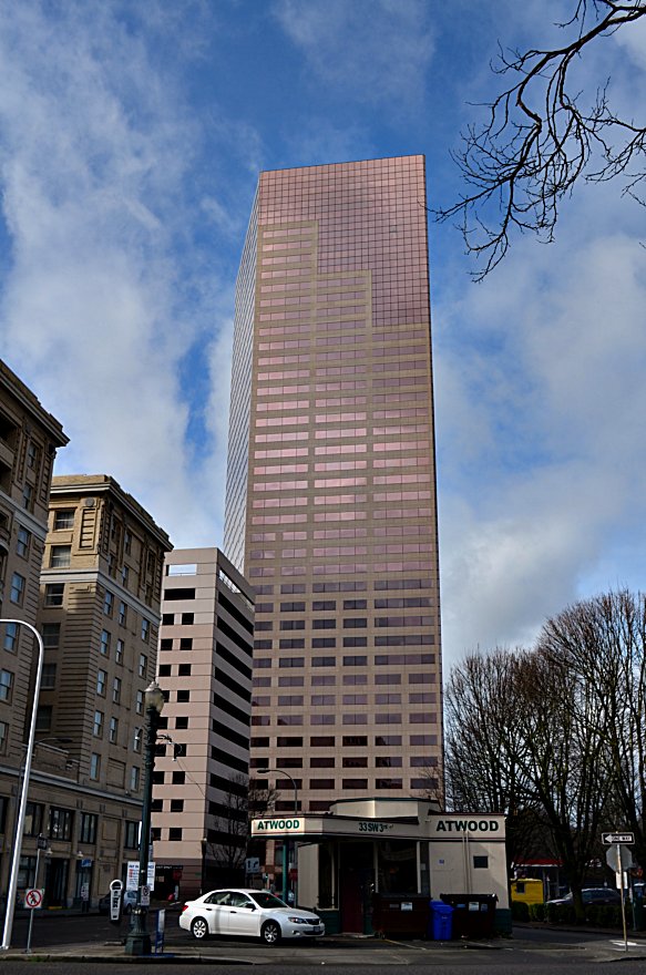
I took this photo one morning on my commute through the TriMet bus windshield. You can see that it completely blocks my beloved view of the Big Pink and the Portland Oregon neon sign that I had enjoyed for several years of commuting west on NE Couch by TriMet bus. No longer is the intersection an inspirational way to begin my day; it's a gosh-awful hodge-podge of modern ugliness.

24215450716_55a39e704a_o_BF

I flat-out do not like the changes going on in every direction. Besides being ugly buildings, the housing units they hold are priced too high for regular-job-holders. I don't care if the 21-story Yard had a number of apartments set aside for households with incomes of up to 60 percent of the area's median family income--57 out of the 284--that's a pitiful, insulting toss of crumbs to Portlanders who deserve affordable housing options.

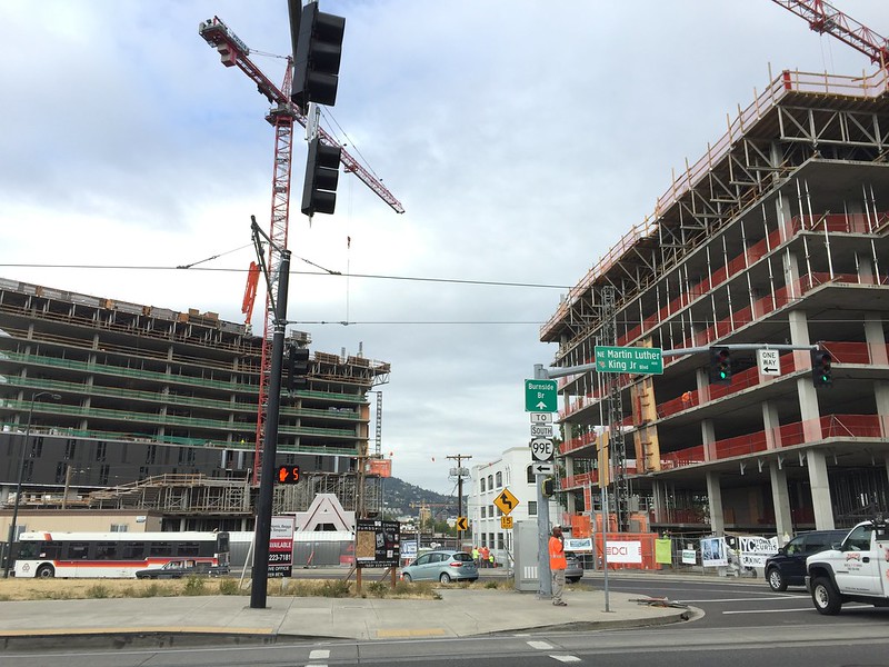
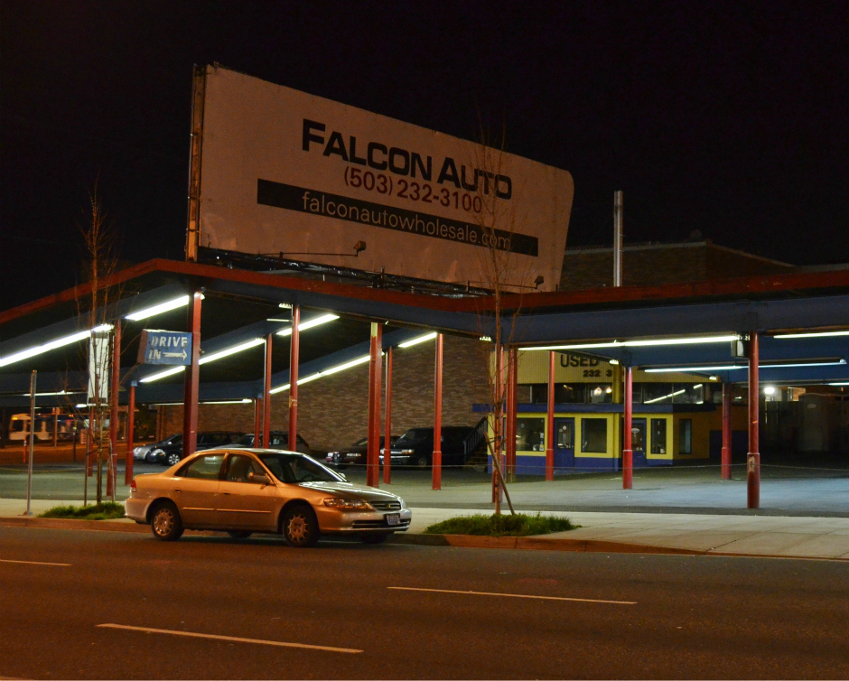
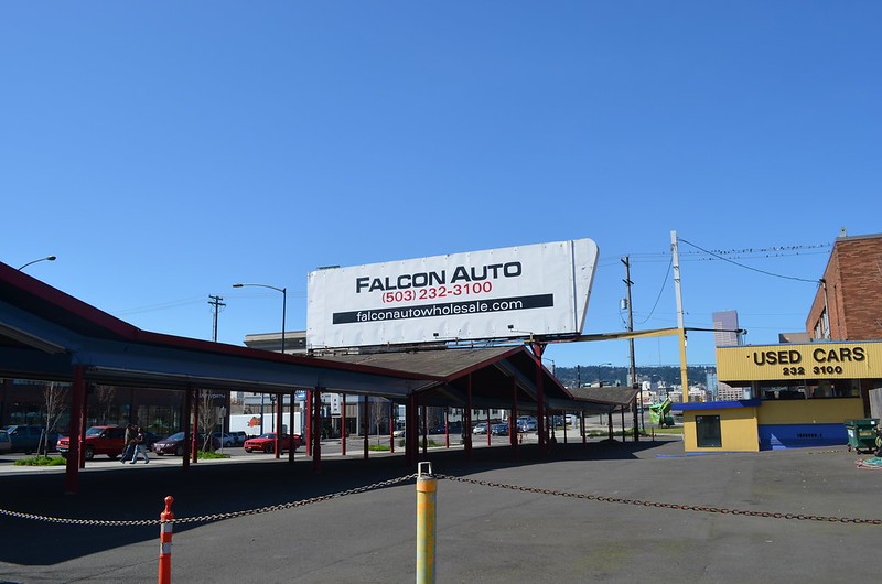
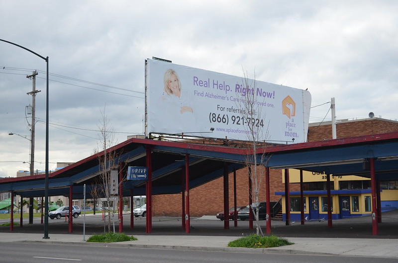
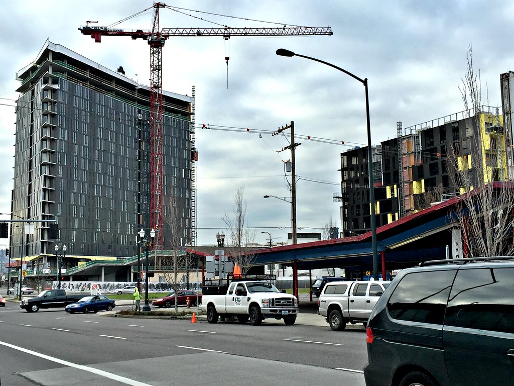
Besides the possible replacement of Fishels, one more is going up on Burnside between MLK and Grand--in the photo above, notice the red and blue angular roof-line--it was part of a used car lot which is gone now, a huge hole filled with the footings of what will become an L-shaped building; another one is supposed to go up across the street north of Yard--it will obliterate the view of the sky between Yard and that other ugly building going up on the right side of this photo; one more is going up in a tiny, odd-shaped bit of grass in front of Yard--it's that bit of bright green you see to the right of the person in the chartreuse-colored jacket. When I changed locations to watch the parade yesterday, I noticed that digging had begun. I believe this little bit of green should have been left along, should have been made into a lovely park where folks could relax a bit amid the ugliness and the traffic which will only increase at what is already a busy bunch of intersections within a few blocks of each other.

I'll stop here and not get on the soapbox; it's a lovely early Sunday morning here in Portland, and I need to get outside for a little while.

I won't go without saying thank you to Brian Libby and every other person who works tirelessly for preservation of our architectural treasures here in Portland, who want our fascinating neighborhoods to remain recognizable, who want new construction to fit into those neighborhoods instead of appearing like gashes in their very fabric. It's not that we don't want to house everyone here, we just want to do it in a responsible, affordable way that respects our beloved Portland.

Tuesday, September 8, 2015

UPDATE and the after-work commute today

UPDATE: I made it through work today without any problems--hooray! Soon I'll be back in the recliner at the Oncology Center for Chemo Round Three. I wonder if it will be different, the side effects. Or, will it be much the same as Rounds One and Two? We'll see.

iPhone pix

After work today, I missed the streetcar, so I took the 4 bus across the Hawthorne Bridge to wait for the 12 that I would then ride the rest of the way home. Here we are looking south on SW 6th Avenue. Where's that next bus? I like to be in downtown, so I do this most all of the time after work when I'm there full time because the bus gets filled up with folks coming out of downtown office buildings. That means if I were to ride the streetcar or a bus north on SE Grand to change at East Burnside like I did last week in the middle of the afternoon, I'd be waiting on a 12 or 19 bus with no seats available. I'd rather go west across the river, then end up going east to make certain that I get a seat. It's safer to ride sitting down than standing up, in my opinion.

Untitled

Ah, there's the 12 at the other end of the block. Why? I know. It's shift change, from driver to driver. When I walked by after getting off the 4 bus, I had noticed a TriMet employee sitting on the sidewalk with his back leaned against one of the huge concrete planters that dot the streets of downtown Portland. When I noticed the 12 pull in, I put two and two together and came up with shift change. I've been riding the bus since July, 2006, and often make correct guesses as to what's going on after observing lots over time.

iPhone pix

Curbside service, thanks to TriMet and the 12 bus, y'all! I only had to wait seven minutes, total; I spent the first few minutes sitting at the bus shelter, but the sun shined on me too directly which I knew I didn't need to have happening, due to the chemotherapy, so I ended up standing where I figured the bus would come to a stop in order for all of us commuters to board.

iPhone pix

I decided to put my phone on, I guess you call it Facetime, so that I could hold it up to the window and catch some candid shots, maybe a video. Here's a photo that I cropped because about a third of it was of the inner wall that separates this window from the next one. I like how this turned out! The shelter and the stop are at the MAX Green and Yellow Lines' stop beside Pioneer Courthouse on SW 6th between SW Yamhill and SW Morrison. Pioneer Courthouse Square is directly across the street.

IMG_7776

I like this video! The building is one of A. E. Doyle's best, in my opinion--it's my favorite--the Bank of California built in 1924. I wish I were filthy rich 'cause I'd love to own it! The video ends as the 12 pulls to a stop at the bus shelter in front of a restaurant called the Original Dinerant on SW 6th. The next building north is the Big Pink. I've eaten at the Original twice, but that was at least two or more years ago. The food was good, sort of expensive if you don't make Happy Hour, and I might stop there some time in the future before I go to a Portland Trail Blazers' home game. I would then catch the MAX to the game at the stop beside the Big Pink.

IMG_7777

Here's a video as we head up the slope of the Burnside Bridge and on across the Willamette River. I stopped the video sooner that I meant to, but that's OK. You get the idea of how the bridge railing looks, as well as the sidewalks. At the beginning of the video, the bridge approach is above downtown streets and the Tom McCall Waterfront Park, thus all of those trees.

IMG_7778

Finally, here is a video shot through the windshield, showing you the new building being built at the east end of the Burnside Bridge, right up against the north side of the bridge. The building's name? Yard. Just Yard. Not The Yard.

Monday, August 31, 2015

UPDATE and I made it to work and back today!

UPDATE: I worked today from 10:30 a.m. to 2:30 p.m., without needing a nap, dining on tidbits of cheese and crackers and fruit at my desk while I kept working--four hours means you don't qualify for a lunch hour, but I certainly didn't need one, and I know beyond any doubt that I'm not ready for however many hours you need to work to qualify for a lunch hour. I rode the bus to work with one transfer and not too far to walk from that last bus to the office. I rode the streetcar--boarding it right in front of the office, then transferred to the bus for the last leg of the home-bound commute. When I got off the bus two and a half blocks from home, I walked straight into Subway and got a six inch tuna on wheat with lettuce and tomato, a individual-sized bag of chips, and a cup of Coca-Cola. I walked on home, sat down in my apartment, and ate all of that Subway stuff. Now I'm ready to make an effort to stay awake until bed time and do it all over again tomorrow. Well, not the Subway part probably. I need to cook something to eat, but I'm not sure I'll have the energy this evening. We'll see. Thanks for every single prayer--I felt each one!

iPhone pix 083115

When I got off the bus at NE Couch and NE MLK to transfer to another bus for the rest of the work-bound commute, I saw the progress that has been made in building these two. I just read online that the one on the left will be 21 stories tall and is named Yard, not the Yard, just Yard. I'm not very happy about the changes in the view, nor am I happy about what the apartments in these two are likely to cost. Too many people are no longer able to live in inner Portland unless they have high-paying jobs. I believe that the city commissioners have dropped the ball about affordable housing in Portland. Shame on them.

IMG_5730

Here's a short video that shows how the taller building on the left looked on June 10. Oh, well. I hope the building turns out to be not as ugly as lots of those which are being built in Portland's residential neighborhoods, also with crazy high rents, things like $1400 for a 570 square foot studio!

iPhone pix 083115

Not happy to be missing the Big Pink, I walked down to the corner for a look across the Burnside Bridge and took this photo to show you what we're missing.

iPhone pix 083115

Here's how I looked right after I arrived at the office today. Ready to go! I'm holding up my bus pass which we get for free--the best perk I've ever had--with its brand new 2016 sticker. The 2015 one expired today, so I'm thankful that I got to go back to work today early enough to get it before signing in at work.

Tuesday, April 14, 2015

I want to get inside more buildings and take photos from a higher plane.

DSC_0356

March 4, 2013, I took off from work and attended the tour attached to the Benson Hotel's 100th anniversary. The best part, being able to go into empty hotel rooms, look around a bit, then take some photos through the windows. I'm looking northeast here. Notice on the skyline the rounded top of Mount St. Helens, still covered with snow? See the black, open-work towers of the Steel Bridge sticking up above that red brick building?

Best of all, this view of the Big Pink. I know, I know. It doesn't look pink this time--it's more a taupe color, in my opinion. I like that you can see that the corner is not a 90 degree angle. (Read more about both in the next paragraph.) Fun fact: My two sons Lamont and Leland used to prep and cook at the Portland City Grill which takes up the entire 30th floor of the Big Pink. When Mama and I visited Portland for the first time in the summer of 2004, we stayed at the Benson Hotel and got to tour the Portland City Grill in the morning before it opened. I think it was July 4, but I cannot remember for sure. I love that places and sights I remember from that first visit are in my life, almost daily in some instances--my work commute involves the Big Pink, morning and afternoon. Sweet.

Here's more about the Big Pink's design, including the glass and the granite. Perhaps the most unusual features of the U.S. Bancorp Tower are its shape and color. Pietro Belluschi, consultant on the building, was most concerned about the play of light and shadows on its surface; meanwhile, the designers, Skidmore, Owings and Merrill (SOM), had to work with a uniquely shaped lot due to the street grid. Because of the street grid, the tower features no right angles in its parallelogram footprint. This, in turn, makes it look either extremely slender or wide depending upon one's viewing angle. Belluschi carefully selected the glass and granite for the exterior facing. The pink granite covering the building was quarried in Spain. The Pittsburgh Plate Glass used for the windows is also pink, an effect caused by its being "glazed in a semitransparent coating of copper and silver that looks pink from the outside." The windows can absorb or reflect light depending upon how much light is upon them, while the surrounding granite may appear darker or lighter than the window panes, depending upon the time of day. The unusual color earned the building the nickname "Big Pink."


Monday, November 24, 2014

The only constant is change, right?

-->

DSC_0138

I'm standing in an area labeled the Burnside Bridgehead, at the east end of the bridge. See the backside of that giant A? It stands for Andersen Construction which recently started construction of a building on what is known as Block 67, very close to the north side of the bridge itself, in between NE 3rd and NE 2nd which run parallel with the Willamette River. Notice the Portland Oregon sign across the river, just visible between the A and the black pole? The Big Pink across the river, coming out of the top of the A? Well, before this new building is completed, maybe by the estimated date of May, 2016, I'm certain that neither one will be visible from where I stood on November 15, 2014, to take this photo--a great deal of this view of downtown Portland will disappear, available only to those who decide to rent an apartment in the building--I haven't discovered its name yet, but plans call for it to be a 21-story apartment tower on a 0.76 acre site; Skylab Architecture designed the building which is far from your typical tower in its shape. It's supposed to have 284 apartments on the top 16 floors. On the remaining floors, retail and commercial space, plus 202 parking spaces. Planned building amenities include a community plaza with a barbecue area, bike parking with repair station, technology lounge, pet exercise area, fitness center and spa. I read one place online that the intention is to offer 20% of the apartments to residents making 60% or lower of median family income, in an effort to respond to the growing need for workforce housing. Is that really going to happen? Oh, and just on the other side of that fencing, in between NE 3rd and NE Couch (the street in between me and the fence) there will be another building built which will be either two or three stories, commercial use only. I read it described as a spit of land, labeled Block 76W these days.

Sunday, April 13, 2014

Fremont Bridge

IMG_2180

On a rare bright sunshine day in March I happened to be on the rooftop garden at work for my morning break. When I walked out and saw the sunshine lighting up the Fremont Bridge, I immediately took this photo with my iPhone 5. I cannot remember ever seeing this, and I've worked in that building since June, 2006. Not that I'm on the rooftop garden every single work day, but you'd think I would have seen it at least one other time in all of those years.

Friday, March 21, 2014

See what prompted me to get off the 20 bus on East Burnside last Saturday


An enclosed tricycle. What do you think of it? While I think it is so cute, I myself cannot imagine being out in regular traffic in it--even with bike lanes--mainly because I cannot imagine riding a bicycle or a tricycle in traffic, period. Someone parked it here, beside the bike rack--that blue bar--so someone rode in it.


Once I walked across East Burnside onto NE 16th, I stopped to take this photo. Now I see that the enclosed trike is in between two bike racks; I wonder why it is not locked to one of them? Hmmm. Look ahead on the sidewalk and you'll see a bicycle waiting for its rider. I wonder if it is locked to a bike rack? Oh, one more thing to notice in this photo that I took in Northeast Portland. Beyond the green street sign and the yellow one with the arrow on it, see what looks like a tall building? That is the Big Pink which is on the west side of the Willamette, a mile and three tenths away! So cool to find the unexpected in a photograph!


Closer view of the back of the trike. It's an interesting piece of machinery.


Wednesday, October 16, 2013

Director Park, downtown Portland, blue sky and clouds


Click here for a trip to City Daily Photo, transporting you around the world every day.

DSC_0029_PM

October 8, 2011, a Saturday. Walking around Director Park, I looked up at the glass canopy and decided to take this photograph. I liked how the blue sky and clouds looked beyond the various buildings north of the park. Especially pleasing to me is the Big Pink peeking at me over towards the right edge of the photo. I'm standing at a diagonal from it, near the corner of SW Yamhill Street and SW 9th Avenue.  Click here for  Director Park Commonly Asked Questions. Gosh, I like that phrase a whole lot more than FAQ.

Monday, October 14, 2013

The short-lived snag

Click here for a trip to City Daily Photo, transporting you around the world every day.

I know I promised this on Sunday, but I didn't feel very well all day--felt a chill, didn't even make it to my Northwest Film Center's Reel Music Festival documentary, THIS AIN’T NO MOUSE MUSIC!

DSC_0909_PM

I walked to the corner of SE Grand Avenue and East Burnside. When I stopped at the bus shelter, I immediately noticed that the Burnside Bridge was up. The snag. I'm on the east side of the Willamette, waiting for an eastbound bus which is coming from the other side of the Willamette River. I took this photo at 3:02 p.m. By 3:07, the bridge was closed and traffic appeared in the eastbound lanes. Naturally, I don't know the entire length of time that the bridge was open, just the span of time from when I saw it completely open until it was completely shut--I'd say five minutes is a short snag when something that huge is involved! Soon the bus came and I rode home. In another example a serendipitous positioning of structures in a photo, look at the line up here--the Big Pink, the Burnside Bridge's Italian Renaissance tower where sometimes there is an operator inside, and the open bridge structure. I'm a huge fan of serendipity!

I'll never forget the first time that I drove west on Burnside back when we lived in Northwest Portland. I was headed across the river, can't remember why now, but as I got closer to the bridge, my mind filled with confusion as I realized cars were stopped in front of me. Then I saw a big shape on the horizon and thought, "They're moving a house across the bridge. Nope! That's the bridge! It's up!" My first time ever to approach an open bridge in Portland. What a treat!

Here's information from the Multnomah County Web site about the Burnside Bridge:

One of four Willamette River crossings built in Portland during the "Roaring Twenties," the Burnside Bridge stands in age right behind the County's Hawthorne and Broadway bridges.

This 1926 structure is located on one of the longest and busiest streets in the Portland area. The five-lane Burnside is a direct connection between downtown Portland, Beaverton to the west and Gresham to the east. Last year, about 40,000 vehicles a day used it. So did more than 1,000 pedestrians and bicyclists each day.

In addition to its important daily work load, Burnside plays a key role during emergencies. Burnside Street and bridge are designated as an official emergency transportation route. The bridge, as part of this "lifeline corridor," is the one non-freeway river crossing which emergency vehicles and suppliers are asked to use.

Burnside's artistic side

The three-span Burnside is a historically significant structure. It is the only Willamette River bridge in Portland designed with the help of an architect, a result of the early 20th century City Beautiful Movement that called for adding architectural ornamentation to engineering designs. The bridge's distinctive Italian Renaissance towers reflect the trend. Burnside is eligible for the National Register of Historic Places and protected by preservation laws. Originally designed by the firm of Hedrick and Kremers, Burnside was completed by Gustav Lindenthal (1850-1935). Burnside's opening mechanism, or bascule, was designed by Joseph Strauss (1870-1938), whose Golden Gate suspension bridge would open 11 years after Burnside.

The Burnside Bridge main river structure consists of two 268-foot side span steel deck truss side spans and a 252-foot double-leaf Strauss trunnion bascule draw span. The bridge originally had six lanes of traffic, but in 1995 the City of Portland requested that bike lanes be added to the bridge, so one lane of traffic was converted into two bike lanes. There are sidewalks on both sides of the bridge. The overall width of the structure is 86 feet. Vertical clearance of the closed bascule span is adequate for the majority of river traffic, with openings necessary only about 40 times per month.

Only minor modifications have been made to the bridge since its construction. Electric street car rails were removed in the late 1940’s, lighting and traffic control devices were updated in the late 1950’s, automobile traffic gates were installed in 1971 and the bascule pier fenders were replaced in 1983. Several deck resurfacing projects and expansion joint repairs have also taken place.

The east approach to the bridge is approximately 849 feet long and has two distinct types of construction. The first eight spans consist of steel plate girder spans ranging from 75 feet to 106 feet in length. The steel girders and steel interior floor beams are completely encased in concrete. A concrete deck spans the floorbeams. The next seven spans are composed of concrete stringers spanning continuously over concrete columns and floorbeams. Six of these spans are 22 feet long and one is 40 feet long.

The west approach is approximately 604 feet long and consists of 19 reinforced concrete spans ranging in length from 22 feet to 62 feet. The first 13 spans average 22 feet and consist of reinforced concrete stringers acting continuously over concrete columns and floorbeams. The next three spans average 40 feet in length and are of similar construction. The last four spans are 62 feet long and consist of four main simple span concrete girders that carry interior concrete floor beams and stringers. A concrete deck is cast with the girders, stringers and floorbeams.

And a bit about a bascule bridge:

Bascule bridges have sections that rotate upward and away from the centerline of the river, providing clear passage for river traffic. Side-by-side on the Willamette River in downtown Portland, the Morrison and Burnside Bridges are two examples of bascule bridges. These two bascule type bridges have a very clean, uncluttered look to them because the counterweights and operating machinery are located out of sight in the piers supporting the bridge. The Morrison Bridge is a Chicago-type bascule bridge, and the Burnside Bridge is a Strauss-type bascule bridge.

Saturday, October 12, 2013

Fall foliage and the Big Pink--can't get much better on a blue sky Saturday

Click here for a trip to City Daily Photo, transporting you around the world every day.

DSC_0906_PM

Last Saturday after my volunteer work at the Architectural Heritage Center was done, I walked north on SE Grand from SE Alder to East Burnside. My intention, to catch the next 12 or 19 bus home, struck a short-lived snag, but on the way I got to take this fall foliage, Big Pink, colorful Central Eastside Industrial District photo. Crossing SE Ash, I noticed that if I stood in just the right spot, I could make it seem that the Big Pink came up out of the corner of that vintage building painted a pale butter yellow. (I read something recently about plans to tear down the pale butter yellow building and put up some sort of taller building. I am not happy about that. I hope it doesn't happen.) Anyway, I check the traffic signals and the traffic, then stood in the street and took myself this photo. Success! By the way, the Big Pink is on the west side of the Willamette River, and I'm over on the east side taking this photo, almost a mile away! Come back Sunday for a photo or two of the short-lived snag.

Wednesday, April 10, 2013

April 10, the movement of pigeons and automobiles. Where have they gone?

Click here for a trip to City Daily Photo, transporting you around the world every day.

DSC_0360_PM_alt

On January 26, 2013, I noticed the pigeons once again swirling above the intersection of NE MLK and East Burnside, at the west end of the used car lot. I've seen them off and on since I moved to Northeast Portland in January, 2011, flying in all directions at this intersection, sitting on the wires between utility poles and on the billboard above the mid-century roof of the used car lot. Once I had seen the pigeons being fed by a man as I stood at the bus/streetcar stop just a few steps to the right, out of this photo. On this particular day, I happened to discover that the man feeding them came out of the office at this used car lot. See several photos on this topic, below.
  DSC_0237_BF_fill_light.jpg_PM_rsz

The evening of March 23, on my way home after the members' party at the Oregon Rail Heritage Center which is south of here, imagine my surprise when I saw this sight  from the bus shelter on East Burnside. No used cars beneath the roof, just a few left at the back edge of the lot, far from the street. When had someone moved the cars? Why? A quick Google revealed no online evidence of going out of business connected with this business. A mystery.
  DSC_0207_PM_alt

Here's a photo that I took on March 29, trying to capture the vast emptiness of the lot. I like that the Big Pink towers in the background, several blocks past the other end of the Burnside Bridge, less than a mile from where I stood to take this photo.

DSC_0347

Back to the pigeons and their movement. The original billboard, pigeons perched, taken on January 26. 
  DSC_0348_PM_alt

The pigeons take flight because the man who feeds them has come out of the office and is walking west, to feed them across MLK, just south of the bus/streetcar shelter where I had seen once while I waited to transfer from one bus to the other. Can you see him? He's towards the bottom left corner of this closely cropped photo, smack dab between two poles. 

DSC_0353_PM_alt

Once he's tossed all of the bird food onto the sidewalk, the man crosses the street and goes back to the office. The pigeons ignore his movement, way more interested in eating  than in following him. I suppose the actions of these pigeons prove that they are capable of learning. 
  DSC_0213

The original billboard, minus the pigeons along its top edge--they're over to the right on the utility wires. I bet they're wondering what's happened to the man who used to come out of that yellow structure with the blue roof, carrying an orange bucket of bird food for them. 

DSC_0029

Another surprise. The new billboard, photographed on April 2. One pigeon perched.

Monday, January 7, 2013

Seen from the Portland Streetcar

Click here for a trip to City Daily Photo, transporting you around the world every day.
DSC_0068

Since the streetcar has a dedicated lane for its tracks right beside the sidewalk, taking photos through its windows can result in some good shots, unless the reflection overpowers what you're trying to photograph. Luck was with me when I took this photo on Saturday, September 29, 2012, while riding east over the Broadway Bridge on the Portland Streetcar's Central Line. 

Notice the bicyclist in the lower left? Many Portlanders commute across Portland's bridges, the ones which have bicycle lanes and/or sidewalks and are open to more than vehicles. Lots of folks ride on the weekends, too. And don't think they only ride in blue sky weather. Nope. I see them riding in the rainy, cold days throughout winter.

For me, a highlight of this photo is the 1896 Union Station and its recently renovated roof--an article in The Oregonian identified the work as an upgrade, pointing out that it was the first one since the 1930s and that it was needed because of the roof's condition which meant that buckets could be found here and there inside the station, filling up with dripping rain. 

The Big Pink, the tall building to the right of center, stands within walking distance of the railroad station--seven blocks--or a short ride on the MAX Yellow Line which is the MAX line that I take from downtown to the Portland Trail Blazer home NBA basketball games at the Rose Garden Arena--the MAX Yellow Line crosses the Willamette River on the Steel Bridge which is south of the Broadway Bridge and just out of sight to the left of this photo.

The curving street is NW Broadway, until it crosses West Burnside at about the vanishing point of the pavement in this photo, then it becomes SW Broadway. Burnside divides Portland into north and south, while the Willamette divides it into east and west. 

On the right edge of the photo, the building you see a portion of is the main US Post Office for Portland. 

Thursday, March 8, 2012

Northwest Hills, March 6, 2012

DSC_0376p_p_sharpened_cropped_HDRish
Deja vu? Sort of. Here's the same view as yesterday’s post. No snow. The Portland Oregon sign's not lit. Still, that bluish tint near the tops of the hills caught my eye, so I had to get my camera out and take a few shots. I am so blessed to have that camera with me in either my backpack or my purse. Blessed. Taking photos adds a large part to however sane I am at any given time.

Wednesday, March 7, 2012

Northwest Hills, March 1, 2012

DSC_1071p_cropped_sharpened
I change from one bus to another at the intersection of SE MLK and SE Couch. I'm standing in Northeast Portland when I wait for that second bus. Often I look west across the Willamette River, towards the Big Pink and the venerable Portland Oregon neon sign. The Big Pink is south of West Burnside, so it is in Southwest Portland. The Portland Oregon sign is north of West Burnside, so it is in Northwest Portland.

This particular morning snow had fallen at the higher elevations. The wintry view enticed me to quickly get my camera out of my backpack and take a few photos. Would that I had had more time. Alas, the bus arrived. My responsibility--to get to work on time.

Friday, February 24, 2012

Big Pink, another modern piece of architecture which totally fascinates me.

DSC_0509_p_sharpened_color
I cannot remember the term used to describe what's going on with the building in the left corner, the Embassy Suites which started out as the Multnomah Hotel. I believe the same thing impacts the building (a parking garage maybe) which stands between the hotel and the Big Pink. You see, my simple goal as I stood facing west on SW 3rd Avenue on Saturday, February 18, 2012, was to enjoy the glory of that huge blue sky, a sight almost unseen during a Portland winter. Naturally I noticed the Big Pink. Had to take photos, just had to take photos, hoping to catch the sky and the building at their best.

Once I had downloaded the photos to iPhoto, I noticed a bit of serendipity--at first glance the alignment of some floors of the Big Pink seem to meet the building to its left in the photo, the one which I think is a parking garage. Makes it look like the two buildings are connected, doesn't it? Actually they rise on opposite sides of SW 5th Avenue.

Image altered at Picnik, Basic Effects, Sharpen and Color.

Thursday, December 22, 2011

It's all in how you look at it.

DSC_0524p
Big Pink and a parking lot sign. The sign is on the southeast corner of SW Broadway and West Burnside. Big Pink is exactly one block east of the sign. I used the tilt feature of my camera so that I could take a satisfactory look from this unusual angle. I've cropped the photo and used the HDR-ish special effect at Picnik. By the way, Big Pink is either 536 or 546 feet tall and is the second tallest building in Portland. I found both heights on the Internet, so who knows. I do know I've been on the 30th floor, which is not the top floor, to the Portland City Grill. See views from the PCG here and here.

Friday, September 23, 2011

A few more views from on high

August 23, the afternoon found Milton, Kay and me in downtown Portland on the 30th floor of the Big Pink, at the Portland City Grill. After a snack and a drink, I stood up and walked from the bar to the dining room to take a few more photos.

DSC_0100p_exposure_altered_sharpened
Looking northeast across the Willamette River. The rust-colored bridge is the Broadway Bridge. The sweeping arched bridge is the Fremont Bridge. And in the foreground is the magnificent Union Station which is undergoing some sort of work on its exterior. I altered the photo in Picnik with the exposure and the sharpness tools.

DSC_0104p_HDRish_frame_800
Looking more north than east across the Pearl in the forefront and a sort of light industrial area that brackets the train tracks as the head north out of downtown Portland, not far from the river. See there in the distance where the hills meet the river? Two dark, upright shapes? Just to the left of the leftmost one, there's a dimmer upright shape. And between the two dark, upright shapes there is a dim shape that goes from the dimmer upright shape on to in between the two dark, upright shapes and parallel with the surface of the river. OK. The two dark, upright shapes are part of the Burlington Northern Railroad Bridge, a truss bridge with a vertical lift. The dimmer upright shape and the dim shape parallel with the river are part of the St. Johns Bridge, a photo of which is included in my September 19 post. When I rode the SP 4449 on July 3, we crossed the Willamette River using that railroad bridge. Milton and Kay crossed it as they entered Portland. I altered this photo with the HDR-ish effect and put a frame around it.

DSC_0112p_exposure_sharpen
Looking straight down to the east at Voodoo Doughnuts' original location on the corner of SW 3rd Avenue and SW Ankeny Street. See the tiny people in line from the red truck, along the front of the building and ending almost beneath the pink sign? Those are a few people in line for doughnuts in the middle of the afternoon--that's the hold that Voodoo has on folks, some folks anyway; to tell you the truth there are usually a whole lot more people in line. And the small, almost school-bus-colored items side-by-side in SW Ankeny are actually wooden picnic tables, while the black and white spots farther on are actually umbrellas over additional picnic tables. Portland decided in late July to make this portion of SW Ankeny car-free, a sort of patio area. The bit of a bridge that you can see on the left is the Burnside Bridge. See the MAX train in the trees, about two thirds of the way up from the bottom of the photo? It's crossing alongside the Skidmore Fountain in what's known as Ankeny Plaza. All through those trees where the three cars are parked you'll find the Portland Saturday Market which continues to the white arches topped with bricks and across the street and beneath the rest of the trees. The gray area between the trees and the river is the sort of plaza just south of the rest of the Saturday Market.

Monday, September 19, 2011

Out and about with Milton and Kay, Tuesday, August 23

Up early, coffee and protein drink, and then to the bus for a ride north of the apartment to try out the Cadillac Cafe on NE Broadway. I found it on the Internet and thought it looked worth a shot, plus it was near a Goodwill that we didn't make on Monday, one we could walk to after brunch.

DSC_0036p
While we waited across the street from the Lloyd Center, a great big shopping center, to transfer to our third and final bus for the trip, this hard-working young woman road through the intersection on her Soup Cycle.

DSC_0037p
We boarded the bus, and on the way to NE Broadway, I took this photo of another busy bicyclist.

Here you see my glass of orange juice, Milton's omelette, and my breakfast. Kay got the same thing I did, but with fried eggs. I forgot to take a photo of her plate. I did get two photos of the Cadillac that has its own special space inside the cafe.
DSC_0039pDSC_0041DSC_0042DSC_0043DSC_0044

DSC_0048
We walked to the Goodwill after we ate, then walked over to the Barnes & Noble at Lloyd Center so that Milton and Kay could look for a DVD, "Oregon Splendor," that they'd watched with friends at home. They wanted their own copy to take back to Mississippi with them. There was one copy of it in the store. On the way to Lloyd Center we walked by this sculpture, "In the Tree Tops" by Margarita Leon.

DSC_0065p
After we left the shopping center, we walked south to the MAX stop so that we could get on board and ride to catch MAX Yellow Line at the Rose Garden and then ride north to Lombard where we boarded a bus that we rode to St. Johns. We got off there and walked a couple of blocks so that we could see the St. Johns Bridge. It's a beautiful bridge.

DSC_0074p
Soon we retraced our route, bus back to MAX and got off downtown so that we could make our way to the 30th floor of the Big Pink and hopefully get to sit at the windows in the bar at the Portland City Grill where we planned to have something to drink and a little snack to tide us over until supper time. From the MAX car, I took this photo of an art car at a service station. It's a hoot!

DSC_0076
Speaking of art, here is a photo of two of the cairns on NW 5th Avenue which are part of the public art that one finds here and there along the MAX lines. I took it from inside the MAX car.

Here's what the TriMet pamphlet has to say about the Cairns:

Christine Bourdette, Cairns, 2008 Silver ledgestone, NW 5th and 6th between Irving and Glisan
My inspiration for Cairns came from the man- made stacks of stones that have historically served as landmarks for navigation, memorials, rituals and commemorative markers all over the world. Travelers on cross-country hiking trails traditionally add stones to cairns as they pass, resulting in animated and sometimes precarious stacks of rocks and pebbles. This evidence of our comings and goings, often in rather comical human form, signify safety and reassurance in the wilderness. In the urban wilderness, finding one’s way through the various stages of hurry-up-and- wait is just as significant. I am fascinated with all the ways my fellow citizens and I learn how to navigate our surroundings. My specific intention for these stacked stone forms was to mark the path to the light rail stations as well as to celebrate points of arrival and departure.
Masonry: Cliff Townsend Masonry, Inc. Oregon City, OR

Oh, before I forget. We got a table at the windows. Come back tomorrow for the views!