Showing posts with label Burnside Bridge. Show all posts

Tuesday, October 20, 2015

UPDATE and my interesting morning TriMet commute

UPDATE: Made it through today fine. Ate leftover meatloaf and rice for supper. Going to have pre-chemo blood work tomorrow morning, then an appointment with the chemo doctor. Chemo Round 5 is Thursday. Thank you for every single prayer, for your continued love and concern.

PA200024

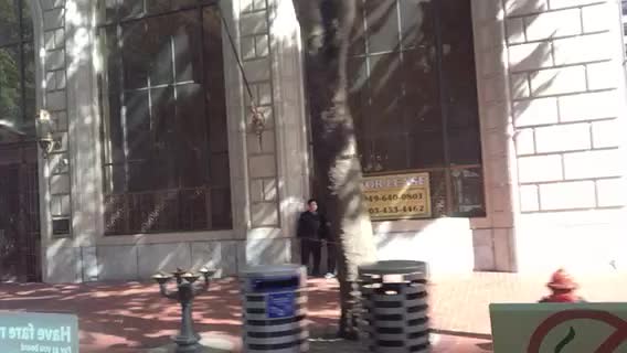
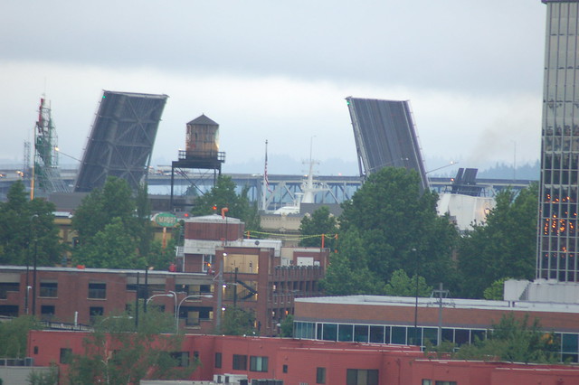
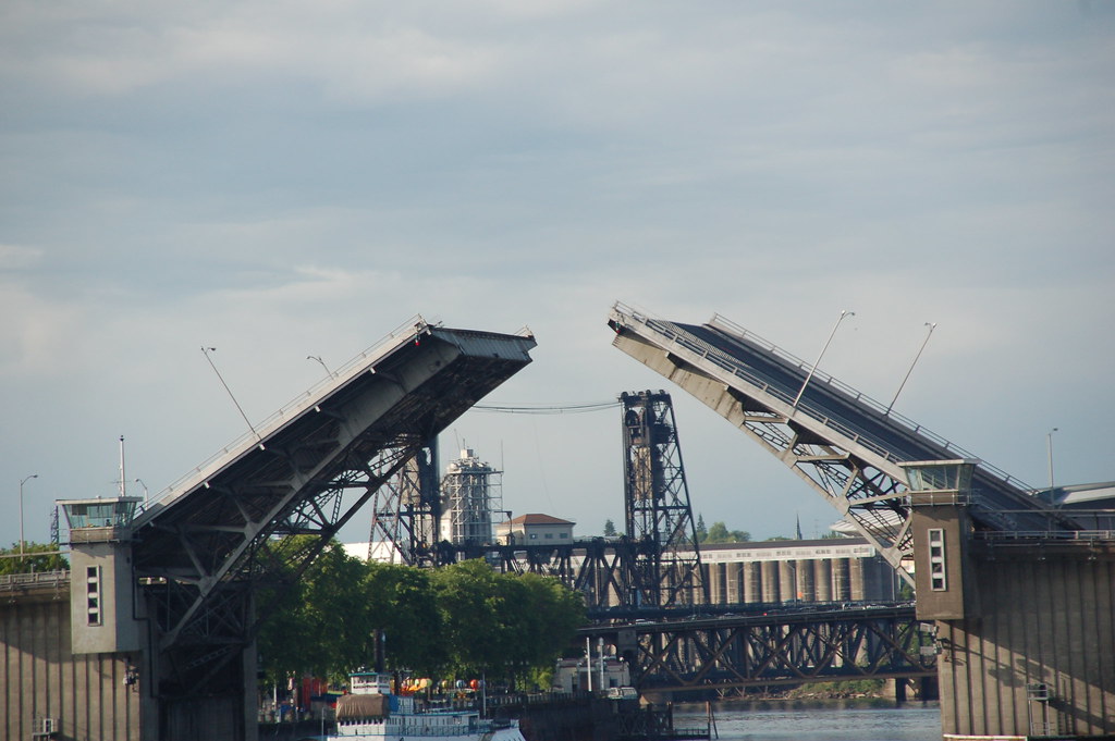
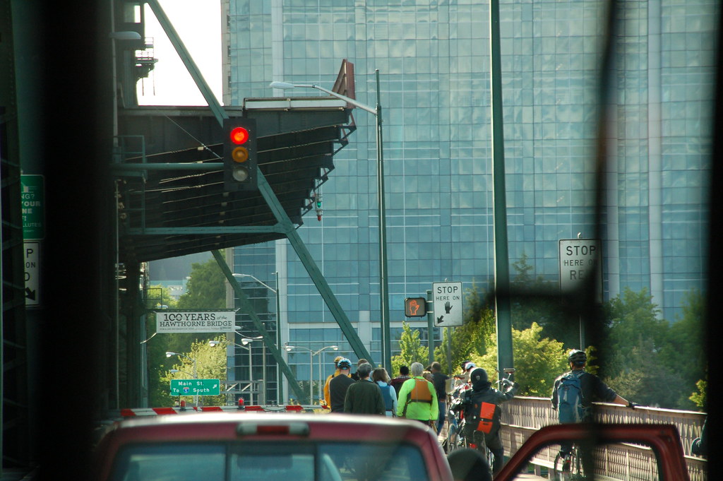
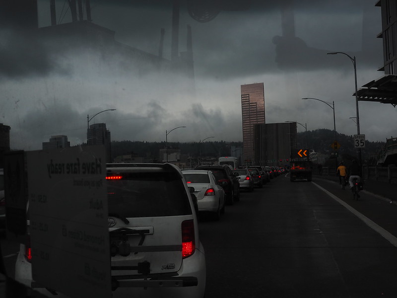
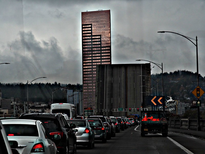
Straight out of the camera, a photo I shot through the 12 bus windshield when we joined the traffic stopped by a bridge lift on the Burnside Bridge. The giant square looming over the vehicles is part of the bridge itself. That's the Big Pink in the background, the multi-story building. I've never been stopped going westward by a bridge lift, only a couple of times going eastward, on this particular bridge. After we started moving again, there was no evidence that I could see of the vessel that caused the bridge to have to open to allow it to pass.

PA200024_BEF_HDR1

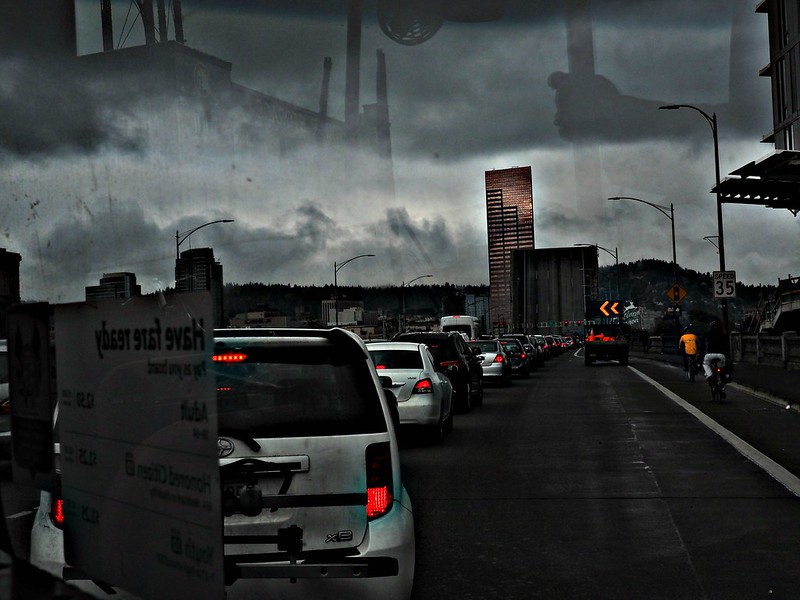
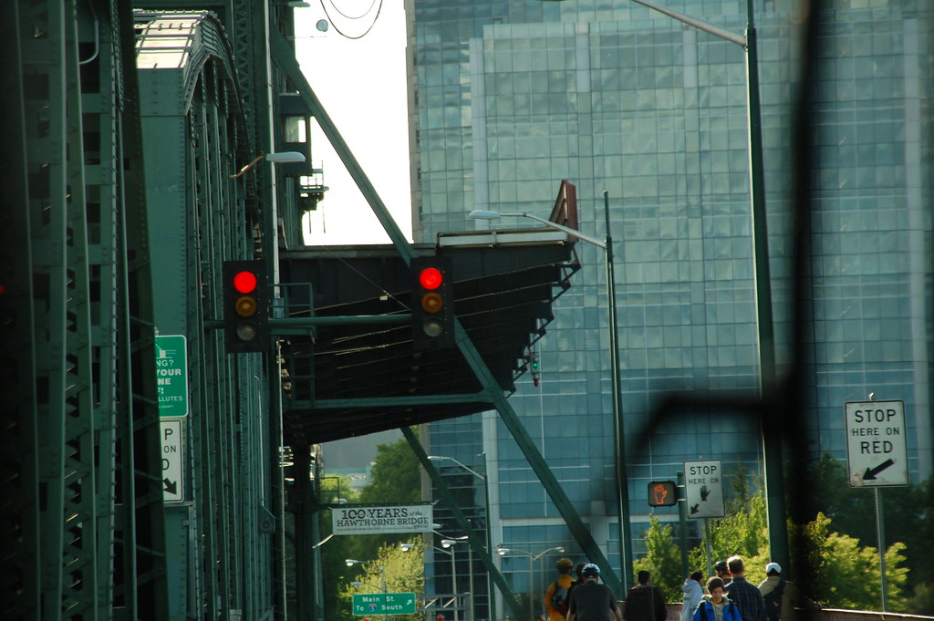
Same photo altered at BeFunky with HDR1. What's your favorite detail? Your most unexpected detail? My favorite, the lighted traffic directional sign in the pickup truck bed, it's two leftward-pointing arrows guiding your eye to the part of the bridge that is raised. My most unexpected, the bit of the bus driver's fan, top center, photographed along with lots of reflections.

PA200027

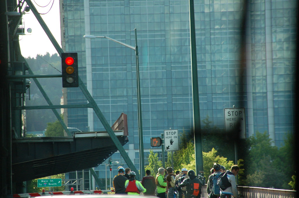
Straight out of the camera, zoomed in on the raised part of the bridge.

PA200027_BEF_HDR1

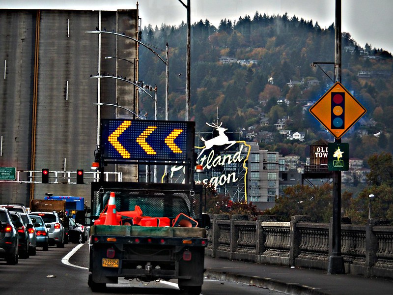
Same photo, altered at BeFunky with HDR1. I used the HDR effect to give you the best chance to see details--I like how it increases the sheen on the Big Pink windows. By the way, it lightly sprinkled rain at this point in my morning commute.

PA200029

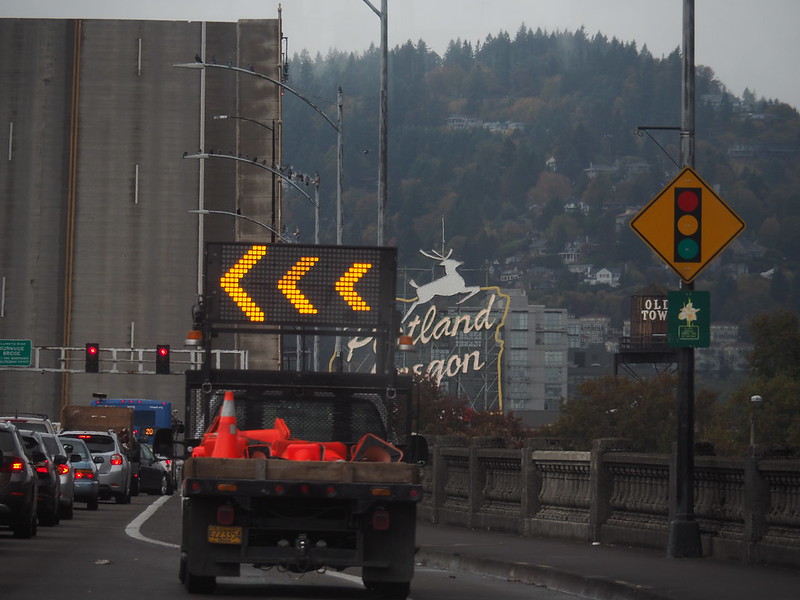
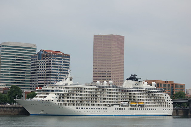
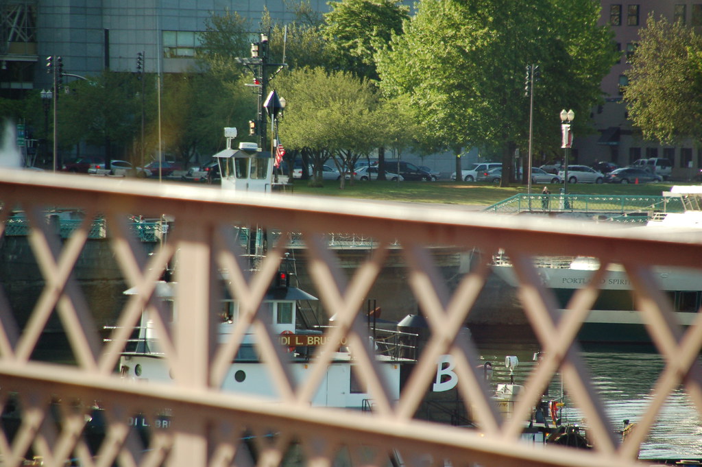
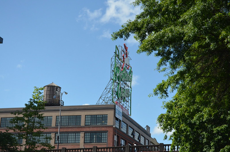
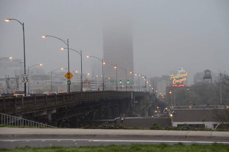
Straight out of the camera. When I realized the part of the neon Portland Oregon sign could be seen past the pickup truck, I zoomed in for this photo. You also get a good view of the pavement and the lane markings on the raised part of the bridge. Plus, you're able to see the 20 bus way ahead of the 12 bus that I'm in. I'll bet the 19 bus had to stop not too far behind us. Once the traffic started to move again, lots of vehicles and at least three buses passed us, going east. Bridge lifts occur frequently in Portland because we're a city with maritime traffic which comes from the Pacific Ocean on the Columbia River and then onto the Willamette which all of our downtown bridges cross, plus the St. Johns Bridge which is north of downtown. It, along with the Fremont, the Marquam, the Tilikum Crossing and the Ross Island bridges do not lift because the were constructed with plenty of clearance and are much younger than those bridges which have to raise for river traffic of certain heights. There's one more which I assume will not have to lift because it's being replaced by a new bridge, the Sellwood Bridge.

PA200029_BEF_HDR1

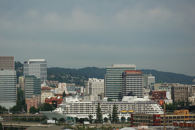
Same photo, altered at BeFunky with HDR1. I like this one a whole lot because there are details all over the place, from houses over in the West Hills to birds on the lamp posts alongside the sidewalk. 

PA200029_BEF_HDR1_cropped

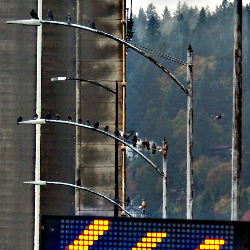
Once I noticed those birds, I decided to look at the photo's original size at Flickr. That's when I noticed two birds, one on each of the two shortest poles, at least they look shortest because most of their height is blocked by the lighted traffic directional sign. Both birds face north, their rusty red feathers smooth, their white tails glowing, the shapes of their heads discernible because they are in profile. I think they are hawks, and the rest of the birds are pigeons trying to ignore their juxtaposition with two birds of prey. I tried cropping so that you could experience these particular details. The result is so-so. So, if you like, please click on the image which will take you to my Flickr account. Once there click at the bottom right of the photo on View all sizes which appears when you hover over the downward-pointing arrow. Once there, click on view Original and scroll around to your heart's content. Do you think that's a drone flying visible between two poles to the right? Do you have any idea what kind of hawks these are? Are they even hawks? Thanks!

Tuesday, September 8, 2015

UPDATE and the after-work commute today

UPDATE: I made it through work today without any problems--hooray! Soon I'll be back in the recliner at the Oncology Center for Chemo Round Three. I wonder if it will be different, the side effects. Or, will it be much the same as Rounds One and Two? We'll see.

iPhone pix

After work today, I missed the streetcar, so I took the 4 bus across the Hawthorne Bridge to wait for the 12 that I would then ride the rest of the way home. Here we are looking south on SW 6th Avenue. Where's that next bus? I like to be in downtown, so I do this most all of the time after work when I'm there full time because the bus gets filled up with folks coming out of downtown office buildings. That means if I were to ride the streetcar or a bus north on SE Grand to change at East Burnside like I did last week in the middle of the afternoon, I'd be waiting on a 12 or 19 bus with no seats available. I'd rather go west across the river, then end up going east to make certain that I get a seat. It's safer to ride sitting down than standing up, in my opinion.

Untitled

Ah, there's the 12 at the other end of the block. Why? I know. It's shift change, from driver to driver. When I walked by after getting off the 4 bus, I had noticed a TriMet employee sitting on the sidewalk with his back leaned against one of the huge concrete planters that dot the streets of downtown Portland. When I noticed the 12 pull in, I put two and two together and came up with shift change. I've been riding the bus since July, 2006, and often make correct guesses as to what's going on after observing lots over time.

iPhone pix

Curbside service, thanks to TriMet and the 12 bus, y'all! I only had to wait seven minutes, total; I spent the first few minutes sitting at the bus shelter, but the sun shined on me too directly which I knew I didn't need to have happening, due to the chemotherapy, so I ended up standing where I figured the bus would come to a stop in order for all of us commuters to board.

iPhone pix

I decided to put my phone on, I guess you call it Facetime, so that I could hold it up to the window and catch some candid shots, maybe a video. Here's a photo that I cropped because about a third of it was of the inner wall that separates this window from the next one. I like how this turned out! The shelter and the stop are at the MAX Green and Yellow Lines' stop beside Pioneer Courthouse on SW 6th between SW Yamhill and SW Morrison. Pioneer Courthouse Square is directly across the street.

IMG_7776

I like this video! The building is one of A. E. Doyle's best, in my opinion--it's my favorite--the Bank of California built in 1924. I wish I were filthy rich 'cause I'd love to own it! The video ends as the 12 pulls to a stop at the bus shelter in front of a restaurant called the Original Dinerant on SW 6th. The next building north is the Big Pink. I've eaten at the Original twice, but that was at least two or more years ago. The food was good, sort of expensive if you don't make Happy Hour, and I might stop there some time in the future before I go to a Portland Trail Blazers' home game. I would then catch the MAX to the game at the stop beside the Big Pink.

IMG_7777

Here's a video as we head up the slope of the Burnside Bridge and on across the Willamette River. I stopped the video sooner that I meant to, but that's OK. You get the idea of how the bridge railing looks, as well as the sidewalks. At the beginning of the video, the bridge approach is above downtown streets and the Tom McCall Waterfront Park, thus all of those trees.

IMG_7778

Finally, here is a video shot through the windshield, showing you the new building being built at the east end of the Burnside Bridge, right up against the north side of the bridge. The building's name? Yard. Just Yard. Not The Yard.

Friday, June 19, 2015

UPDATE: It ain't the news we wanted. And upside what happened in Charleston, SC, Wednesday night, my news is an eyelash loosened from our eyes by the tears we have shed. While you're praying for me, please, I entreat you, consider praying for all of us to treat each other as the valuable people we each are. Now, for the blog post I already had made for Friday: Size, often it's all in perspective and location. Sometimes, it's just flat out huge. No. 3

UPDATE: The needle biopsy results say that there are fragments of atypical cells like the adenocarcinoma which was the kind of cancer that was in my uterus. So, I have an appointment tomorrow at 2 p.m. with the doctor. Tentatively scheduled to have surgery at a different Kaiser facility where there is a robot which will be used for the surgery to remove lymph nodes. I will know about those two things, the pathology and the plan, after the appointment tomorrow. I will have to be off work for probably five weeks. I will not give up. Thursday at work I felt a consisten energy level throughout the day, a decent energy level. I take that to mean that I am stronger. I know that I have lost weight, I know that I recovered smoothly from the hysterectomy. I intend to do that this time as well. I will not give up. Thank you for your prayers, your love and your concern. Love y'all.

DSC_0033

One more close up before the photos that I took of The World's journey north on the Willamette. I couldn't be at the beginning of it and along the river, so I opted to get up very early and ride a bus to somewhere I'd never been, get off, and walk back onto the Broadway Bridge to see what I could see.

DSC_0136

Here comes The World. That is a smokestack that you see to the right of the raised Morrison Bridge. The white things sticking up in between the decks are part of The World. I am standing east of center of the Broadway Bridge, zoomed in as far as I can.

The_World_3647925231_b98e964213_o

In this photo, three bridges are lifted simultaneously. To the far right, that's the Morrison beginning to close. In the center, that's the Burnside Bridge, not quite raised all the way. And to the left, the Steel Bridge looks about half raised.

Come back tomorrow for more photos of The World's exit from Portland on the Willamette River. Thanks!

Wednesday, June 17, 2015

Size, often it's all in perspective and location. Sometimes, it's just flat out huge. No. 1

DSC_0022

The World docked on the west side of the Willamette River. I took these photos on June 16, 2009, when I walked across the Hawthorne Bridge on my lunch hour. I had seen the TV news story about the ship and knew that I'd be a total fool to miss the chance to see it for myself. The Portland Spirit, a local river cruise boat, is docked to the left of The World. And beyond the center of The World, you can see the 30-story Big Pink--it is about a mile away, walking.

Found this quote in the June 17 Oregonian, made by an acquaintance of mine, as well as a bit of interesting info about the ship:

"It's something I have to go take my camera and get a look at," said Dan Haneckow, a ship enthusiast from North Portland. "You just don't see very many big ships below the Steel Bridge anymore."

Haneckow was talking about the 665-foot ship described as a floating luxury condominium complex, which boasts a variety of restaurants, two pools, a tennis court and a running track, among other amenities. The ship's 140 residents and crew of about 270 are touring the Portland area and seeing sights such as Multnomah Falls and Mount St. Helens.

They're also leaving behind some cash. Travel experts predict the ship's stop might inject some extra life into the local economy. While the exact economic impact of the Portland stop was unclear Wednesday, the industry standard for spending by cruise ship passengers is $125 a couple per day.

Bruce Connor, vice president of Sundial Travel & Cruise Center, which helped arrange the local itinerary, said the passengers could easily spend three times that.

DSC_0023

Well, you can certainly tell that is is a close-up shot, can't you?

DSC_0027

Here's another look with three of the four bridges which had to lift for The World to dock here and which will have to lift when it turns and heads down river, north to the Columbia, and then west to the Pacific. The closest bridge is the Morrison Bridge, the two bridge supports you see through the Morrison Bridge are part of the Burnside Bridge, and the black two towers in the distance are part of the Steel Bridge. The bridge not visible here is the Broadway Bridge. There is a westward bend in the river which, at this perspective, situates the Broadway Bridge to the left of the Steel Bridge. The tiny bright blue boat is a Willamette Jetboat, one that people pay to ride on, see the sights, get all wet. All that motion, turning, speed--not for me.

DSC_0016

I took this photo from the 5th floor rooftop garden of my work building which is on the east side of the Willamette River. Remember, The World is docked on the west side of the river; my work building is five city blocks from the river--I don't know the distance in feet.

DSC_0030

Here's that jet boat, speeding away after providing its passengers with a close up look at The World. They must've felt like flies on an elephant, size-wise.

Come back tomorrow for some photos I took as I walked alongside the sea wall, right beside The World. And the next day for photos which I got up very early to take on my way to work, well out of my way to work but on purpose. You'll understand when you see them.

Wednesday, May 20, 2015

Three minutes of bridge lifts, seen from the bus while on the Hawthorne Bridge, heading west after work, May 20, 2010

I've decided to use larger photos today. Please let me know in a comment if they are too large for your computer, making them difficult to see or to load. I'm curious. Thanks!

DSC_0020

Looking north at the Morrison Bridge, mid-bridge-lift, I wondered what large vessel had caused the lift and which direction was that vessel going, north which is down river, south which is up river--the Willamette River flows north. That brown shape to the right of the docked white boat with the blue trim is not what caused the bridge lift. Since the bridge is wide open, I'm guessing that the vessel is on its way to the Morrison Bridge. I took this photo at 5:20 p.m.

A bit about the Morrison Bridge: It is a bascule bridge which was completed in 1958, the third bridge at approximately the same site to carry that name.

The bridge is the largest mechanical device in Oregon. Thirty-six foot tall gears drive 940-ton counterweights located inside each of the piers. The 69 ft. clearance is sufficient for most river traffic, requiring bridge openings only about 30 times a month. It currently carries 50,000 vehicles daily in six lanes. The canted windows of the control towers give the distinctive look of air traffic control towers. The current bridge does not connect to Morrison Street at its west end because the second bridge was left in operation while the latest version was built.

Believe it or not, I've been on a tour of the Morrison Bridge which included walking down the steps inside the west-most pier and seeing those 36 foot tall gears and hearing the sound made by the movement of them and the 940-ton counterweights as the bridge is opened. Totally amazing experience!

By the way, the black, double-decker bridge north of the Morrison Bridge, partially visible in this photo, is the Steel Bridge (1912). Between it and the Morrison Bridge is the Burnside Bridge (1926), not very discernible at this perspective. Look closely along the square-shaped trusses which are a lighter brown color and around the height of those trees--they are part of the Burnside Bridge.

I can't tell from this angle if the Burnside Bridge has started to open, but from the traffic I can make out on it, I don't think it's opening yet. Maybe it won't have to, it all depends on the height of the vessel on the river--the bridge clearance when closed is 64 feet. A bit about the Burnside Bridge: The Burnside Bridge is a 1926-built bascule bridge. The lifting is normally controlled by the Hawthorne Bridge operator, but an operator staffs the west tower during high river levels. This bridge is part of my daily work commute, both morning and afternoon.

All of the black trusses and bridge decks belong to the Steel Bridge. A bit about the Steel Bridge: It is a through truss, double-deck vertical-lift bridge. Its lower deck carries railroad and bicycle/pedestrian traffic, while the upper deck carries road traffic (on the Pacific Highway West No. 1W, former Oregon Route 99W) and light rail (MAX), making the bridge one of the most multimodal in the world. It is the only double-deck bridge with independent lifts in the world and the second oldest vertical-lift bridge in North America, after the nearby Hawthorne Bridge. The bridge links the Rose Quarter and Lloyd District in the east to Old Town Chinatown neighborhood in the west.

DSC_0021

My next thing to wonder about, how long would the bridge lift last for the Hawthorne Bridge (1910). It all depended upon the direction of the vessel--maybe whatever it was had already cleared the Hawthorne Bridge, no matter the direction it was moving. I took this photo looking through the bus windshield. Notice that dark-colored section of the bridge with the rust-colored handrail. There's one pedestrian walking east; those other folks are waiting to continue their westbound walk or bicycle ride.

A bit about the Hawthorne Bridge: It is the oldest operating vertical lift bridge in the United States. The 1,383-foot long Hawthorne Bridge is one of Portland’s busiest bridges, safely carrying approximately 30,000 vehicles and untold pedestrians and cyclists across the Willamette River. Vertical clearance for river traffic is limited and approximately 200 openings per month are required for this vertical lift bridge.

Like other vertical lift bridges, the Hawthorne Bridge uses a system of counterweights and cables to move the lift span straight up and down. The operating system is mostly original, but the electrical power and control systems—which were installed in 1975—were upgraded in 1999. Hawthorne’s counterweights each weigh 450 tons and are supported by the bridge’s two towers, which rise 165 feet above the bridge deck. The Hawthorne Bridge’s main span can be raised 110 feet to allow vessels to pass underneath. On average, an opening of the Hawthorne Bridge is 8 minutes long.

DSC_0022

Looks like it's a tugboat causing these bridge lifts. Some of the letters are blocked by the bridge handrail, but I believe that I can read the name as Heidi L. Brusco. That's my best guess, and I did find that a towing vessel of that name has Seattle as its home port. As of right now, it's heading east on the Columbia River, bound for Cathlamet, Washington.

DSC_0023

A few more folks have gathered to wait out the bridge lift. There's a curious person in the pickup truck in front of the bus.

DSC_0024

Can you tell that the lifted bridge section has moved down quite a bit from the earlier photos? And even more commuters wait patiently. I took this photo at 5:23 p.m.Not too many minutes later, the bridge lift completed, we continued our westbound ride across the Willamette River.

Friday, April 17, 2015

Blue skies make us happy in Portland, especially on Friday!

DSC_0105


The iconic Portland, Oregon, sign stands on top of a building on the west end of the Burnside Bridge. I get to see it every week day on my morning commute. Today it will be backed by blue skies. Happy Friday!

Monday, November 24, 2014

The only constant is change, right?

-->

DSC_0138

I'm standing in an area labeled the Burnside Bridgehead, at the east end of the bridge. See the backside of that giant A? It stands for Andersen Construction which recently started construction of a building on what is known as Block 67, very close to the north side of the bridge itself, in between NE 3rd and NE 2nd which run parallel with the Willamette River. Notice the Portland Oregon sign across the river, just visible between the A and the black pole? The Big Pink across the river, coming out of the top of the A? Well, before this new building is completed, maybe by the estimated date of May, 2016, I'm certain that neither one will be visible from where I stood on November 15, 2014, to take this photo--a great deal of this view of downtown Portland will disappear, available only to those who decide to rent an apartment in the building--I haven't discovered its name yet, but plans call for it to be a 21-story apartment tower on a 0.76 acre site; Skylab Architecture designed the building which is far from your typical tower in its shape. It's supposed to have 284 apartments on the top 16 floors. On the remaining floors, retail and commercial space, plus 202 parking spaces. Planned building amenities include a community plaza with a barbecue area, bike parking with repair station, technology lounge, pet exercise area, fitness center and spa. I read one place online that the intention is to offer 20% of the apartments to residents making 60% or lower of median family income, in an effort to respond to the growing need for workforce housing. Is that really going to happen? Oh, and just on the other side of that fencing, in between NE 3rd and NE Couch (the street in between me and the fence) there will be another building built which will be either two or three stories, commercial use only. I read it described as a spit of land, labeled Block 76W these days.

Sunday, April 27, 2014

Foggy morning commute, April 7, 2014

DSC_0378

Once I crossed the street after stepping off the first of two vehicles which make up my morning commute, either two buses or a bus and a streetcar, I immediately realized I had to get my camera out of my backpack and take a few photos. Fog, the streetlights on the Burnside Bridge, the Big Pink disappearing into the fog, the neon Portland, Oregon, sign. All called out to me. Happy to have had the chance to take several photos before the streetcar arrived.

DSC_0385

I took this photo as the streetcar slowly headed south on MLK--a split second opportunity.

Saturday, April 5, 2014

Back or front, I really love this sign.


The two sides of the Portland, Oregon, sign--in the sunshine. I took this photo through the bus window as we headed east on the Burnside Bridge--March 21, 2014.


See why I love it? I took this photo from the Tom McCall Waterfront Park, looking west, on March 21, 2014.

Wednesday, April 2, 2014

Along the west bank of the Willamette River, No. 8


Looking north, toward the Steel Bridge over the Willamette, in a photo that I took at 5:52 p.m. on Friday, March 21, 2014. The fly over across the river is involved with I-5. I haven't driven on it enough to remember for sure, but I think it is where you can exit I-5 and get onto I-84. Y'all correct me, Portlanders, please. I like the three checking a photograph, no doubt. And their shadows stretching to the river.


Looking south, toward the Burnside Bridge, in a photo that I took at 5:57 p.m. on Friday, March 21, 2014. The supports you see on the left are on the section of the bridge that crossed the Willamette. I like the little girl dancing in pink chiffon on the green grass, as well as the number of folks visible in this particular shot.

Thursday, March 27, 2014

Along the west bank of the Willamette River, No. 2


Here's the jumping girl from yesterday's post, with her dad, mom, and little sister. Sweet to see a family out making memories in the sunshine on the first weekend that the cherry trees bloomed. The way the weather changes around here, sometimes these flowers depart quickly, so it is imperative to get on out there and take advantage of the best conditions, as soon as they occur. That's why I went over between the Burnside and the Steel Bridges Friday, March, 21, after work. I had no idea if I could get back to Tom McCall Waterfront Park on Saturday or Sunday, so I put a reminder on my iPhone 5 and made it happen. The reminder's necessary because on Friday I tend to be on autopilot for home, unless the Blazers are playing.

Monday, October 14, 2013

The short-lived snag

Click here for a trip to City Daily Photo, transporting you around the world every day.

I know I promised this on Sunday, but I didn't feel very well all day--felt a chill, didn't even make it to my Northwest Film Center's Reel Music Festival documentary, THIS AIN’T NO MOUSE MUSIC!

DSC_0909_PM

I walked to the corner of SE Grand Avenue and East Burnside. When I stopped at the bus shelter, I immediately noticed that the Burnside Bridge was up. The snag. I'm on the east side of the Willamette, waiting for an eastbound bus which is coming from the other side of the Willamette River. I took this photo at 3:02 p.m. By 3:07, the bridge was closed and traffic appeared in the eastbound lanes. Naturally, I don't know the entire length of time that the bridge was open, just the span of time from when I saw it completely open until it was completely shut--I'd say five minutes is a short snag when something that huge is involved! Soon the bus came and I rode home. In another example a serendipitous positioning of structures in a photo, look at the line up here--the Big Pink, the Burnside Bridge's Italian Renaissance tower where sometimes there is an operator inside, and the open bridge structure. I'm a huge fan of serendipity!

I'll never forget the first time that I drove west on Burnside back when we lived in Northwest Portland. I was headed across the river, can't remember why now, but as I got closer to the bridge, my mind filled with confusion as I realized cars were stopped in front of me. Then I saw a big shape on the horizon and thought, "They're moving a house across the bridge. Nope! That's the bridge! It's up!" My first time ever to approach an open bridge in Portland. What a treat!

Here's information from the Multnomah County Web site about the Burnside Bridge:

One of four Willamette River crossings built in Portland during the "Roaring Twenties," the Burnside Bridge stands in age right behind the County's Hawthorne and Broadway bridges.

This 1926 structure is located on one of the longest and busiest streets in the Portland area. The five-lane Burnside is a direct connection between downtown Portland, Beaverton to the west and Gresham to the east. Last year, about 40,000 vehicles a day used it. So did more than 1,000 pedestrians and bicyclists each day.

In addition to its important daily work load, Burnside plays a key role during emergencies. Burnside Street and bridge are designated as an official emergency transportation route. The bridge, as part of this "lifeline corridor," is the one non-freeway river crossing which emergency vehicles and suppliers are asked to use.

Burnside's artistic side

The three-span Burnside is a historically significant structure. It is the only Willamette River bridge in Portland designed with the help of an architect, a result of the early 20th century City Beautiful Movement that called for adding architectural ornamentation to engineering designs. The bridge's distinctive Italian Renaissance towers reflect the trend. Burnside is eligible for the National Register of Historic Places and protected by preservation laws. Originally designed by the firm of Hedrick and Kremers, Burnside was completed by Gustav Lindenthal (1850-1935). Burnside's opening mechanism, or bascule, was designed by Joseph Strauss (1870-1938), whose Golden Gate suspension bridge would open 11 years after Burnside.

The Burnside Bridge main river structure consists of two 268-foot side span steel deck truss side spans and a 252-foot double-leaf Strauss trunnion bascule draw span. The bridge originally had six lanes of traffic, but in 1995 the City of Portland requested that bike lanes be added to the bridge, so one lane of traffic was converted into two bike lanes. There are sidewalks on both sides of the bridge. The overall width of the structure is 86 feet. Vertical clearance of the closed bascule span is adequate for the majority of river traffic, with openings necessary only about 40 times per month.

Only minor modifications have been made to the bridge since its construction. Electric street car rails were removed in the late 1940’s, lighting and traffic control devices were updated in the late 1950’s, automobile traffic gates were installed in 1971 and the bascule pier fenders were replaced in 1983. Several deck resurfacing projects and expansion joint repairs have also taken place.

The east approach to the bridge is approximately 849 feet long and has two distinct types of construction. The first eight spans consist of steel plate girder spans ranging from 75 feet to 106 feet in length. The steel girders and steel interior floor beams are completely encased in concrete. A concrete deck spans the floorbeams. The next seven spans are composed of concrete stringers spanning continuously over concrete columns and floorbeams. Six of these spans are 22 feet long and one is 40 feet long.

The west approach is approximately 604 feet long and consists of 19 reinforced concrete spans ranging in length from 22 feet to 62 feet. The first 13 spans average 22 feet and consist of reinforced concrete stringers acting continuously over concrete columns and floorbeams. The next three spans average 40 feet in length and are of similar construction. The last four spans are 62 feet long and consist of four main simple span concrete girders that carry interior concrete floor beams and stringers. A concrete deck is cast with the girders, stringers and floorbeams.

And a bit about a bascule bridge:

Bascule bridges have sections that rotate upward and away from the centerline of the river, providing clear passage for river traffic. Side-by-side on the Willamette River in downtown Portland, the Morrison and Burnside Bridges are two examples of bascule bridges. These two bascule type bridges have a very clean, uncluttered look to them because the counterweights and operating machinery are located out of sight in the piers supporting the bridge. The Morrison Bridge is a Chicago-type bascule bridge, and the Burnside Bridge is a Strauss-type bascule bridge.