Sunday, June 2, 2013

Mother's Day Mini-Vacation, No. 20 - On the Cascade Lakes Scenic Byway

-->

Our waiter at the best-place-to-eat-weekend-breakfast-in-Bend-Oregon, Brother Jon's Public House, had told us that he'd heard the announcement--Cascade Lakes Scenic Byway, open already--usually not before Memorial Day! The guys added this to our plan for Saturday, May 11, 2013.
  DSC_0409_PM_s_sister_m_sister_s_sister_broken_top

Left to right, South Sister, Middle Sister, North Sister, and Broken Top. Outta sight swell and glorious!
  DSC_0397_PM_Mt_Bachelor

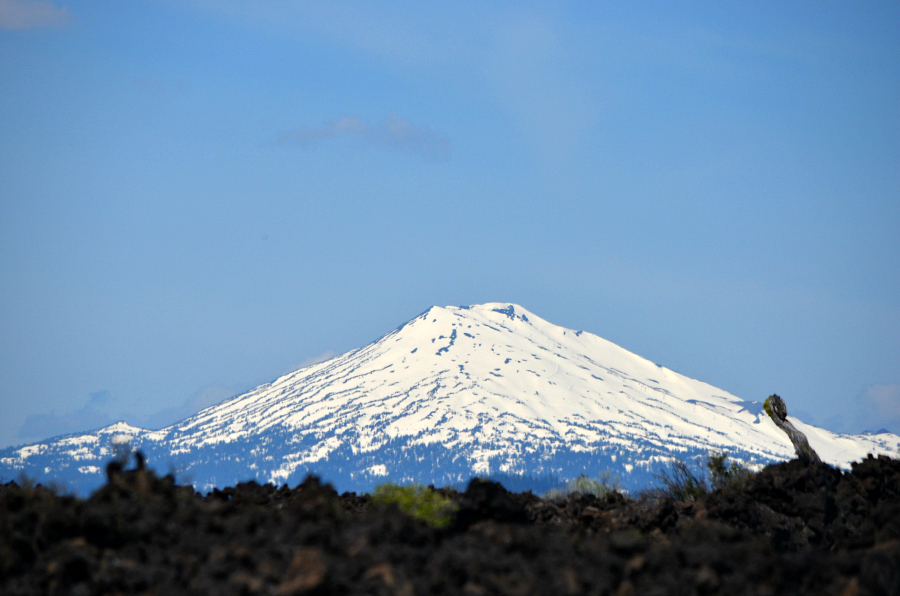
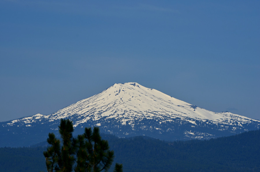
Mt. Bachelor.
  DSC_0412_PM_snow_roadside_left

Snow piled up on the driver's side of the car! Amazing!
  DSC_0388_snow_roadside_right

Around every curve for a while, snow! I haven't seen snow this deep since I rode the cog railway up to the top of Pike's Peak years ago. Of course, this is pile here by snow plows and that at the top of the mountain was plain ol' deep, probably deeper than this, but nevertheless, this snow impressed me. And I still had the window down on the car and could feel the chill in the air. Magnificent!
  DSC_0377_PM_cyclists_snow

Saw these bicyclists. Could not believe how many folks we passed riding bicycles!
  DSC_0452_PM_bicyclist_red_shirt

Look! Here's one now!
  DSC_0469_bicyclist_red_shirt

We stopped to take a look at a lake. As I paused for traffic so that I could cross the byway back to the car, here comes the same guy!
  DSC_0471_PM_Leland_Zipcar

There's Leland in the driver's seat of Engine, our Zipcar Ford Escape. We pulled out from here and stopped at another lake. Lamont walked, carefully watching out for vehicles and bicycles.
  DSC_0488_lake

Isn't this lake a beauty? I wish I knew the name of it. Alas, I saw no sign.
  DSC_0501_PM_lake_snow_trees

Close up of the snow and trees on the far side of the lake.

Saturday, June 1, 2013

City Daily Photo Theme Day: June Theme Day - The beauty of decay

Click here for a trip to City Daily Photo, transporting you around the world every day.
I haven't yet figure out how to link this post directly to the others, by that I mean so that you can easily find other posts on today's theme. I think if you click on the link above, though, you'll come across lots of them.

Collage_chevy_beauty_decay

Vintage Chevrolet 3200 pickup truck, seen on the street in Portland, Oregon. Decay has set in, rust and dents. Yet, this vehicle remains as beautiful and useful. Back to the Mother's Day Mini-Vacation tomorrow.

Friday, May 31, 2013

Mother's Day Mini-Vacation, No.19 - Trail of the Molten Land, No. 3

Click here for a trip to City Daily Photo, transporting you around the world every day.

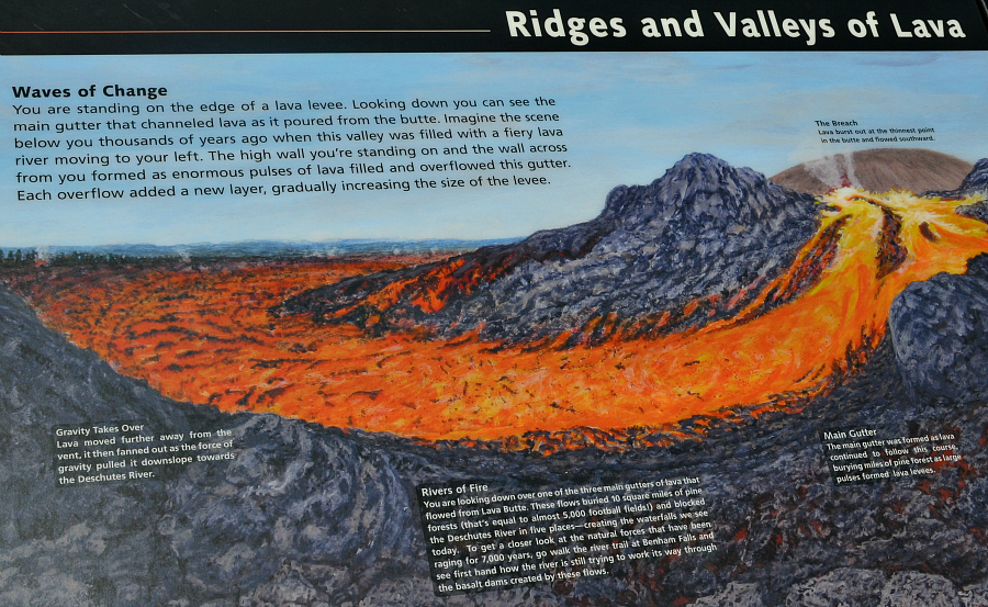
DSC_0305_PM_ridges_valleys_lava_cropped

Ridges and valleys of lava. Yes, indeed. At the top left of this sign, the breach is mentioned as the weak spot in the butte through which the lava flowed southward.
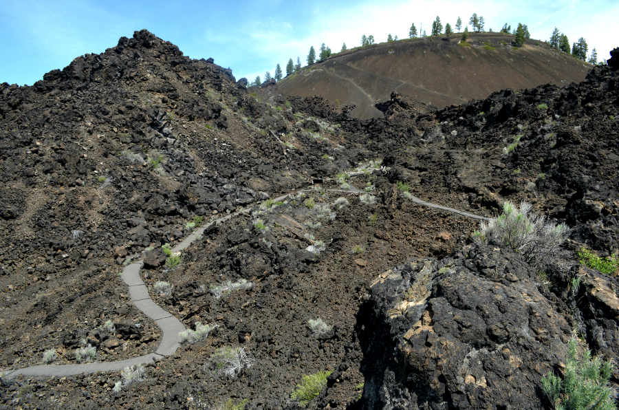
  DSC_0311_PM_lava_main_gutter_lava_levees

The huge orange fiery lava flow on the sign is labeled one of the main gutters. It formed as lava continued to flow from the breach. Lava buried miles of pine forests (equal to 5,000 football fields) as large pulses of it formed the lava levees. The levees are on each side of this photo. Please follow the curving path from left to right. (This part of the trail is that which had been identified as having grades and surfaces that might be challenging without assistance. I didn't walk down there--my goal is to go back and walk there someday, with my sons, of course.) As the path turns right, I hope you can see the tiny informative sign just at the edge of the narrower light gray path. Actually it is the back of the sign--it's black, rectangular and has two skinny little legs. The tiny size of that sign lets you know how far away it is from where I'm standing and how deep this gutter really is. At least I hope that's how you're able to see it in this photo.
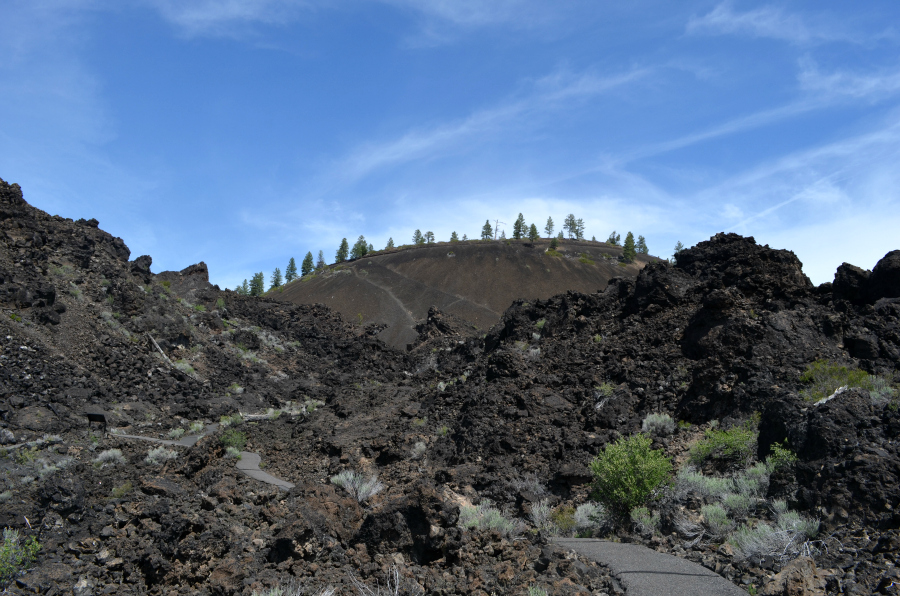
  DSC_0323_PM_lava_gutter_etc_close

Maybe you can see the size and distance in this image. Let me know what you think, please. Thanks! The black sign is near the left side of the photo, just below center.
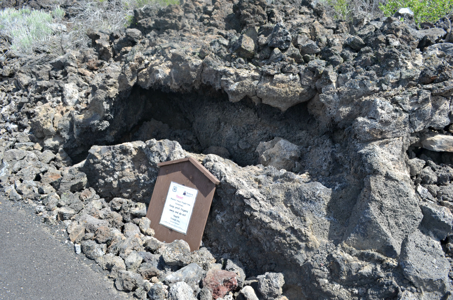
  DSC_0304_PM_lava_formation_sign

While walking through this vast lava flow, I came across an astonishing sight . . .
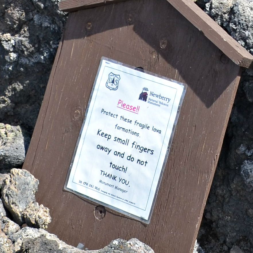
  DSC_0304_PM_protect_lava

. . . with its own sign.
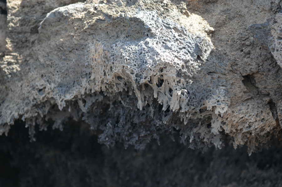
  DSC_0327_PM_lava_formations

Close-up #1
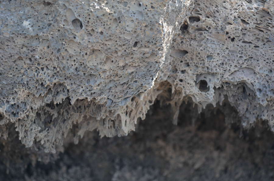
  DSC_0329_PM_lava_formations

Close-up #2
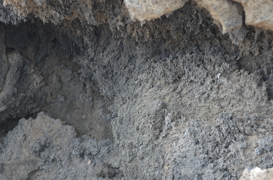
  DSC_0336_PM_lava_formations

Close-up #3

DSC_0365_PM_lava_stops

After we looked around this part of the lava flow, we turned around and headed back towards the visitor center. This is the view along the edge of the lava flow. It just stops. Stops. Amazing.
  DSC_0372_PM_lava_height_trees_mtns_distance

As the trail continued on its way to the visitor center, I took this photo which also gives you an idea of the height of the lava flow.
  DSC_0251_mt_bachelor_over_lava

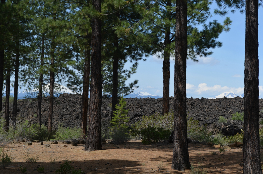
I think the mountain on the left, through the pines, is Mt. Bachelor. Here's a photo that I took of it when I was out on the Trail of the Molten Land. We soon left this all behind and headed for the Cascade Lakes Scenic Byway. Lamont and Leland wanted me to see some lakes, some mountains, and some snow.

Thursday, May 30, 2013

Mother's Day Mini-Vacation, No.18 - Trail of the Molten Land, No. 2


Click here for a trip to City Daily Photo, transporting you around the world every day.

On yesterday's post, someone commented, describing the trail thusly: "For being universally accessible, the trail looks very unobtrusive." I agree as I walked and enjoyed each sight, including every informative sign.


1_PM_4_signs_Collage

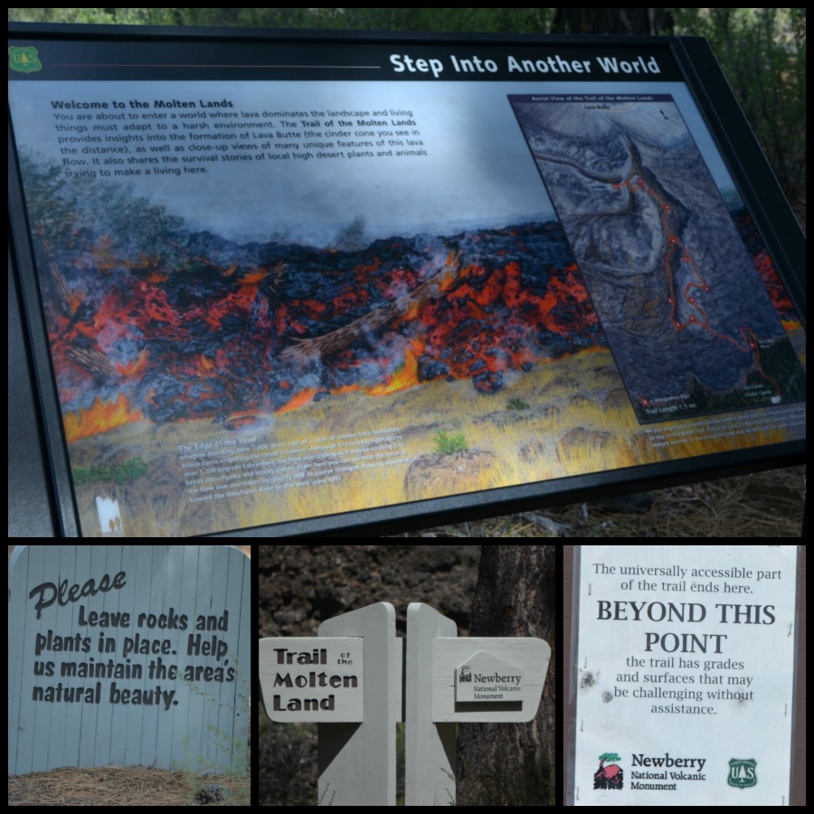
Step into another world, after you read the first two signs, left to right. Then you come to the top sign just as you're about to set foot onto the trail. Later on you come to turn-offs which would take you onto a different trail, thus the "Beyond This Point" sign. I want to get into better walking shape and visit the Trail of the Molten Land again so that I can turn off onto those other trails and see what I missed this time. For starters, I noticed that they slope downward quite a bit, so I imagine that the view is vastly different.

2_sign_Leland_loch_ness_Collage

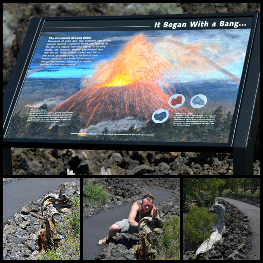
It began with a bang . . . The formation of Lave Butte. I hope you're able to read some of the sign. My favorite part is What's in a color? It goes like this: Lava Butte is not a solid structure, it's a big pile of gas-charged basaltic rocks known as cinders. Depending on factors such as mineral distribution within the rock and atmospheric conditions, cinders (scoria) can be found in shades of red, black, and even iridescent colors. The twisted tree trunk reminded me immediately of the Loch Ness Monster. Do you agree? Leland likes to take photos from a unique perspective.
 

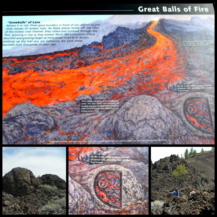
3_lava_balls_Lamont_Leland_lava_PM_Collage

Great Balls of Fire. I tell you what, when I stopped at this sign and read it, then looked up at the "snowballs" of lava, I was truly amazed. And very excited to be right there, near two "snowballs" formed 7,000 years ago. And there you can see Lamont and Leland on the trail just around a curve from where I'm standing. Once again, you get an idea of the height of these piles of lava.

Wednesday, May 29, 2013

Mother's Day Mini-Vacation, No.17 - Trail of the Molten Land, No. 1

Click here for a trip to City Daily Photo, transporting you around the world every day.

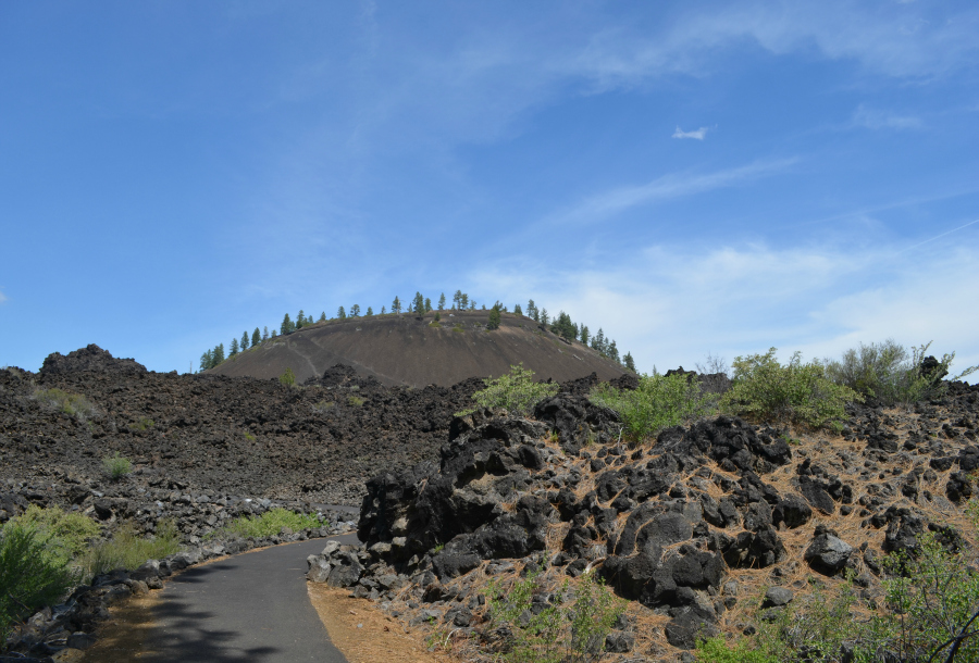
DSC_0367_trail_begins

Lava Butte Cinder Cone, seen from the trail. I'm very happy that the folks did this: One third of the trail is a newly reconstructed section that is Universally Accessible, and the rangers did a super job on the recent trail construction.
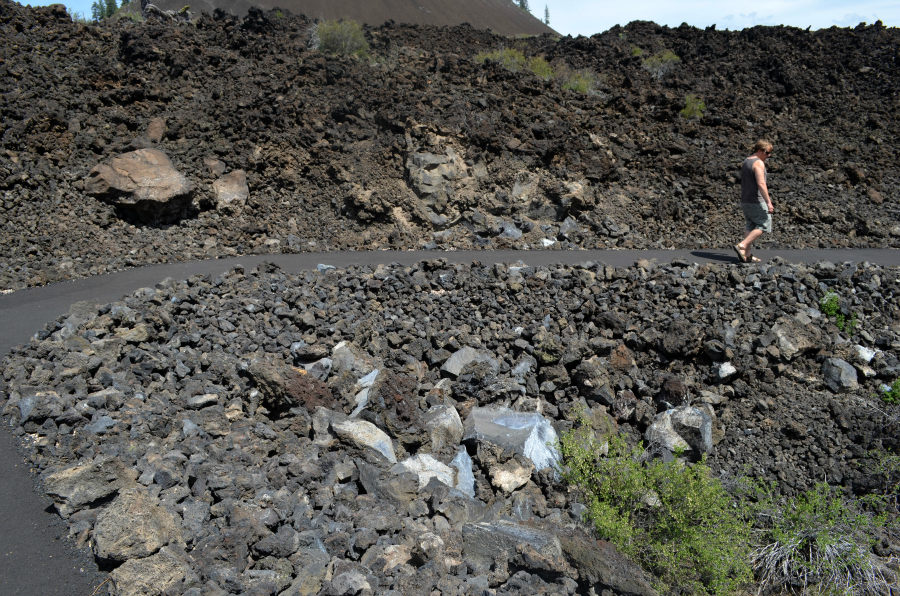
  DSC_0363_PM_lava_height_leland

Leland's walking beside the lava flow, not too far around the curve to the left--the curve in the trail shown in the first photo. Although I took this photo as we were headed back to the start of the trail, I put it here so that you could get the idea of just how tall that lava flow stands. Leland is right at 6 feet tall.
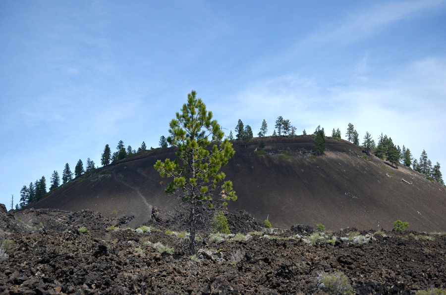
  DSC_0362_PM_lava_tree_cinder_cone

The single tree stands atop the lava flow.

Tuesday, May 28, 2013

Mother's Day Mini-Vacation, No.16 - I think I can, I think I can . . . walk the Trail of the Molten Land!

Click here for a trip to City Daily Photo, transporting you around the world every day.

Screen shot MAP trail 2013-05-25 at 1.15.11 PM

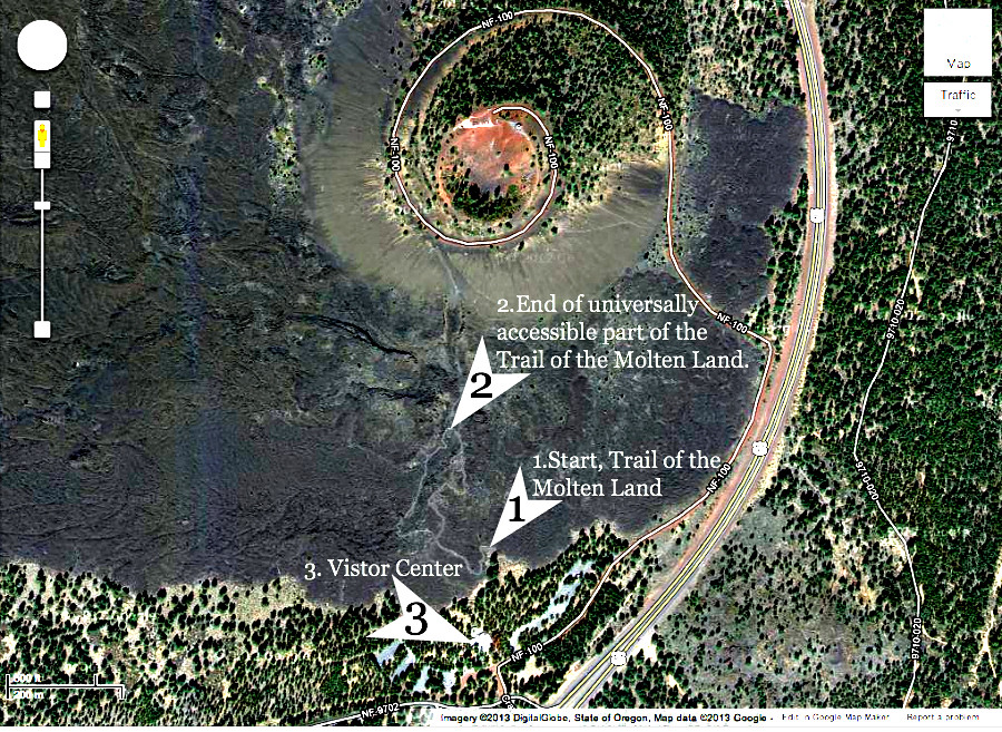
After we left the Lava Butte Cinder Cone, we drove back to the parking lot near the visitor center. The guys assured me that I could walk the Trail of the Molten Land just fine. Am I ever happy to have done that! Come back tomorrow for lots of photos that I hope you will enjoy. And some informative signs.
  DSC_0242_PM_chipmunk

First, though, I couldn't believe my luck when Leland pointed out this little critter on the stump. It he/she a chipmunk?

Here's what I found on the Internet about the trail: Trail of the Molten Land

  • This is a great little hike if volcanoes are something that interests you. From Lava Lands Visitor Center in the Newberry National Volcanic Monument, this trail meanders out across the basalt lava flow for just a little over a mile to its source at the base of Lava Butte.
  • One third of the trail is a newly reconstructed section that is Universally Accessible, and the rangers did a super job on the recent trail construction. Older sections of the trail have grades and surfaces that may be challenging without assistance.
  • There are also several new full color interpretive signs that tell the story of the eruption of Lava Butte and the life that now makes the lava their home. 

Monday, May 27, 2013

Mother's Day Mini-Vacation, No.15 - Views from atop Lava Butte Cinder Cone.


Click here for a trip to City Daily Photo, transporting you around the world every day.

DSC_0156_MP_mt_bachelor

One of Mt. Bachelor's ski lifts is visible in this photo, in its original size. I've resized it here, so I don't think you'll be able to see it. Just looking at it and how it went up and up the side of the mountain scared the hooey outta me.
 

DSC_0227_PM_mtns_view_cropped_3

As far as I can tell, these are South Sister, Broken Top, Middle Sister and North Sister. The angle from where I stood atop Lava Butte Cinder Cone caused this line-up. I looked and looked at maps and photos online, and the order I've mentioned is my best guess.
     DSC_0222_PM_twisted_tree

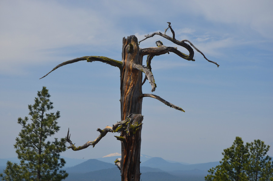
The top of the dead tree still standing in the crater.


DSC_0221_PM_twisted_tree

A lower portion of that same tree's trunk, complete with twisted limbs covered in some sort of vegetation. Did you notice the hole in it?


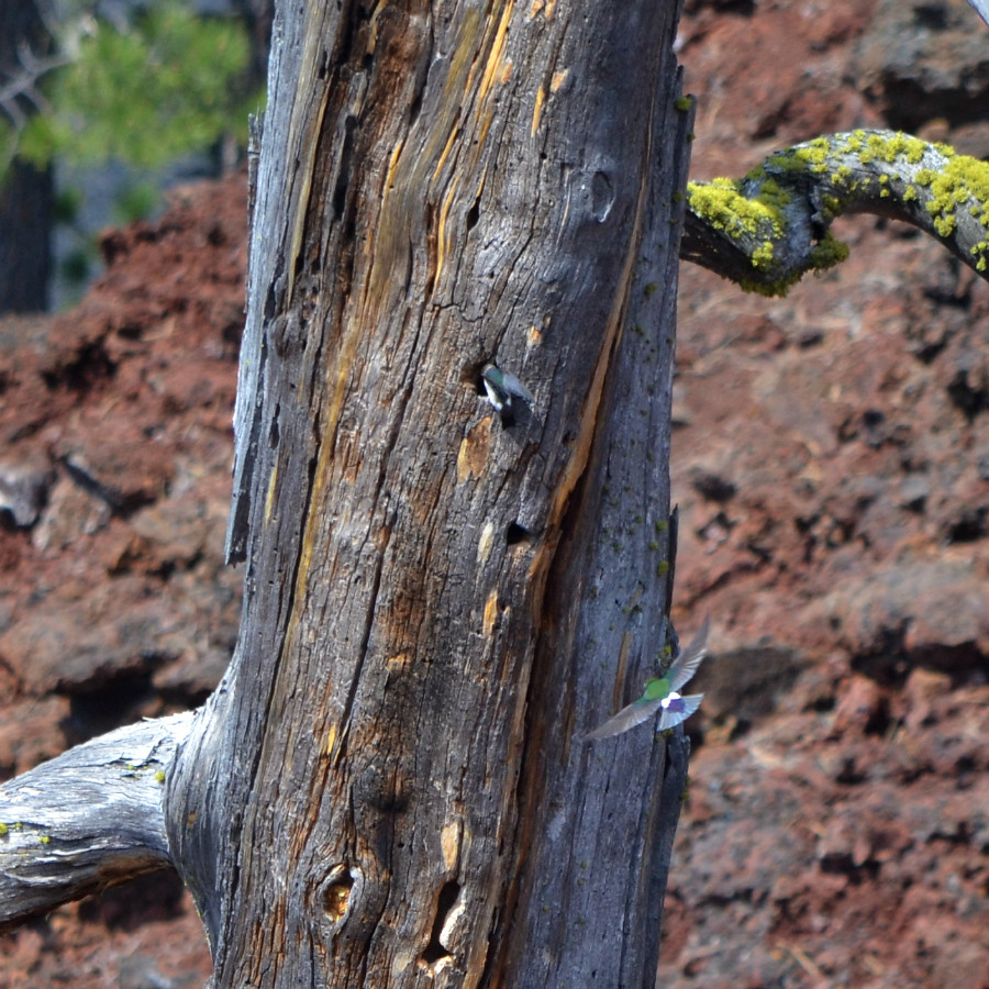
DSC_0207_PM_bird

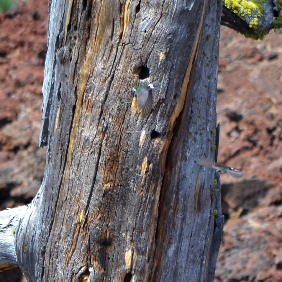
I heard the sound of birds, skittering at each other. Looking carefully, I realized there were five or six tiny birds flying at each other around the dead tree. Here two of them.

DSC_0205_PM_bird

Aren't those wings amazing? And that tail? So lovely, too. My best guess, from looking and reading on the Internet and from listening to the sounds of various hummingbirds found in Oregon, is that these are Calliope hummingbirds. I hope someone who knows for sure will find this post and let me know.


DSC_0217_PM_bird

Cropped and altered in a effort to allow you to see the hummingbird on the tree trunk.

Sunday, May 26, 2013

Mother's Day Mini-Vacation, No.14 - Every foot we traveled to the top was worth it.

Click here for a trip to City Daily Photo, transporting you around the world every day.

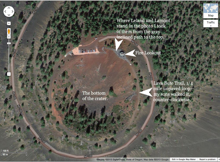
Screen shot MAP lava butte close 2013-05-26 at 6.52.21 AM

NF-100 is the red cinder road to the parking lot at the top of Lava Butte Cinder Cone.
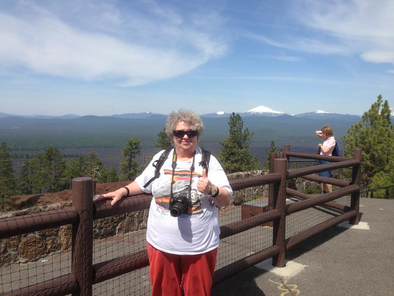
  MD_me_atop_lava_butte_316407_10151596978779429_1172173810_n

Here I am, at the 5020 ft. top of Lava Butte Cinder Cone. Whoopee! How did I get here, you're wondering, right?
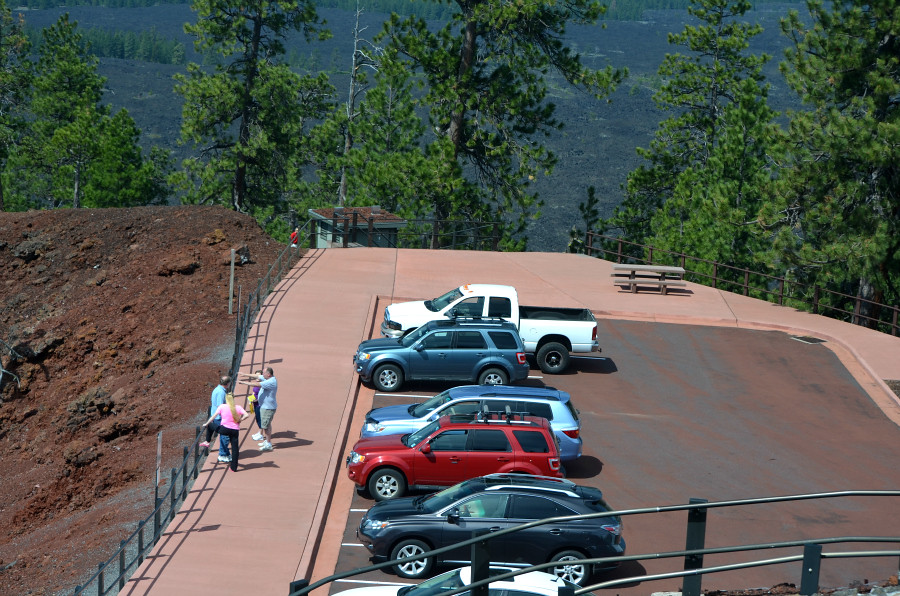
  DSC_0179_PM_lot_bathroom

Leland drove us right up that red cinder road to the parking lot. See Engine there, our Zipcar, the red Ford Escape? Now look past the parked cars to where it looks as if the level surface ends abruptly. Actually, it steeply slants downward. Notice the teensy person in the red shirt to the left of the restroom? That person's head, in relation to the roof of the restroom and the end of the level surface gives you an idea of the steepness of the slant. I managed, with the help of a sturdy handrail that you cannot see very well in this photo--it's lost in the foliage on the trees--to walk down the first part of that slant, let go of the handrail and walk the four feet to the door. I didn't notice the steps leading down to it from the other corner, steps with a handrail, until after I had let go and turned left to make my way to the door. Actually, I felt very proud of myself for not texting one or both sons to come walk on either side of me down that slant in the first place. Anyway, I got back up onto the level surface by myself, too, but I cannot remember for sure which method I used, steps or slant. Seems like it was the steps, now that I think about it.
  DSC_0140_PM_fire_tower

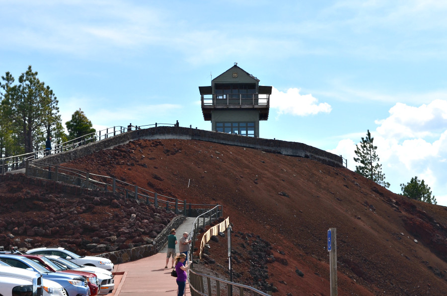
I stopped after I got back on the level surface and took this photo, wondering if my fear of heights would compel me to remain there and miss out on what must be a monumental view. I took off walking, determined to make it. I realized that I could hold on for every step once I started up the incline.
  DSC_0142_PM_view_from_first_turn

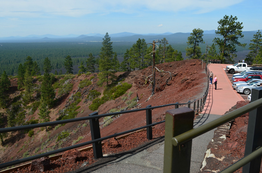
The view from the first turn in the walkway, to my right.
  DSC_0143_PM_another_view_from_first_turn

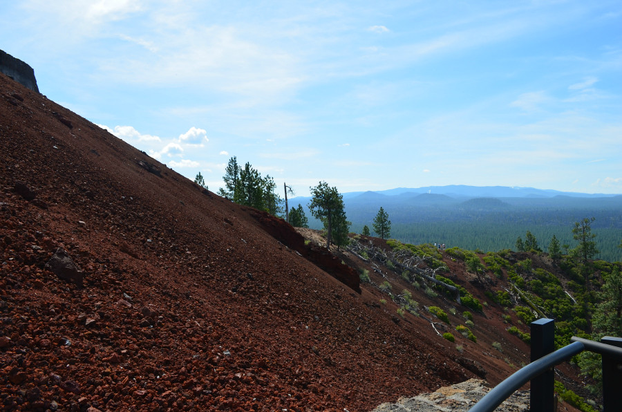
The view to my left from the first turn in the walkway.
  DSC_0168_PM_handrail_lot_bathroom

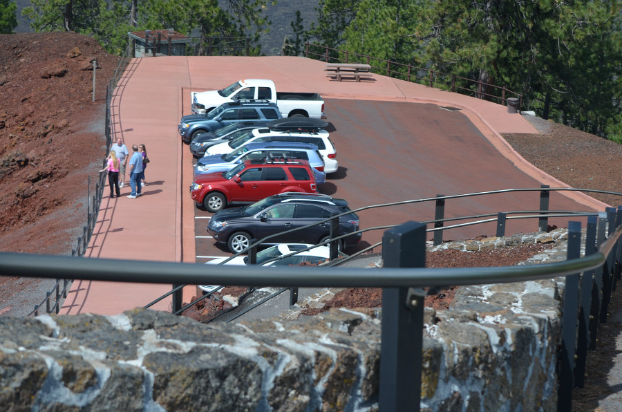
I made the second turn and stopped to take this photo. This gorgeous handrail, surely made of steel, and its rock walls convinced me that I could make it right on up to the top.
  DSC_0146_PM_Leland_Lamont_top

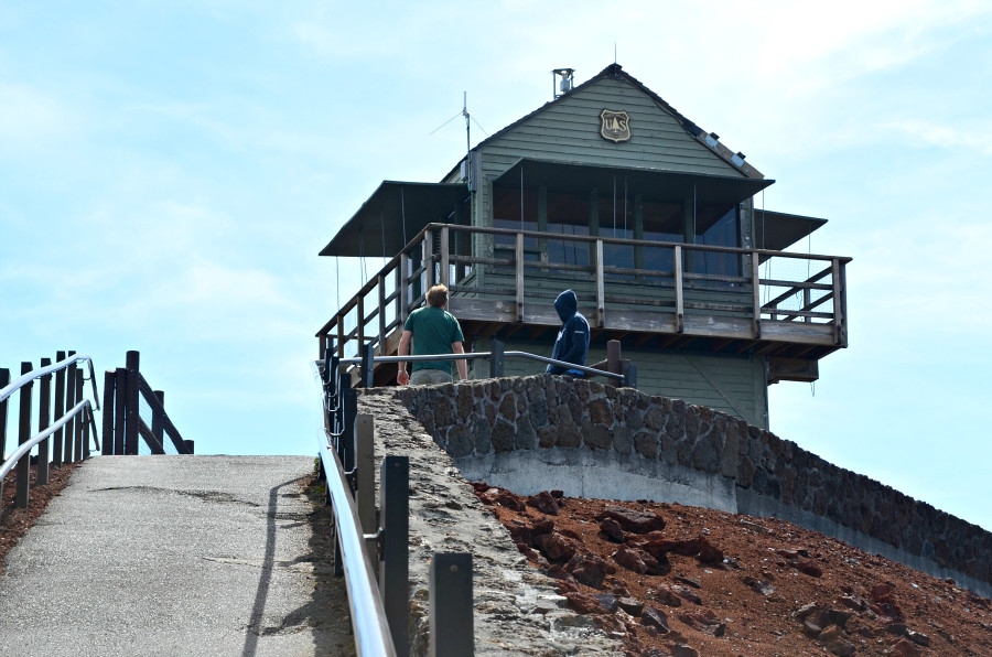
Before I started walking again, I turned to look up higher, leaned into the handrail, and took this photo of Leland and Lamont, already at the top.
  DSC_0149_PM_the _entire_crater

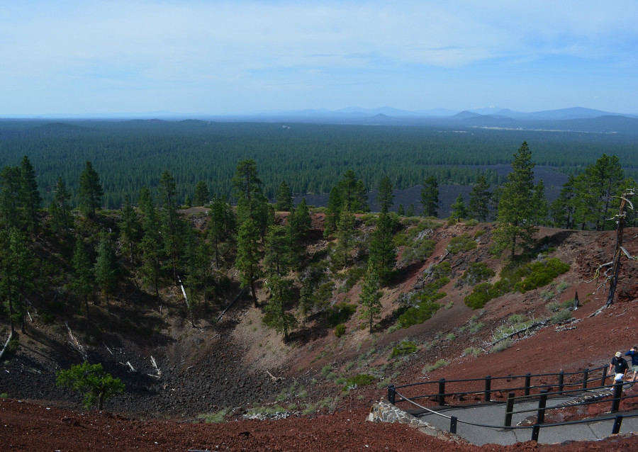
I also took this photo of the entire crater, well all of it that I could see from that spot. At this point, I didn't realize that there was a quarter-mile loop trail around its edge.
  DSC_0152_PM_parking_lot_panoramic_view_1

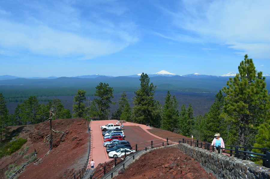
I made it to the top! I took this panoramic photo from where I'm standing in the photo above, the one that Leland took of me with my iPhone. Yea!
  DSC_0150_PM_lava_flow_1

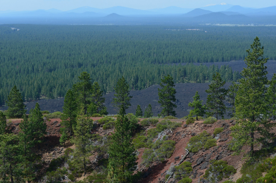
I also took this photo from the same spot. The lava field blew my mind! Talk about learning something new each day. This particular Saturday was one learning experience after another. I loved it!
  DSC_0155_PM_step_fire_lookout

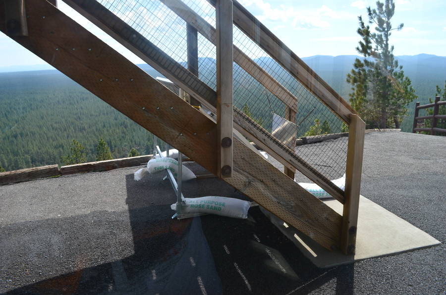
I noticed these bags of All Purpose Rose Sand beneath the stairs. Curious. I walked to the end of the stairs, feeling pretty good about how flat the surface was there around the Fire Lookout. Then I noticed there was no railing along the back side of the surface. So I walked carefully to that railing you can see on the right of the photo and turned back to look at the building.
 DSC_0159_PM_solar_panels

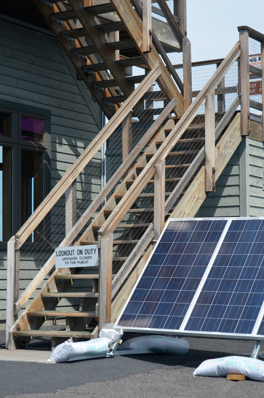
Ah, the sandbags kept the solar panels in place. From this vantage point I looked around for a while, saw what looked like a path with no handrails slanting away from where I stood, and watched as a family of four--the children were probably seven and nine--walked right by me and on down the trail. Whoa! I looked some more and then noticed people walking ahead of them on the edge of the crater. I also realized I had not seen Lamont or Leland for a few minutes. I figured they were walking around the edge, too. So I walked back to the other side of the building where I could stand and see the entire loop.
  DSC_0171_PM_loop_Lamont

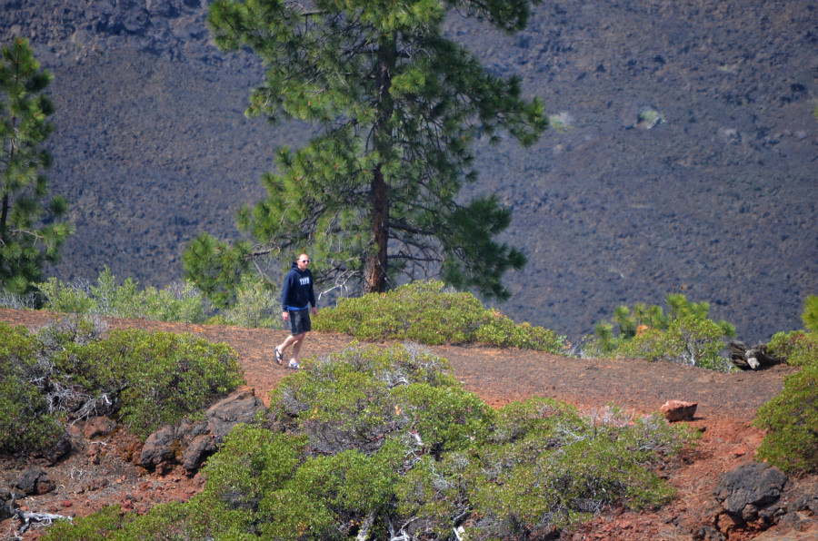
I found Lamont first.
  DSC_0211_PM_loop_Leland

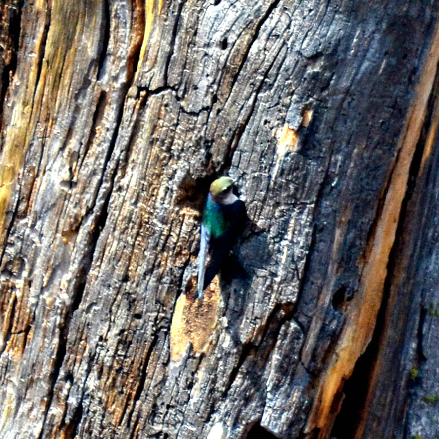
Then I found Leland.

Come back tomorrow for monumental views and teensy birds, plus that twisted tree to the right side of the crater.