Showing posts with label Marquam Bridge. Show all posts

Saturday, August 24, 2013

Back to the Waterfront Blues Festival, July 5, Let's get this party started! And several inadvertent plugs for corporate sponsors

DSC_0108_PM

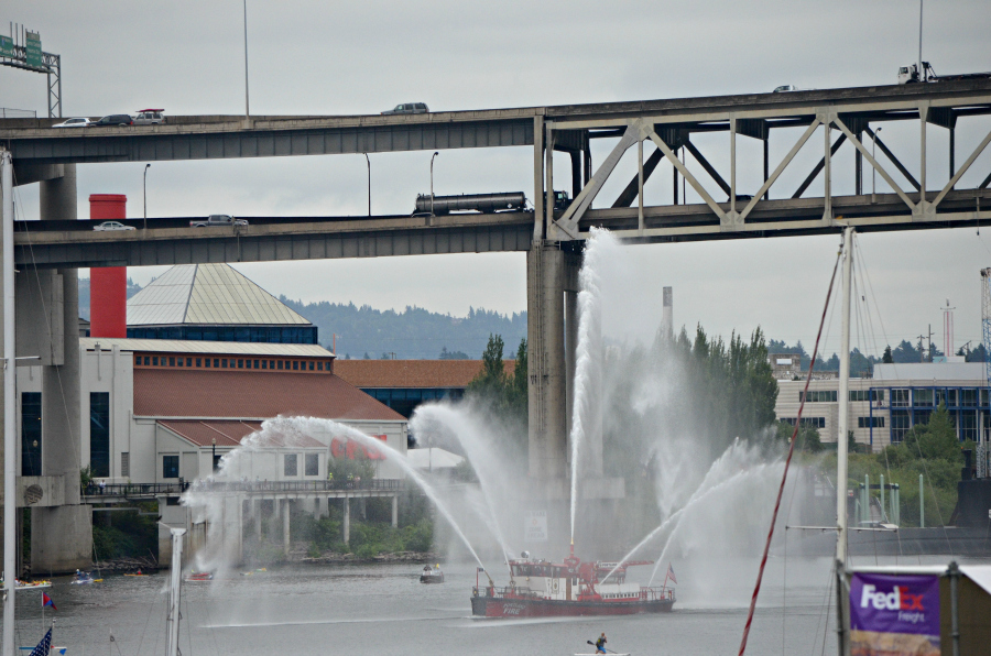
First large-scale sight of the day, right about 10:30 a.m., a welcoming spray from the Portland Water Bureau's fireboat. To me, it doesn't get any better than this--living in a city with a river running through it, populated by all sorts of waterborne vessels, some outfitted with water canons! Well, I have to tell the truth, it does get better, when the water is red, white and blue. Rising above the Willamette River is the north- and south-bound Interstate 5 on the Marquam Bridge. The various shaped roofs you see, and the red chimney, are the Oregon Museum of Science and Industry, a great place to visit. The red letters you can see on the wall, beneath the leftmost water cannon spray, spell OMSI. We say Ahm-zee around here.
  DSC_0110_PM

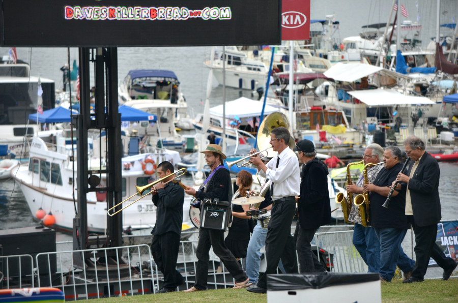
First large-scale sound of the day, the Transcendental Brass Band played their way across the bowl at Tome McCall Waterfront Park on their way to the rest of the festival grounds. Love, love, love those sounds!

BTW, did you see the inadvertent plugs for corporate sponsors? Two are major sponsors, FedEx and Kia, the other is a Safeway Sponsorship Partner, Dave's Killer Bread.

Friday, March 1, 2013

Seen outside the Oregon Rail Heritage Center

Click here for a trip to City Daily Photo, transporting you around the world every day.

DSC_0205

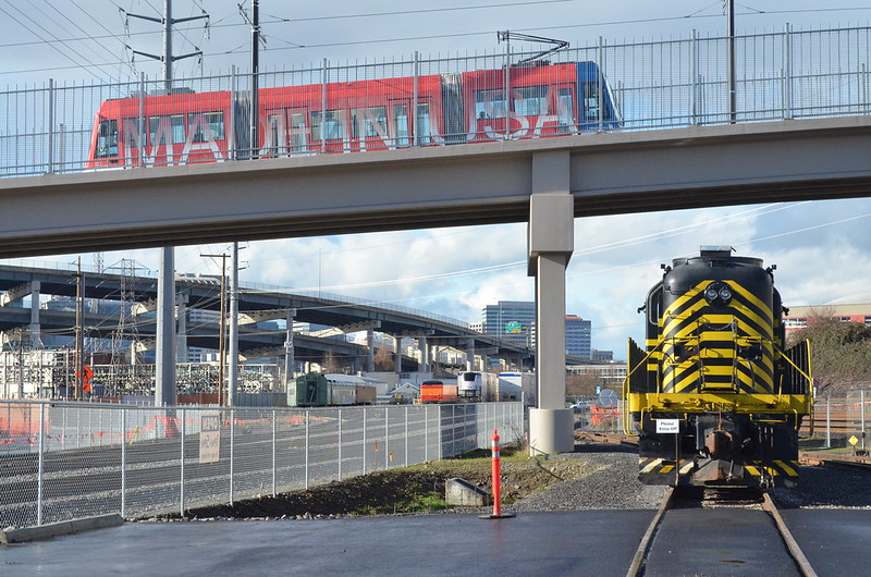
Saturday, February 16, I enjoyed visiting the Oregon Rail Heritage Center, going in through the front door, a regular-sized-people-use-door, through the building with gigantic steam locomotives on each side of me (more photos soon), and out the back doors which are huge because the locomotives use them! 

Out back I finally got a photo that I've been wanting to take since last September. Here's the Portland Streetcar crossing over the whole area on the bridge built especially for it. That streetcar was made at United Streetcar which is in Clackamas, Oregon, southeast of downtown. United Streetcar is a subsidiary of Oregon Iron Works. On the tracks in front of me, the Nickel Plate Road 324 switcher, not operating at this moment, so I'm completely safe. To the left, those ramps are part of the Marquam Bridge, I-5 north and south. The buildings in the distance are in downtown Portland.

Sunday, November 20, 2011

Sunday Bridges: Marquam Bridge over the Willamette River

Sunday Bridges at San Francisco Bay Daily Photo

DSC_0583p_marquam_bridge
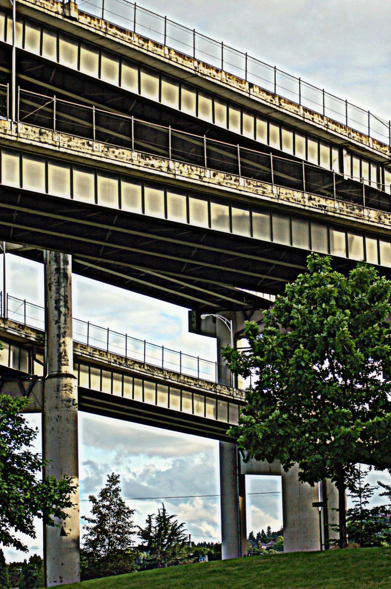
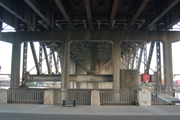
June 4, 2008, during the Rose Festival, I took this photo standing on the west side of the Willamette River beneath the Marquam Bridge. The upper deck is I-5 North, the lower deck is I-5 South. The lowest ramp must be for either entering or exiting the bridge from nearby surface streets. Due to its height and the fact that it also curves, I stay away from this bridge when driving, if at all possible. Too scary for me, although I have been south once and north once, talking to myself the entire time about staying on the bridge. You see, I not only have a fear of heights, I have a getting-better-all-the-time fear of bridges.

Saturday, August 27, 2011

Portland, seen from the Aerial Tram

DSC_0190p
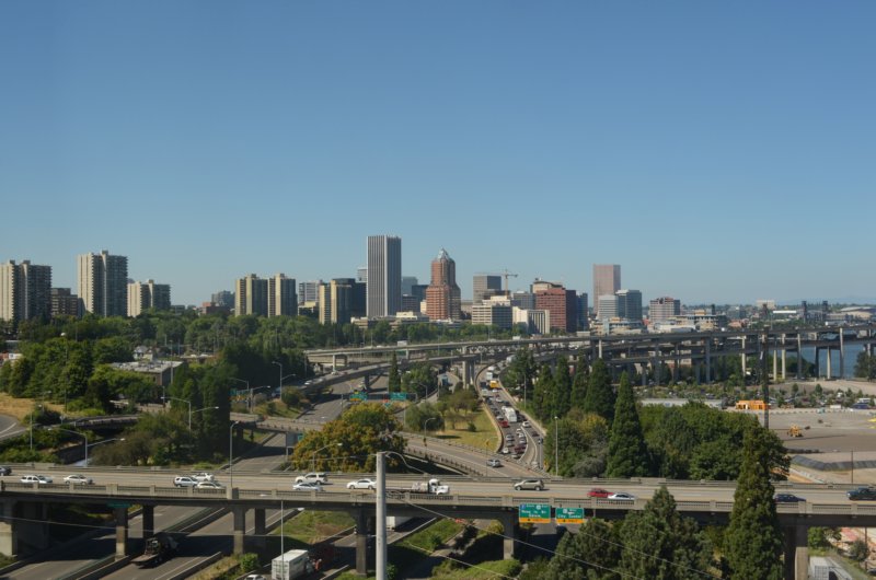
Looking north from the Aerial Tram, the Ross Island Bridge running east and west across the bottom of the photo, the Marquam Bridge curving north and south.

DSC_0166
The Marquam Bridge--the upper deck is I-5 northbound, the lower deck is I-5 southbound.

DSC_0175
The Ross Island Bridge goes over the Willamette River between southeast and southwest Portland. At the right edge of the photo, about a third of the way up from the bottom, you can see the Aerial Tram. I'm not sure if it is coming up or going down.

DSC_0183p
Looking pretty much northeast, you can see lots of southeast, northeast and north Portland. The bridges are, from right to left, Marquam, Hawthorne, Morrison, and Burnside.

Tuesday, September 21, 2010

Primary Color Red #1

DSC_0018
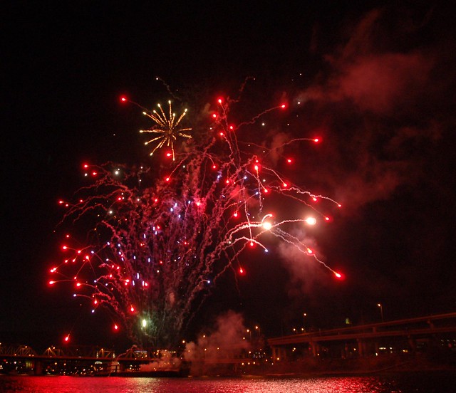
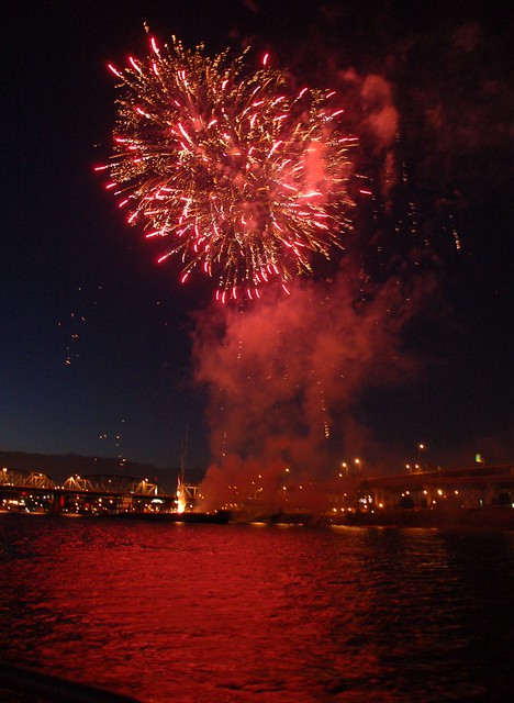
July 4, 2010, mostly red fireworks reflected on the Willamette River, downtown Portland. The Hawthorne Bridge is on the left of the fireworks barge--a ramp coming off the Marquam Bridge to the right.

DSC_0430p
One more fireworks shot, mostly the primary color red. Needless to say, I had a blast on the river with friends on the 4th of July. How's that for a pun? Actually I heard one blast after another, reverberating around the downtown buildings and the river.

Friday, June 13, 2008

This creeps me out!

crushed_vehicles_18whlr_marquam
As I stood on the west bank of the Willamette, shooting those photos of the tall ships, different things kept catching my eye, up on the Marquam Bridge. When I realized what this was, I thought, "Yuck! Flattened vehicles! On an flat-bed truck!" Snap. Not exactly what someone with a fear of bridges wants to see on the northbound interstate, top level of an extremely high bridge over the Willamette, let me tell you.

Sunday, June 8, 2008

Busy river last Wednesday, June 4, 2008

15_tall_ships_shot_sr_middle

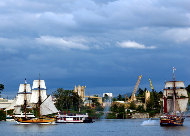
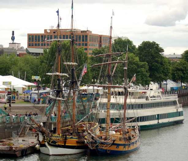
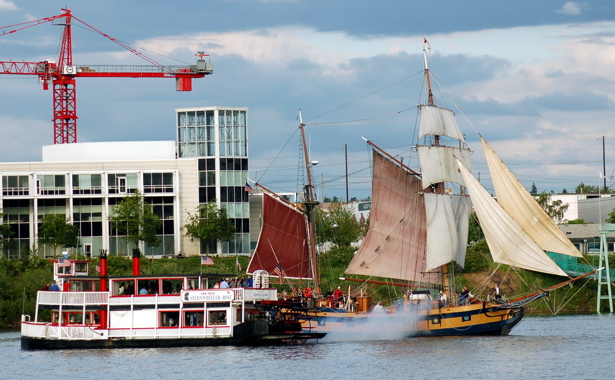
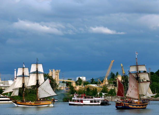
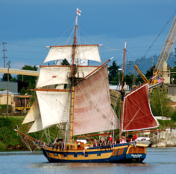
From the Hawthorne Bridge, left to right, the Lady Washington and the Hawaiian Chieftain. Behind them you see the Portland Spirit.
1_tall_ships_docked

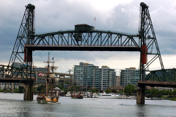
The raised Hawthorne Bridge allows both tall ships to pass beneath it, going south on the Willamette River, on their way to the mock battle. You can see the Riverplace Marina to the right of the tall ships.
2_tall_ships_under_haw_brdg

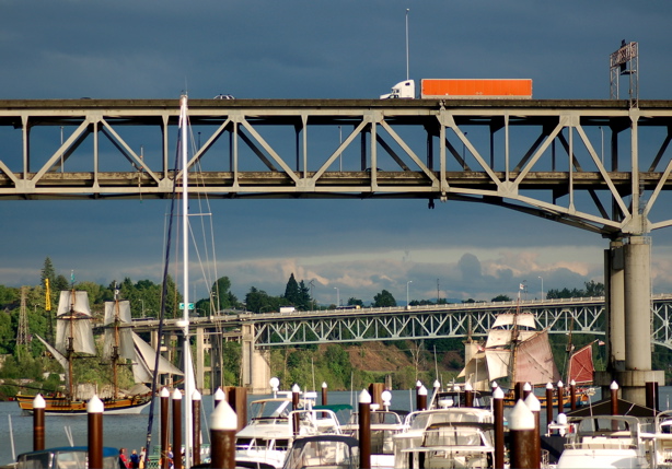
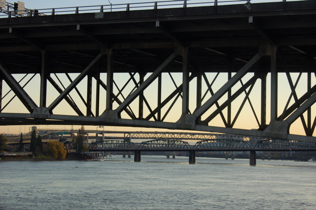
Before I walked past the marina, I took this photo which shows a portion of the Marquam Bridge with the Ross Island Bridge in the background.
3_tall_ships_marina_marquam

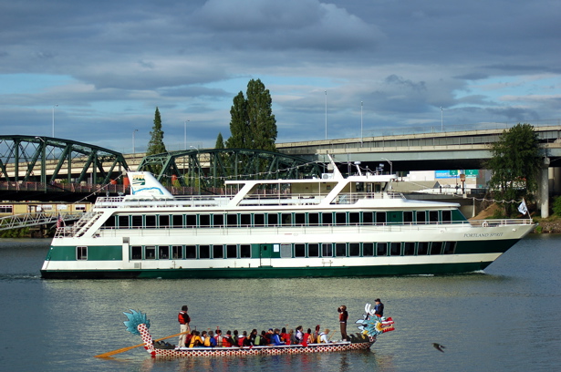
The Portland Spirit and the dragon boat I had been watching earlier.
4_pspirit_drgnboat

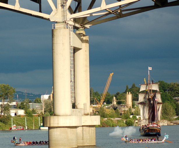
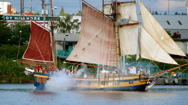
Beyond the Marquam Bridge, the Hawaiian Chieftain cannon fires as dragon boats practice nearby.
5_hchief_shot_dboats_mbrdg_support

The Willamette got really busy. You can see the Oregon Museum of Science and Industry in the background, too.
6_busy_river_omsi

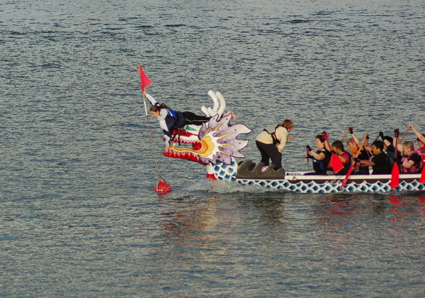
7_dboat_practice_grab

Looks like the Sternwheeler Rose got a bit too close for the Hawaiian Chieftain.
10_sternwheelerrose_hchief_shot

12_busy_river

14_lady_washington_shot_sr_hc

A sailor works on the cannon.
16_hc_man_cannon

18_hc_shot_close

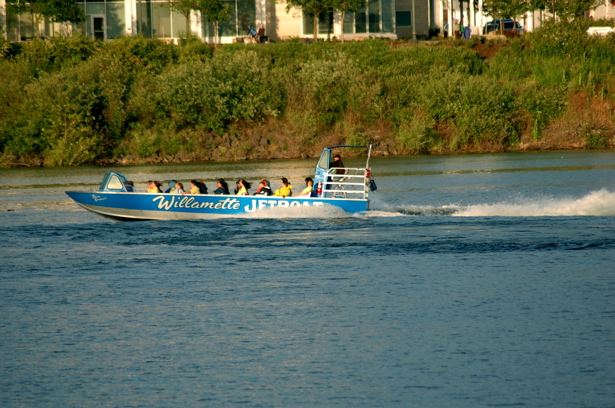
The Willamette Jetboat distracted me from the mock battle.
22_jetboat

26_jetboat

The ships must have turned around not too long after I took this photo of them close by the Ross Island Bridge. It doesn't open, so they would have had to do that and return to their moorings, after passing underneath the raised Hawthorne Bridge once more.

tall_ships_ross_island

Saturday, December 8, 2007

Looking south at the Morrison Bridge, et al

Today dawned clear and cold, perfect December photo weather for the Pacific Northwest. After finishing two errands, I went lookin' for bridges. First for you, the Morrison Bridge from Tom McCall Waterfront Park.
br_morrison_boat_marquam_background

The Crystal Dolphin sets sail on the Willamette River from the east bank, between the Hawthorne and Marquam Bridges. Here it glides beneath the Morrison Bridge. You can read all about this yacht-for-rent here. In the background above the yacht, that's the Marquam Bridge curving down as it finishes crossing the river from west to east. This view further reinforces my hope to never have to drive or ride, to tell you the truth, over the top of that bridge.

br_morr_underside_other_bridges_background

In this close-up shot of the Morrison, you can see Hawthorne and Marquam Bridges in the distance.

br_morr_beneath

Just before I crossed Naito Parkway to head for the bus stop and a homeward bound 15 bus, I took this photo.

br_morr_to_washington

Standing at the bus stop at SW 3rd Avenue and SW Washington, I took this photo looking back towards the Morrison Bridge. You can see the bridge splits and the westward bound three lanes come off on SW Washington at SW 2nd Avenue.

Can you see what looks like green traffic signal lights on the bridge, near the control towers? That's not an ordinary traffic signal--it turns red when the bascule bridge has to open for river traffic. Remember the photo of the open bridge, on the Dec. 7 post? I'm guessing that if the bridge had been raised when I took this photo that the control tower on the left would have been hidden from view by the bridge deck.

Please come back tomorrow for Portland's Steel Bridge.

Thursday, December 6, 2007

Two bridges I photographed that are south of the Hawthorne Bridge

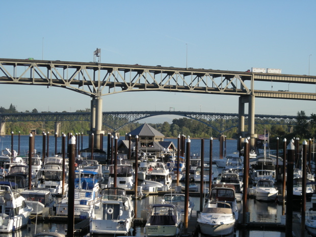
South of the Hawthorne Bridge and past the Riverplace Marina, you see the double-decker Marquam Bridge and the Ross Island Bridge. I took this photo on a beautiful September day, right after work.
bridge_marq_rossislandarch_marina

The Ross Island Bridge is the first bridge that I drove over that crosses the Willamette River. It was at some point in July, 2006. Mama and I had decided we wanted to go to the Spirit Mountain Casino in Grand Ronde, Oregon, to play the penny slot machines. Since the bridge has such a short-seeming railing, I was thrilled that two lanes go each way because I could get in the middle and not be able to see much of the river or be able to tell how high up we were in the car.

We made our way off the bridge and onto I-5 South, then to state highways and finally to the casino where we had a good time for a couple of hours.

As we neared the Ross Island on the way back, intending to take it to our then apartment in Southeast Portland, it became obvious that going back would not follow exactly the same path as going forth. What I mean is that I couldn't find the way to get onto the west end of the bridge. I could, however, find my way onto Naito Parkway and then onto the west end of the Hawthorne Bridge which we crossed with ease, mainly due to the fact that the 10-foot-wide sidewalk between the lane I drove in and the railing really helped me cope with my fears. I believe it took at least four trips back from the casino before I finally figured out the convoluted method of gaining access to the west end of the Ross Island Bridge from northbound I-5. I can't even describe it to you accurately, nor can I take photos of it because I'm always the one driving. Just believe me when I tell you that convoluted describes it to a T.

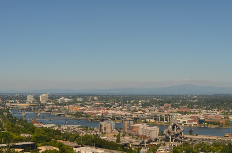
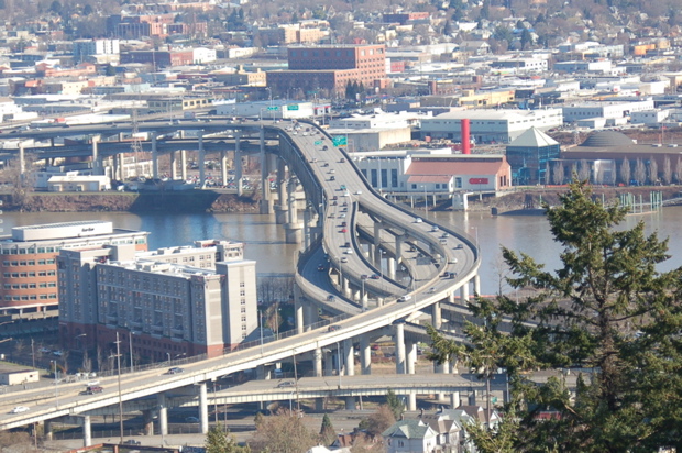
Here's another shot of the Marquam Bridge, taken from the Peter Kohler Pavilion at Oregon Health & Science University, up on Marquam Hill. I've driven south on the Marquam Bridge twice, I'm proud to say. Neither time did I allow myself to do anything but stay in the center lane, concentrating on breathing and driving. I have yet to go north on it, and to tell you the truth, I'm hoping that I don't have to--from where I stand, the railings just don't look high enough to make me feel safe. I mean, even the Fremont Bridge's top deck has that soaring arch up above it which gives me the allusion of being enclosed. I know that's irrational, but it's the way I feel. But I do love looking at these curves from afar.
bridge_marquam_wide

In this photo of the two bridges, you're looking westward. Those high rise buildings are in an area known as the South Waterfront. I don't know for sure, but I suspect that one of them is the building that Mama and I went to on Monday, Dec. 3. She had an eye doctor appointment.
bridge_marquam_rossisland_crop_may

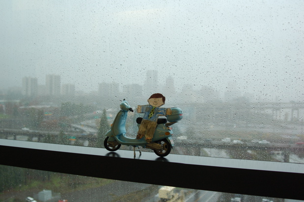
I took this photo from the 11th floor of the Oregon Health & Science University's Center for Health & Healing--I do know the name of the building even if I don't know if it's in my other photo. It never dawned on me what a view there would be from the windows until we walked off the elevator and turned left. Can you imagine how I would have felt if I didn't have my camera and Flat Stanley?

The bridge closest to the little guy, sort of going through the tires on the Vespa, is the Ross Island Bridge. The one you can barely see in the distance, behind his left shoulder on the right side of the photo, is the Marquam Bridge. And that's the skyline of downtown in the background. The rain is part of the 3.55 inches that Portland got in three days which was a drop in the bucket compared to other areas of Oregon and Washington. Please say a prayer for all those whose lives have been drastically changed by the weather.
fs_120607_11thfloorwindow_marquam_rossisland

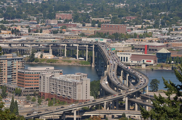
Wikipedia: The Marquam Bridge is a double deck cantilever bridge that carries Interstate 5 traffic across the Willamette River south of downtown Portland, Oregon. It is the busiest bridge in Oregon, carrying 135,600 vehicles a day as of 2004. The upper deck carries northbound traffic; the lower deck carries southbound traffic. ... Total length-1043 feet. Width-57 feet. Clearance below-130 feet. ... As it has great importance, the Marquam was the first Portland bridge to undergo a seismic retrofit in 1995.

Wikipedia: The Ross Island Bridge is a cantilever truss bridge that spans the Willamette River in Portland, Oregon. It carries U.S. Route 26 (Mount Hood Highway) across the river between southwest and southeast Portland. Although it looks like a deck arch bridge, it is the only cantilever deck truss bridge in Oregon. ... The bridge is named for its location close to Ross Island, an island in the Willamette River which measures about one-and-a-half by one miles. The bridge is about 800 feet (250 m) north of the island and does not connect with, nor does it provide access to Ross Island. ... There is a pedestrian walkway on the north side of the bridge, with no barrier between the sidewalk and the westbound right lane.

Saturday, September 15, 2007

What I got off the bus to see the other day

091507_tug_5x7_640x426

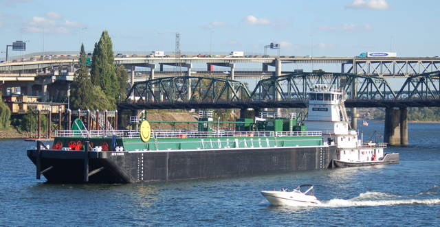
As the No. 14 bus headed west over the Hawthorne Bridge, I spied something I’d not yet seen in the 14 months I’ve lived in Portland. It's a barge named New Vision--I see that on the front corner of it--and a tug named The Chief, right in the middle of downtown, on the Willamette River. Neat!

I got right off that bus at its first stop and walked back east, heading north along the river. They were slowly moving downstream. I walked and walked and walked, until I could get the entire barge and tug in the photo.

Look at that blue sky, reflected in the river. Didn't I luck out at what I consider a momentous moment (sorry) in the story of my life in Portland? I think so. And did you know that the Willamette River runs north, to its mouth and the intersection with the Columbia River which then runs west to the Pacific Ocean? That's why I was walking north and the barge and tug were moving downstream.

091607_tug_bridges_640x332

Here's another angle. The green metal struss bridge is the Hawthorne Bridge, and the double deck cantilever bridge beyond it is the Marquam, home of I-5 as it crosses the river.

If you like ocean-going vessels, you ought to look at my other blog, Mama and Me from PDX, in the August Posts. Scroll on down to August 16 (which takes you by my Aug. 23 parody of "Always Look on the Bright Side of Life," which I entitled, "Always Delete the Spam from Your Life") to see a huge yacht at the marina on the other side of the Hawthorne Bridge.

Here's a tidbit from the barge company’s Web site:

Tidewater—more than a barge line. In operation since 1932, Tidewater has traditionally offered a variety of barge transportation services on the Columbia-Snake River System. Today, in our endeavor to provide extended services to our customers, Tidewater has evolved into a multi-modal transportation company serving the Pacific Northwest with its integrated system of towboats, barges, and terminals. We appreciate the privilege of operating in the Pacific Northwest and are committed to performing in a manner that will preserve the livability of this region for future generations.