Showing posts with label Burnside Street. Show all posts

Friday, November 9, 2007

Have you seen dump trucks like these in your city?

110907_double_dump_truck

Thursday morning I boarded the 20 bus in front of the Volvo place and rode ten blocks east on Burnside, downhill.

I got off at SW 12th, to walk a different route part of the rest of the way to work. First I thought I had lucked out and could get a shot of a big ol' crane, swinging its bucket out over an I-don't-have-a-guess-how-many-stories-deep hole. I could not move fast enough, doggone it. A few steps later, I spied something I've been wanting to photograph for you. Two double tandem dump trucks, just sitting there in the middle of the street, waiting.

By the way, the golden gingko trees in the background stand in front of the church where the "ABC Wednesday J is for Joy" bride and groom wed back in September.

Does that Lay's delivery van look rather larger than normal to you?

110907_double_dump_truck2

I crossed at the corner and walked about half a block, then turned to take a photo of the trucks, looking north. The lead truck had moved down beside the crane, and the second truck had stopped at the crosswalk. Would that I could have seen and photographed what the scoop scooped, then dumped!

I'll still be on the look out for my favorite double tandem dump truck. When I get that photo for you, I'm certain that you'll understand immediately why I say favorite.

Monday, October 22, 2007

Great Leaf Moments, A Series, I

corner_23rd_burnside_red_trees

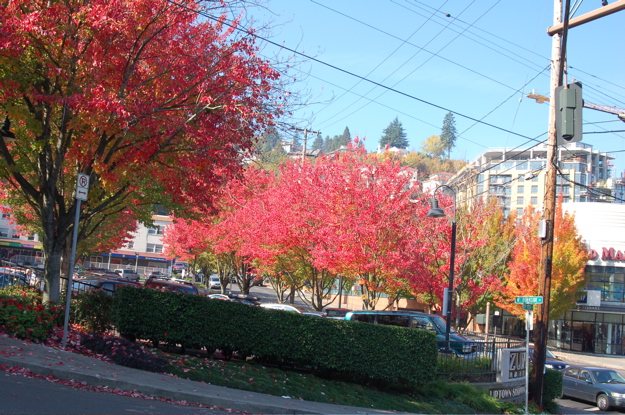
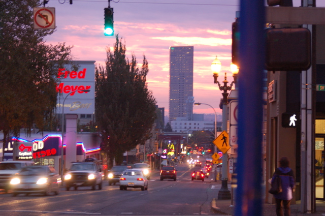
You're looking west. This is the intersection of West Burnside and NW 23rd Avenue, to the right, and SW Vista to the left. To get you oriented to previous posts, I could have turned around after I took last week's photo looking east down Burnside, the one that showed you Jim Fisher Volvo and the trianglular building, and seen this intersection. I didn't take this one right after the other one, though, because the sun wasn't up enough to do the leaves justice.

On Oct. 13, after Mama, Duncan and I got into the car, this is the first photo from our tour of the neighborhood. One week later, the first tree in the row alongside Burnside, the one right above the white van, had lost every single leaf. Like I said, it's been raining and blowing a good bit. Within weeks, leaf-less limbs will branch out from trunk after trunk all over the city, so I'm embarking on a series of sorts to share this beauty with you, in a rush with nature I suppose you could say.

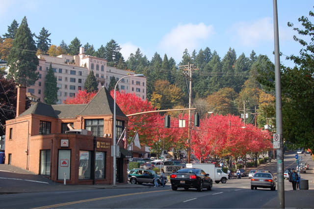
The small brick building on the left houses a State Farm Insurance office. Across from it you can see a sign that reads Zupans--that's a nice high-end grocery store. Up the hill to the left you see a pale building with many windows and the word Envoy top center. Here's a bit from the Web: "The Historic Envoy, built in the 1920's, has been renovated to its original charm and converted to condominiums. Units feature vintage hardwood floors, paned windows and covered off-street parking. Many have city and mountain views." The few I found for sale are in the $330,000 plus range, even the one bedroom. Y'all are beginning to understand why Mama and I happily rent, right?

An hour or so later after driving the twisting and turning roads above our neighborhood to the west, we've stopped on NW 23rd Avenue, waiting to cross West Burnside, so that we can take SW Vista up into another part of the hills. Burnside divides Portland into north and south, hence the direction change for the streets. Some but not all streets also change names, like at this particular intersection. Here's the corner from another angle.

corner_23rd_burnside_red_trees2

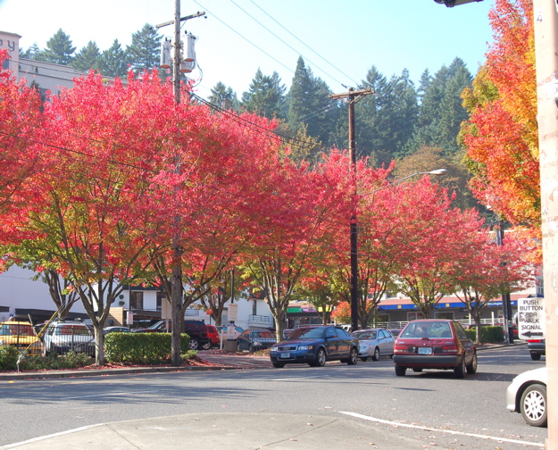
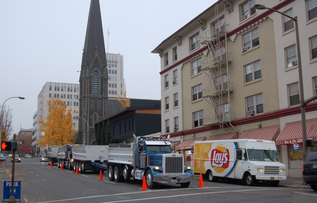
After driving up Vista and making a couple of right hand turns, plus stopping to take a few photos from a stairway hanging on the side of a steep hill--or at least that's how it seemed to me, the one with a pronounced fear of heights--we arrived at the intersection one last time.

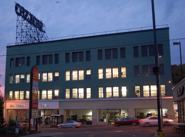
You can see from this photo how steep Vista is as it heads south from Burnside. It gets even steeper very quickly. My goal is to be able to walk up it so that I can go to the Vista Bridge and take photos from the 120 foot tall bridge--there's no where nearby to park, so why not? Well, to tell you the truth, it will be scary as all get out, as we say in the South, but I'm going to do it because I want to take photos from it. This photo-blogging is positively changing my life.

corner_23rd_burnside_red_trees3a

Tuesday, October 16, 2007

Volvo Deja Vu and a Windshield View

101607_volvo4

Feeling at home with this particular block on Burnside yet?

I took this photo Monday morning about 7:15 a.m. I'm facing south, standing in the parking lot in front of Walgreens (drugstore) and Wells Fargo (bank). The sliver of a building that you can see on the right is a Subway sandwich shop. And just to the right of the word Volvo, you see TriMet stop # 749 with its curved roof.

As I put away the camera, the 20 bus stopped, then drove away without noticing a young woman frantically running down the sidewalk, trying to catch it. I knew the 15 bus would arrive soon, so I crossed the street, got out my camera and took two more photos, snapping the last one as the bus pulled to a stop.

As I boarded and showed the driver my bus pass, he said, "That makes for a vivid picture, doesn't it?"

"Yes, it does," I answered and took my seat, making sure I could look out the windshield of the bus as we rolled down Burnside, until we turned right in front of The Civic.

Here's what disappeared from view but not from memory.

101607_sunrise

Saturday, September 29, 2007

For you, a part of what I see walking to work

092907_triangle_bldg_625x469
Friday morning as I walked part way to work, this view particularly appealed to me. It's about 7:05 AM, PDT, and we're looking east down West Burnside on the left and southeast down SW Morrison on the right. Some mornings when I walk down Everett to Third, I'm walking at the same downward slope you see on Burnside. If I decide to walk on Morrison instead, then go due south to take Salmon down to Third, I walk slightly uphill before it levels off and then slopes down towards the Willamette River. Either way I walk, I make good time, take a few photos, and catch the bus that takes me over the river to work. I love to walk in Portland, and I'm curious to see how I can work it out to walk as much as possible during the wet winter.

The pale peach-colored building in the intersection is one of two triangular-shaped buildings that I've noticed in the sharp-angled intersections on the south side of Burnside. At its closest end, it houses a pizza place; at the opposite end, there's a bar and grill. I believe the upper floors are apartments. The tall, many-windowed building behind it is the Civic, a brand-new condo building. In between it is the rust-colored shorter building, the Morrison. They represent an interesting concept, new to Portland, as reported recently in the Portland Tribune. You can read about it at http://www.portlandtribune.com/news/story.php?story_id=118945870998628300.

Here's a bit from Wikitravel about how Burnside and the Willamette River work to delineate parts of the city: Portland is divided into five sections. Burnside Street is the north/south split. The Willamette (pronounced will-LAM-et) splits Southeast and Southwest, but the river takes a turn north of Burnside. Since Mother Nature doesn't care much about straight lines, the city decided to split what would be the Northwest quadrant into Northwest (West of the river) and North (East of the River), then divide North and Northeast at Williams Avenue. All Portland addresses contain their designating sector inserted between house number and street name (i.e. 3719 SE Hawthorne Blvd.) This will make it easier to figure out where things are. If you hear Portlanders talking about Southwest or Northeast, they're probably talking about the section of the town rather than Arizona or Massachusetts.