Showing posts with label Morrison Bridge. Show all posts

Friday, June 19, 2015

UPDATE: It ain't the news we wanted. And upside what happened in Charleston, SC, Wednesday night, my news is an eyelash loosened from our eyes by the tears we have shed. While you're praying for me, please, I entreat you, consider praying for all of us to treat each other as the valuable people we each are. Now, for the blog post I already had made for Friday: Size, often it's all in perspective and location. Sometimes, it's just flat out huge. No. 3

UPDATE: The needle biopsy results say that there are fragments of atypical cells like the adenocarcinoma which was the kind of cancer that was in my uterus. So, I have an appointment tomorrow at 2 p.m. with the doctor. Tentatively scheduled to have surgery at a different Kaiser facility where there is a robot which will be used for the surgery to remove lymph nodes. I will know about those two things, the pathology and the plan, after the appointment tomorrow. I will have to be off work for probably five weeks. I will not give up. Thursday at work I felt a consisten energy level throughout the day, a decent energy level. I take that to mean that I am stronger. I know that I have lost weight, I know that I recovered smoothly from the hysterectomy. I intend to do that this time as well. I will not give up. Thank you for your prayers, your love and your concern. Love y'all.

DSC_0033

One more close up before the photos that I took of The World's journey north on the Willamette. I couldn't be at the beginning of it and along the river, so I opted to get up very early and ride a bus to somewhere I'd never been, get off, and walk back onto the Broadway Bridge to see what I could see.

DSC_0136

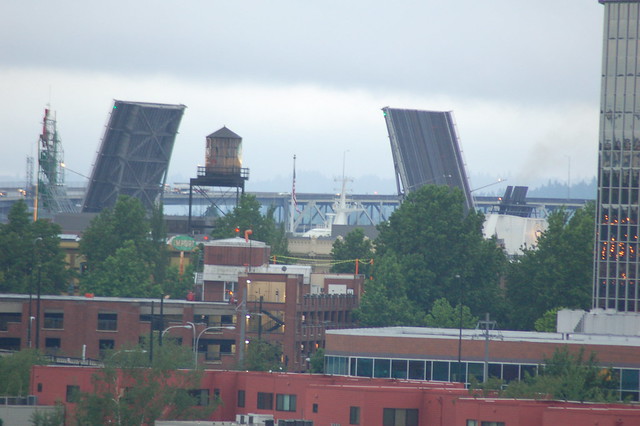
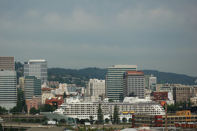
Here comes The World. That is a smokestack that you see to the right of the raised Morrison Bridge. The white things sticking up in between the decks are part of The World. I am standing east of center of the Broadway Bridge, zoomed in as far as I can.

The_World_3647925231_b98e964213_o

In this photo, three bridges are lifted simultaneously. To the far right, that's the Morrison beginning to close. In the center, that's the Burnside Bridge, not quite raised all the way. And to the left, the Steel Bridge looks about half raised.

Come back tomorrow for more photos of The World's exit from Portland on the Willamette River. Thanks!

Thursday, June 18, 2015

Size, often it's all in perspective and location. Sometimes, it's just flat out huge. No. 2

DSC_0061

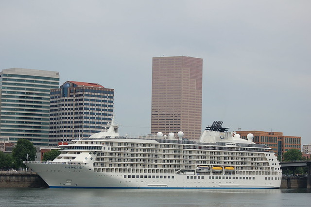
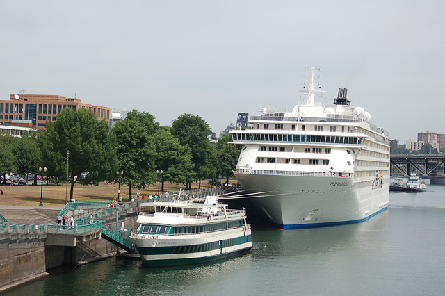
Here's an even closer view of The World, taken as I stopped for a look from the sidewalk alongside the river. That is the Morrison Bridge in the background.

DSC_0063

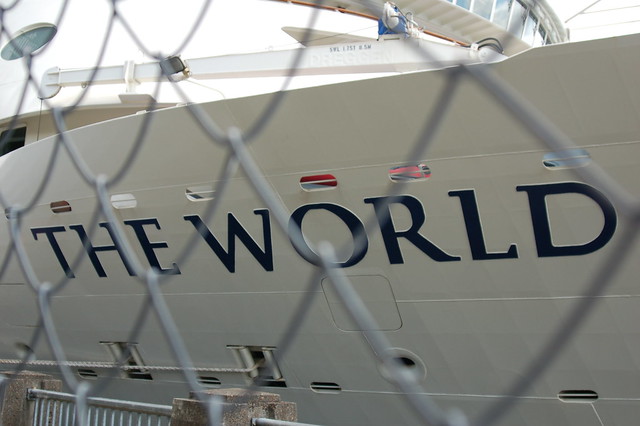
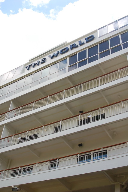
Leaves no doubt as to the name of the ship.

DSC_0064

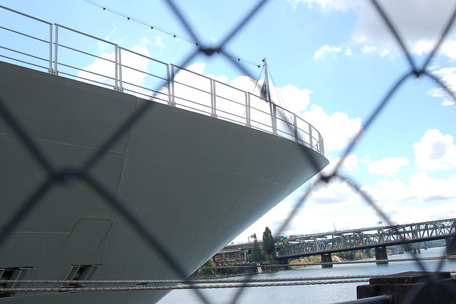
How many feet above my head is the deck? I don't know, but it looks pretty high up to me.

DSC_0071

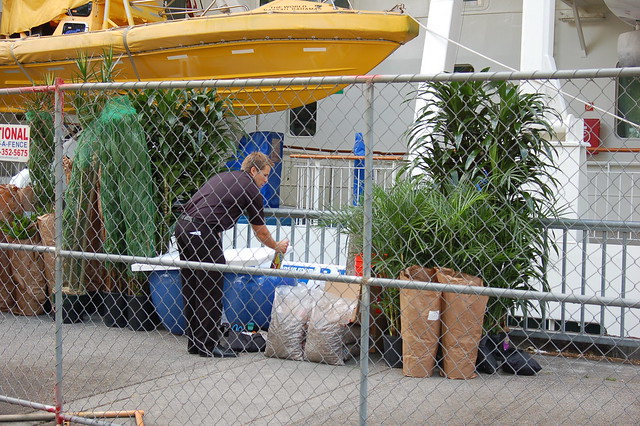
That's not a bottle of booze he's holding. It's plant refurbishment time while The World docked in Portland. Busy, busy times, I imagine for lots of those 270 crew members on board, whenever the ship is in a port.

DSC_0074

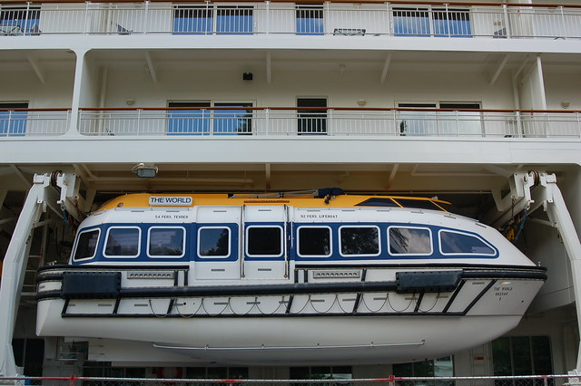
A life boat.

DSC_0068

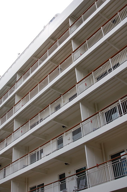
Looking up at the decks with their balconies.

DSC_0072

Wonder how large those letter are?

DSC_0100

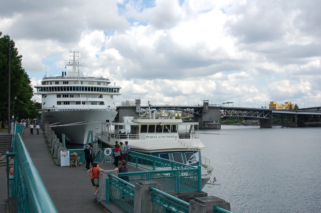
As I walked back towards the Hawthorne Bridge so that I could make my way back to work, I turned back for one more photo, this one showing the Portland Spirit and The World, both docked at the seawall. Also, you can see people in this photo, which gives you an even better idea of the difference in size of the two ships.

Wednesday, June 17, 2015

Size, often it's all in perspective and location. Sometimes, it's just flat out huge. No. 1

DSC_0022

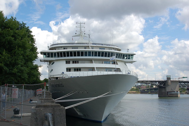
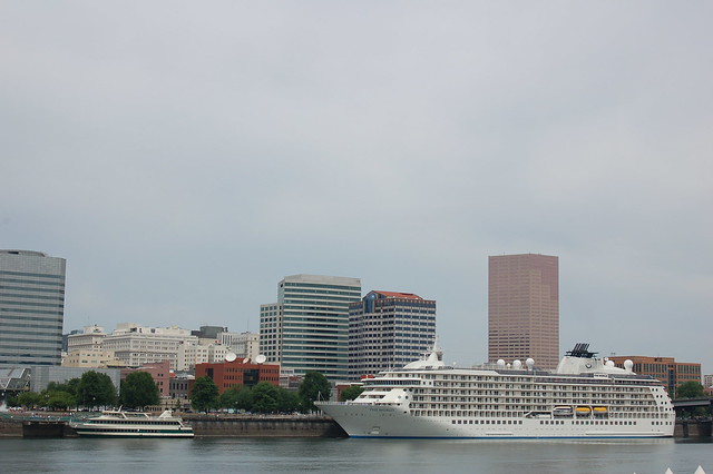
The World docked on the west side of the Willamette River. I took these photos on June 16, 2009, when I walked across the Hawthorne Bridge on my lunch hour. I had seen the TV news story about the ship and knew that I'd be a total fool to miss the chance to see it for myself. The Portland Spirit, a local river cruise boat, is docked to the left of The World. And beyond the center of The World, you can see the 30-story Big Pink--it is about a mile away, walking.

Found this quote in the June 17 Oregonian, made by an acquaintance of mine, as well as a bit of interesting info about the ship:

"It's something I have to go take my camera and get a look at," said Dan Haneckow, a ship enthusiast from North Portland. "You just don't see very many big ships below the Steel Bridge anymore."

Haneckow was talking about the 665-foot ship described as a floating luxury condominium complex, which boasts a variety of restaurants, two pools, a tennis court and a running track, among other amenities. The ship's 140 residents and crew of about 270 are touring the Portland area and seeing sights such as Multnomah Falls and Mount St. Helens.

They're also leaving behind some cash. Travel experts predict the ship's stop might inject some extra life into the local economy. While the exact economic impact of the Portland stop was unclear Wednesday, the industry standard for spending by cruise ship passengers is $125 a couple per day.

Bruce Connor, vice president of Sundial Travel & Cruise Center, which helped arrange the local itinerary, said the passengers could easily spend three times that.

DSC_0023

Well, you can certainly tell that is is a close-up shot, can't you?

DSC_0027

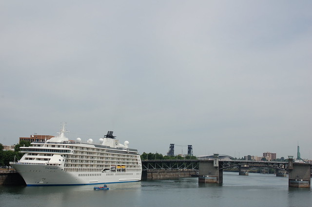
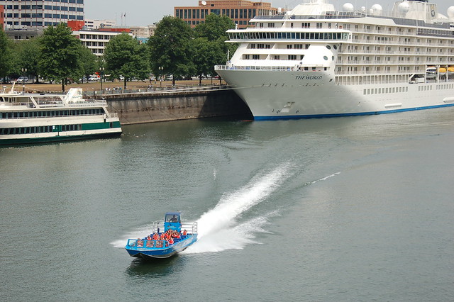
Here's another look with three of the four bridges which had to lift for The World to dock here and which will have to lift when it turns and heads down river, north to the Columbia, and then west to the Pacific. The closest bridge is the Morrison Bridge, the two bridge supports you see through the Morrison Bridge are part of the Burnside Bridge, and the black two towers in the distance are part of the Steel Bridge. The bridge not visible here is the Broadway Bridge. There is a westward bend in the river which, at this perspective, situates the Broadway Bridge to the left of the Steel Bridge. The tiny bright blue boat is a Willamette Jetboat, one that people pay to ride on, see the sights, get all wet. All that motion, turning, speed--not for me.

DSC_0016

I took this photo from the 5th floor rooftop garden of my work building which is on the east side of the Willamette River. Remember, The World is docked on the west side of the river; my work building is five city blocks from the river--I don't know the distance in feet.

DSC_0030

Here's that jet boat, speeding away after providing its passengers with a close up look at The World. They must've felt like flies on an elephant, size-wise.

Come back tomorrow for some photos I took as I walked alongside the sea wall, right beside The World. And the next day for photos which I got up very early to take on my way to work, well out of my way to work but on purpose. You'll understand when you see them.

Wednesday, May 20, 2015

Three minutes of bridge lifts, seen from the bus while on the Hawthorne Bridge, heading west after work, May 20, 2010

I've decided to use larger photos today. Please let me know in a comment if they are too large for your computer, making them difficult to see or to load. I'm curious. Thanks!
DSC_0020

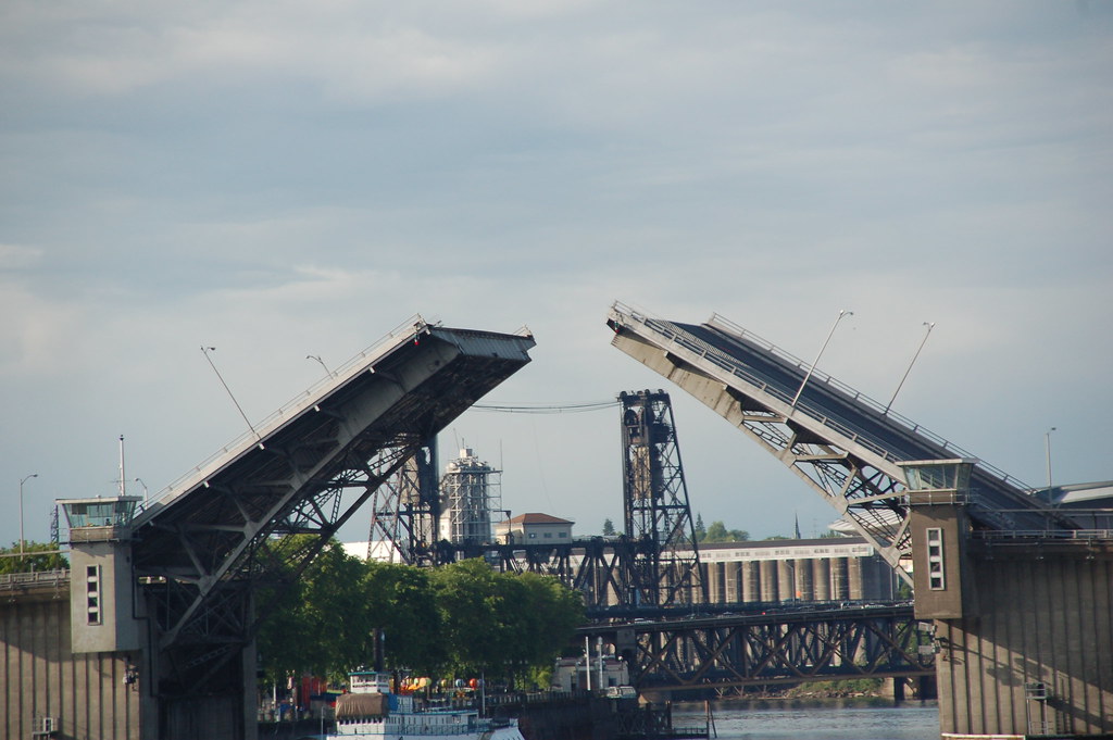
Looking north at the Morrison Bridge, mid-bridge-lift, I wondered what large vessel had caused the lift and which direction was that vessel going, north which is down river, south which is up river--the Willamette River flows north. That brown shape to the right of the docked white boat with the blue trim is not what caused the bridge lift. Since the bridge is wide open, I'm guessing that the vessel is on its way to the Morrison Bridge. I took this photo at 5:20 p.m.

A bit about the Morrison Bridge: It is a bascule bridge which was completed in 1958, the third bridge at approximately the same site to carry that name.

The bridge is the largest mechanical device in Oregon. Thirty-six foot tall gears drive 940-ton counterweights located inside each of the piers. The 69 ft. clearance is sufficient for most river traffic, requiring bridge openings only about 30 times a month. It currently carries 50,000 vehicles daily in six lanes. The canted windows of the control towers give the distinctive look of air traffic control towers. The current bridge does not connect to Morrison Street at its west end because the second bridge was left in operation while the latest version was built.

Believe it or not, I've been on a tour of the Morrison Bridge which included walking down the steps inside the west-most pier and seeing those 36 foot tall gears and hearing the sound made by the movement of them and the 940-ton counterweights as the bridge is opened. Totally amazing experience!

By the way, the black, double-decker bridge north of the Morrison Bridge, partially visible in this photo, is the Steel Bridge (1912). Between it and the Morrison Bridge is the Burnside Bridge (1926), not very discernible at this perspective. Look closely along the square-shaped trusses which are a lighter brown color and around the height of those trees--they are part of the Burnside Bridge.

I can't tell from this angle if the Burnside Bridge has started to open, but from the traffic I can make out on it, I don't think it's opening yet. Maybe it won't have to, it all depends on the height of the vessel on the river--the bridge clearance when closed is 64 feet. A bit about the Burnside Bridge: The Burnside Bridge is a 1926-built bascule bridge. The lifting is normally controlled by the Hawthorne Bridge operator, but an operator staffs the west tower during high river levels. This bridge is part of my daily work commute, both morning and afternoon.

All of the black trusses and bridge decks belong to the Steel Bridge. A bit about the Steel Bridge: It is a through truss, double-deck vertical-lift bridge. Its lower deck carries railroad and bicycle/pedestrian traffic, while the upper deck carries road traffic (on the Pacific Highway West No. 1W, former Oregon Route 99W) and light rail (MAX), making the bridge one of the most multimodal in the world. It is the only double-deck bridge with independent lifts in the world and the second oldest vertical-lift bridge in North America, after the nearby Hawthorne Bridge. The bridge links the Rose Quarter and Lloyd District in the east to Old Town Chinatown neighborhood in the west.
DSC_0021

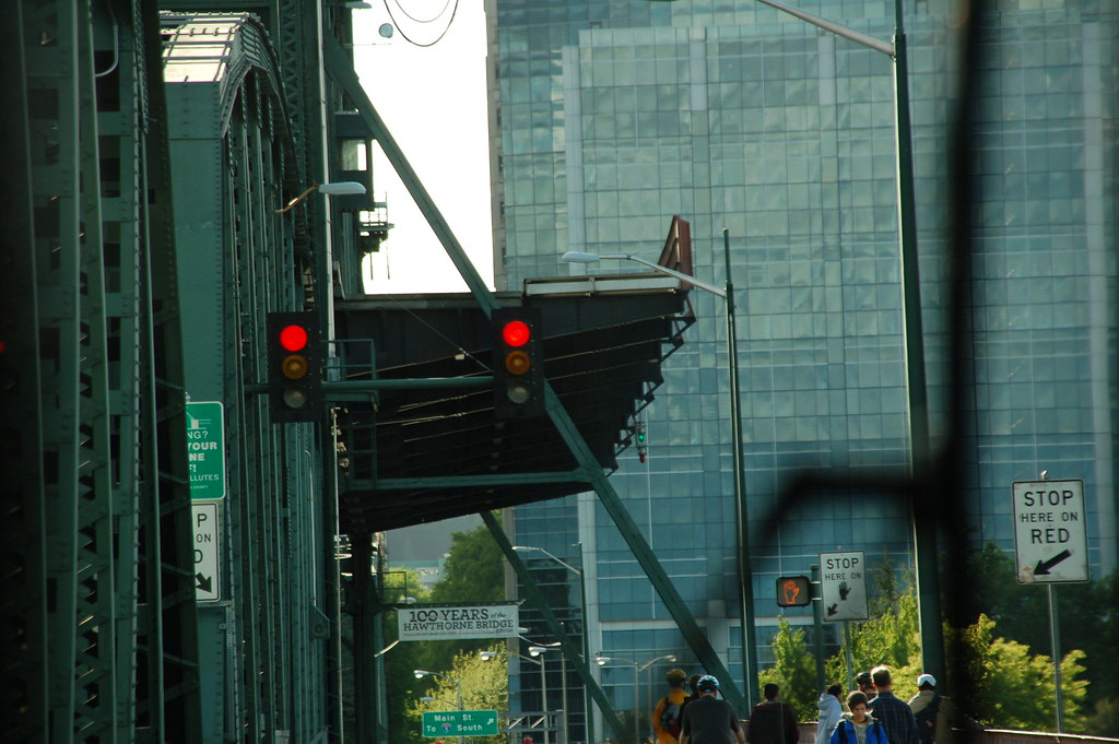
My next thing to wonder about, how long would the bridge lift last for the Hawthorne Bridge (1910). It all depended upon the direction of the vessel--maybe whatever it was had already cleared the Hawthorne Bridge, no matter the direction it was moving. I took this photo looking through the bus windshield. Notice that dark-colored section of the bridge with the rust-colored handrail. There's one pedestrian walking east; those other folks are waiting to continue their westbound walk or bicycle ride.

A bit about the Hawthorne Bridge: It is the oldest operating vertical lift bridge in the United States. The 1,383-foot long Hawthorne Bridge is one of Portland’s busiest bridges, safely carrying approximately 30,000 vehicles and untold pedestrians and cyclists across the Willamette River. Vertical clearance for river traffic is limited and approximately 200 openings per month are required for this vertical lift bridge.

Like other vertical lift bridges, the Hawthorne Bridge uses a system of counterweights and cables to move the lift span straight up and down. The operating system is mostly original, but the electrical power and control systems—which were installed in 1975—were upgraded in 1999. Hawthorne’s counterweights each weigh 450 tons and are supported by the bridge’s two towers, which rise 165 feet above the bridge deck. The Hawthorne Bridge’s main span can be raised 110 feet to allow vessels to pass underneath. On average, an opening of the Hawthorne Bridge is 8 minutes long.
DSC_0022

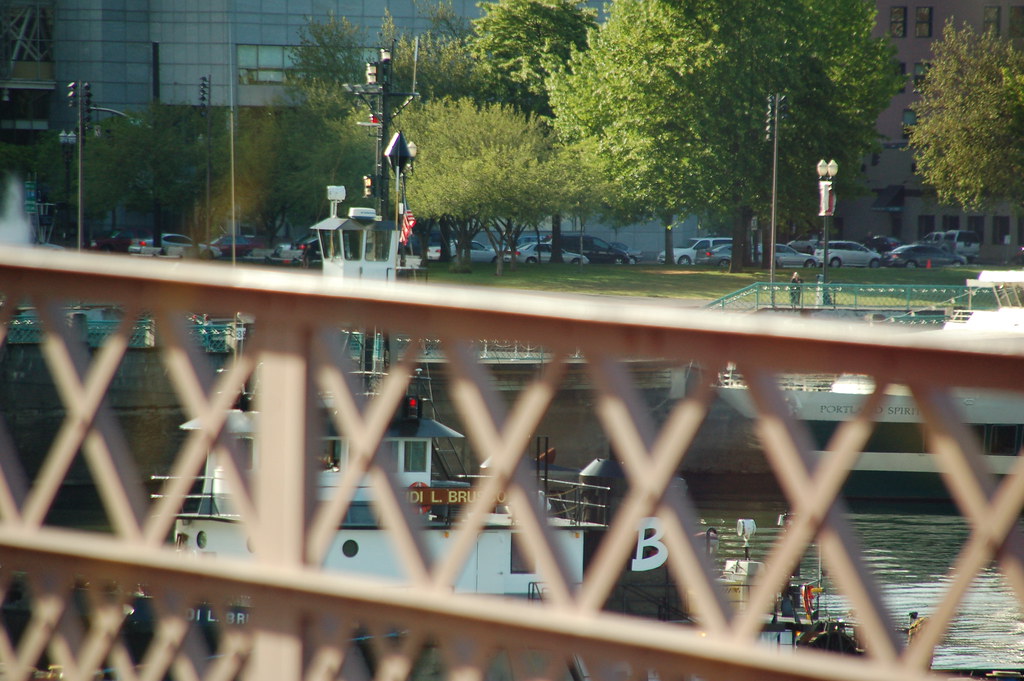
Looks like it's a tugboat causing these bridge lifts. Some of the letters are blocked by the bridge handrail, but I believe that I can read the name as Heidi L. Brusco. That's my best guess, and I did find that a towing vessel of that name has Seattle as its home port. As of right now, it's heading east on the Columbia River, bound for Cathlamet, Washington.
DSC_0023

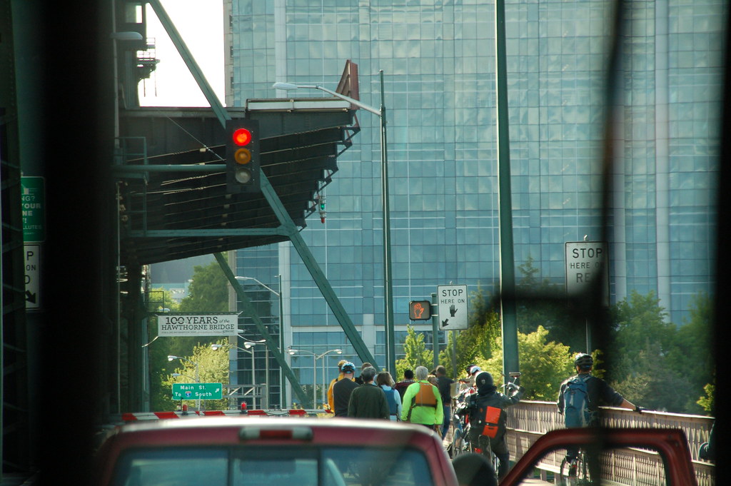
A few more folks have gathered to wait out the bridge lift. There's a curious person in the pickup truck in front of the bus.
DSC_0024

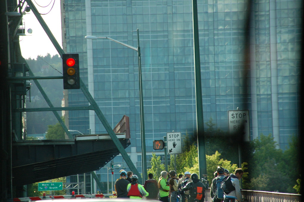
Can you tell that the lifted bridge section has moved down quite a bit from the earlier photos? And even more commuters wait patiently. I took this photo at 5:23 p.m.Not too many minutes later, the bridge lift completed, we continued our westbound ride across the Willamette River.

Monday, October 6, 2014

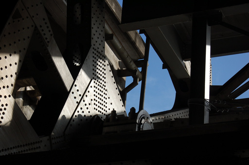
The blue sky seen from deep inside the leg of the Morrison Bridge while on the bridge walk, October 25, 2008


DSC_434

Here's what I mentioned on yesterday's post, the view as the bridge operator raised the bridge while we were down inside the western support. The towers are on the south side of the bridge, and we entered through the bridge operator's door.

Here's some info on the bridge that I found on the world wide web:

The bridge is the largest mechanical device in Oregon. Thirty-six feet gears drive 940-ton counterweights located inside each of the piers. The 69 ft. clearance is sufficient for most river traffic, requiring bridge openings only about 30 times a month. It currently carries 50,000 vehicles daily in six lanes. The canted windows of the control tower give the distinctive look of air traffic control towers. It is named after John L. Morrison, a Scottish immigrant who built the first home on Morrison Street. The current bridge does not connect to Morrison Street at its west end because the second bridge was left in operation while the latest version was built.

Sunday, October 5, 2014

I'm not gonna let vacation slow me down, y'all.


DSC_0890

I'm posting this photo today in honor of my departure from Portland's international airport, known as PDX. I'm off to England and Scotland for a Trafalgar tour, a dream trip with my friend Juliet who moved to Portland from Minneapolis. She found me through this blog! So cool!

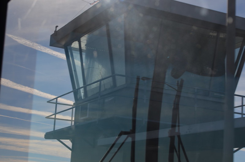
Don't be fooled, though. This is not the air traffic control tower seen from the airplane. I took this photo on October 5, 2013, from a TriMet bus window as we crossed the Morrison Bridge. The bridge operator works in there and raises the bridge as necessitated by Willamette River traffic. I've actually been on a tour of that bridge and got to go down into the support, which I call the leg, of the bridge through the door on the tower. After we walked down the stairs, the bridge operator raised the bridge and we got to hear and see all of the works move--Spielberg woulda loved that sound!--as well as a huge concrete section which eventually opened enough that we could see the sky!

Tuesday, March 4, 2014

While cold and blustery weather lingers, I'm dreaming and knowing this too will come, No. 5

I took this photo at 6:43 p.m. on June 14 2008, as I walked across the Morrison Bridge towards Southeast Portland. Look at that blue sky! I hope that I can remember to take a similar photo this year, just to document any changes in the buildings. And I hope that the sky is just as blue! Can you see the people walking on the Eastbank Esplanade? They know how to enjoy the Willamette River's east bank. When I got there, I walked down that spiral ramp and along the esplanade until I came to the Hawthorne Bridge. Then I walked across it and began my homeward bus rides, taking a couple of them to get home. I lived in Northwest Portland then, in the Alphabet District. My little Mama and our miniature dachshund Duncan were still alive then, and we totally enjoyed our lives in Portland. We'd been here two years, almost to the day.

P.S. I work in the brick building with the flags on top. When I take photos from the rooftop garden, I'm on that lower part of the building, very near those windows, the ones half visible due to the angle of the photo.


There's a nice patio there, a neat place to go outside at break or at lunch, to enjoy whatever the weather has to offer. Here it is after a rain had marked the edges of the tiles. I took this photo on August 23, 2013, at 7:13 a.m.

Wednesday, February 13, 2013

A shared mass transit stop on SE MLK

Click here for a trip to City Daily Photo, transporting you around the world every day.

DSC_0260_crp_rz


January 26 after the lecture at the Architectural Heritage Center, I decided to ride the Portland Streetcar down to the Oregon Rail Heritage Center to visit the steam locomotives. As you can see from this photo, the streetcar and the TriMet bus share this stop. That's the Morrison Bridge westbound approach you see there above the streetcar.


DSC_0259_crp_rz

I waited while this lady boarded the bus. I think it's fantastic how that little ramp automatically folds out of the bus floor once the driver activates it. Once the bus drove off, the streetcar moved into place beside the yellow strip of ADA truncated domes which serve as a detectable safety zone, a system of textured ground surface indicators which assist blind and vision impaired pedestrians. Personally, I find them helpful, too, especially when it's been raining. I feel like they're less slick than a wet sidewalk. Anyway, the doors on the streetcar slid open and I walked on, took a seat and looked out the huge windows as we continued southward are MLK, going underneath the eastbound exit ramp of the Morrison Bridge. I love mass transit!

Tuesday, January 24, 2012

Quirky find of mine, at the east end of the Morrison Bridge

DSC_0619p
I took this photo on November 20, 2010. SPF 100, 768,000 FL OZ. I can't remember how long the water tower was painted like this, but I do remember hearing something about its decoration being illegal, according to city guidelines. I thought it matched the hideously large signs about flying to Hawaii. If I were to remove anything from this intersection, it would be those signs, not the decoration on the water tower. I altered the photo with the HDR-ish special effect at Picnik.

Wednesday, September 21, 2011

A few views of Portland from the 30th floor of the Big Pink

August 23, with Milton and Kay, I enjoyed my city from on high, through these views from the Portland City Grill in downtown.

DSC_0077p_HDRish
Looking south along SW 5th Avenue. I cropped and altered with image at Picnik with the HDR-ish effect.

DSC_0088p
Looking southeast with the Morrison Bridge in the foreground--it's undergoing work to replace the open steel grating on the lift span. I cropped and sharpened the image a little bit at Picnik.

DSC_0089p_sharpen
Looking mostly south down the Willamette River. The bridges, from the foreground back--the Hawthorne Bridge, the Marquam Bridge, and then the Ross Island Bridge. This photo has been cropped and sharpened at Picnik.
More views soon.

Saturday, August 27, 2011

Portland, seen from the Aerial Tram

DSC_0190p
Looking north from the Aerial Tram, the Ross Island Bridge running east and west across the bottom of the photo, the Marquam Bridge curving north and south.

DSC_0166
The Marquam Bridge--the upper deck is I-5 northbound, the lower deck is I-5 southbound.

DSC_0175
The Ross Island Bridge goes over the Willamette River between southeast and southwest Portland. At the right edge of the photo, about a third of the way up from the bottom, you can see the Aerial Tram. I'm not sure if it is coming up or going down.

DSC_0183p
Looking pretty much northeast, you can see lots of southeast, northeast and north Portland. The bridges are, from right to left, Marquam, Hawthorne, Morrison, and Burnside.