Friday, August 28, 2009

The Downtown Plan

DSC_0096_downtown_plan_sign

Tidbits about The Downtown Plan, found here and there on the World Wide Web:

From American Heritage:
Two years before the 1972 Downtown Plan was passed, the New York Times architecture critic Ada Louise Huxtable described Portland as a collection of “towers, bunkers and bombsites.” To celebrate the plan’s thirtieth anniversary, the city could adopt a new motto: “We planned. It worked.”
...
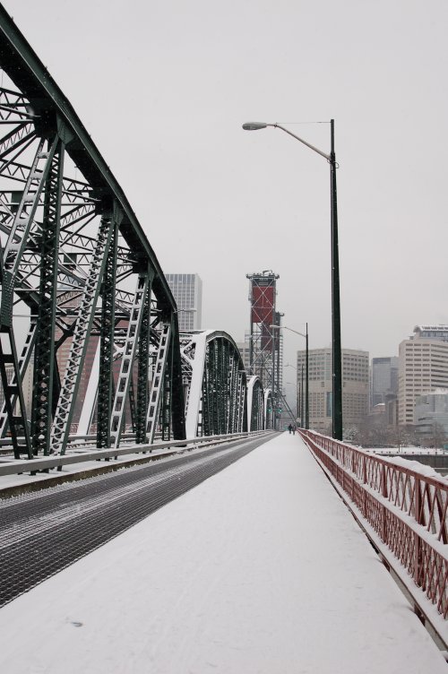
the measures outlined in the city’s 1972 Downtown Plan. The Steel Bridge offers a first glimpse of Tom McCall Waterfront Park, named for the governor who audaciously jackhammered away the unsightly riverside freeway. The first downtown stops are in Old Town and the Yamhill Historic District, which between them have America’s largest collection of cast-iron buildings outside Manhattan’s SoHo. A couple of stops later is Pioneer Place, one of the first of the downtown festival marketplaces that have enhanced so many cities since. Next stop is Pioneer Courthouse Square, which, complete with its speaker’s podium, has become the Hyde Park of Portland.
...
The Downtown Plan’s most significant accomplishment may be its taming of the automobile. Today, thanks to the guidelines first set down in the 1972 plan, virtually all of Portland’s buildings, even its parking garages, feature ground level retail spaces, turning every sidewalk into a true pedestrian experience. Curb extensions throughout the city make the city’s already narrow streets (20 to 60 feet wide at the broadest) yet more crossable.

From All Experts:
Portland, Oregon's skyline is centered mainly in the southwest district of the city. The skyline is usually viewed to the west, with the west hills in the background and the Willamette River in the foreground.

Portland is unique, in that in its founding, city blocks in downtown were made an even 61x61 meters (200x200 feet). This was to encourage easy walking and make more corner lots, which are more valuable. In addition, Portland's buildings are restricted in height.

The downtown area is usually considered to extend west from the Williamette River to Interstate 405, and south from W. Burnside St. to just south of the PSU campus (also bounded by I-405). Some might consider the South Waterfront area (currently in development) as a potential extension of downtown.

Success vs. Central City Decay
Downtown Portland largely escaped the central city flight (or "urban hollowing") that befell many U.S. cities in the 1970s through a program of aggressive city planning and transportation reform as part of the rather groundbreaking 1972 Downtown Plan (unlike most major downtown revitalization projects throughout the country at this time which normally called for wide-spread demolition and reconstruction). In the early 1970s, Portland's central city was beginning to decay, with the creation of suburban shopping malls in the neighboring cities of Beaverton, Tigard, and Gresham drawing away money and people from downtown. However, the creation of a downtown transit mall (1976) (see Transportation, below), a new waterfront park (1978) later named after Governor Tom McCall, the creation of the Pioneer Courthouse Square (1984), the construction of the Portland-Gresham light rail line in 1986 and the 1990 opening of Pioneer Place Mall successfully drew or retained businesses and lured customers. The downtown, which had been a virtual ghost town after 6pm, is now becoming more and more a vibrant all-hours shopping, dining, and business venue.

This apparent success due to Portland's policies has not been without criticisms. Some charge that the transit mall and increased pedestrian traffic has attracted transient and homeless persons from around the city, and aggressive panhandling has increased, despite periodic police crackdowns. Others argue that a proposed expansion of the transit mall is an unneeded expense, and that parking and traffic problems in the downtown area are an indication of the failure of Portland's transit policies to address growth-related problems.

Despite detractors, the majority of Portlanders believe in the success of its urban policies and many take pride in the accomplishments of the city and its regional planning in creating a very livable urban environment.
...
The city's downtown is also served by a number of alternate transportation options. Because of its shorter blocks, walking is often preferred by the locals. TriMet, the regional mass transit agency, operates MAX light rail east/west on Yamhill and Morrison street, and north/south on 1st Ave. An extensive transit mall (known as Portland Mall) on 5th and 6th Avenues is closed to cars in many areas and is where over 50 bus lines connect to one another and Portland's suburbs. Plans are currently in place to renovate 5th and 6th Avenues, and the transit mall, to accommodate light rail. This work is completed now.

Additionally, the City of Portland also operates the Portland Streetcar system from Riverplace north into the Pearl District. The system is approximately 8 km (5 mi) long, and an extension in under construction to South Waterfront, a new high-rise district south of downtown that will be connected by aerial tram to Oregon Health & Science University (OHSU). The tram is completed now.

ARTICLE
This article appeared in the November/December 2005 issue of the SPUR newsletter.

They Planned, It Worked
Learning from Portland’s collaborative approach to local governance

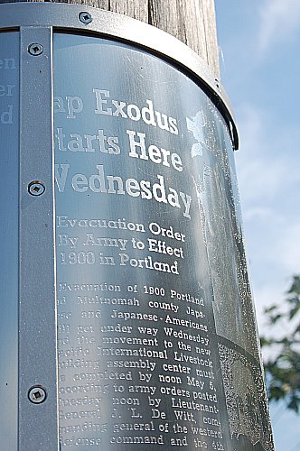
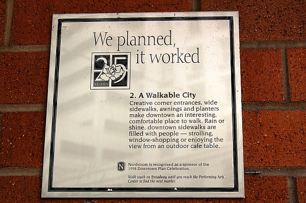
Is there any other city with so many plaques paying homage to planning? On buildings and in plazas one reads about Portland’s 1972 downtown plan, under the heading, “We Planned, It Worked.”
...
The Downtown Plan
Clearly, Downtown Portland is the glowing centerpiece of planning progress in the metropolis. On typical weekends, thousands assemble for a host of activities, most people using transit for access to this vibrant setting. The plan that was instrumental in making this happen was the Portland downtown plan. Before the 1960s there had been few signs of city improvement downtown. The catalyst for change in that was the leadership of the forward-looking mayor (and later governor), Neil Goldschmidt, who helped fend off competition from a regional supermall, rescue a bankrupt bus company, and prevent large-scale clearance of older historic neighborhoods by redevelopment. Goldschmidt mobilized talented professionals and fostered adoption of the first downtown plan in 1972. It included replacement of a riverfront expressway with parks; offered high-density retail corridors, and promoted transit across downtown; established a university district and other historic districts; and fostered higher-density housing.

The plan called for a downtown bus mall to speed service and allow transfer to other lines, thus tying the downtown and the region together along a north-south axis. The downtown bus mall today seems like a foreign and somewhat disruptive urban element, but it still works well as a transportation artery. With the addition of light rail, first from the east and later the west, both crossing downtown, there was a notable reduction of auto commuting, down to around 50 percent of employees. In 1988, the city adopted a Central City Plan, retaining the focus on urban design, subdistricts, and other elements to make the Central City more livable and walkable.

Wednesday, August 26, 2009

Another neighborhood rose

DSC_0024__22nd_place_rose
I took this photo walking from the bus to the apartment after work on Tuesday. Actually, I took a few and will share some others with you soon. They're too pretty to pass on.

Tuesday, August 25, 2009

Flags on a sign--huh?

DSC_0182_stop_sign_flags
"What's up with those flags?" I asked Leland as we pulled to a stop.

DSC_0180_new_flagged_stop_sign
"It's a new stop sign, Mom," he explained. "They put the flags on it to make sure people see it."

"Great idea!" I exclaimed.

Monday, August 24, 2009

Waiting for the streetcar

DSC_0034_wait_streetcar
I walked 11 blocks Thursday morning before catching the bus. I finally felt somewhat normal and wanted to take photos! I'd noticed several display windows a couple of blocks west of where I stood waiting for the bus. When I looked up and noticed this lady, I wished for my zoom but snapped anyway, hoping for a clear enough shot to crop closely. Got it. What fun! Have you had this kind of fun lately?

Friday, August 21, 2009

Thursday, August 20, 2009

What goes up ...

DSC_0119_boys_up_park

... can bounce.
DSC_0120_boys_down_park

I took these photos at lunch on May 1, 2009.

Wednesday, August 19, 2009

Reflections in John Helmer's front window, downtown Portland

DSC_270_helmers_sale_window_picnicked
I've posted twice about John Helmer's, Haberdasher, here and here.

I stay continually fascinated by their display windows.

Tuesday, August 18, 2009

Shedding some light on the subject?

DSC_279_
An empty window with its display lighting caught my eye. Would it have grabbed hold of you?

Monday, August 17, 2009

More of the PCPA Tour Guides tour of public art on the MAX Yellow Line

At the end of the Yellow Line, we followed our guide Valerie Otani off the MAX at the Expo Center Station. This particular public art is mainly Valerie's. Facts from TriMet's Web site.

DSC_0057
Valerie Otani addresses the theme of Japanese relocation during World War II at the site of the 1942 Portland Assembly Center.Traditional Japanese timber gates strung with metal "internee ID tags" mark station entrances. Vintage news articles are etched in steel and wrapped around the gate legs.
DSC_0051_picnicked

Bronze trunks provide seating on the platforms.
DSC_0034

Community maps feature the floor plan of the converted livestock exhibition hall and a copy of the exclusion order.
DSC_0036_picnicked

Info from the PCPA Volunteers Newsletter:
DSC_0038
Expo Center station was perhaps the most meaningful of our trip. Valerie Otani was the artist and she designed large timber gates reminiscent of those found in Asia. The gates reflect a transition, or an entrance, or beginning. The Expo Center was historically a livestock yard, but was converted into a temporary WWII internment center for those of Japanese descent.

At the top of the large gate are 4000 metal tags in commemoration of the 4000 internees located there. The tags resemble the ID tags required for all Japanese to wear.
DSC_0050

DSC_0053_picnicked

The base of each gate is wrapped in metal to protect its wooden structure – since this is art for the public and must be able to withstand public use. Some metal wrappings are etched with actual newspaper accounts of the time of internment which are shocking (and saddening) to our eyes.

DSC_0046_picnicked

DSC_0056_picnicked

DSC_0048
Ms. Otani is of Japanese descent and told us of her family’s story. Her immediate family lived in California and they were interned there. Her grandfather had lived in Hawaii for 30 years before the night of Pearl Harbor when he, and other leaders in the Japanese community, were arrested. He returned to Japan after the war and never saw his U.S. family again.

Sunday, August 16, 2009

I'm so excited, and I just can't hide it! I have a photo in the 2010 Hawthorne Bridge Calendar, celebrating 100 years in art and words!

DSC_0011_calendar_600

Back in mid-June I got at e-mail from Facebook, from Sharon Wood Wortman, Portland's Bridge Lady. Here's part of that e-mail: Lynette, I found your image of the Hawthorne Bridge during one of our snowstorms on your blog and would like to include it on the December page of the 2010 Hawthorne Bridge Commemorative Calendar. There are more than thirty images in the 2010 calendar. Yours will be one of the smaller images, but it's strategically placed.

Needless to say, my heart rate increased dramatically, and my breathing changed, too. I fulfilled the requirements to get my photo published in the calendar as quickly as possible to meet the printing deadline.

After I received a copy of it in the mail less than a month later, I got even more excited. My photo is small, but it's on December, 2010, the birthday month for the Hawthorne Bridge and me! It turns 100 a week after I turn 62! And my photo sits right beside Dec. 31, which would have been mine and LeRoy's 38th wedding anniversary.

The only way I could be happier is if I had one of the big photos for a month. But there's always the Steel Bridge that turns 100 in 2012 and the Broadway Bridge that celebrates its centennial in 2013. Maybe I can take a photo worthy of a big photo for one or both of those. It's a grand goal to have, don't you think?

Go to PDX Bridge Festival for all sorts of great info about the upcoming celebration. Plus there's a wonderful animation of the bridge going up.

Here's my photo which I named "Snow Break." Here in Portland Mama and I have enjoyed many a sun break, when the glorious sun bursts through the cloud cover, so it seem appropriate to me that this photo be named in honor of those wonderful moments--it was hardly snowing at all when I took this one as I walked west over the Hawthorne Bridge on January 16, 2007, during our first Portland snowstorm.
DSC_0087_Hawthorne_Bridge_Calendar_resized

One more thing I'm looking forward to, a Hawthorne Bridge chocolate bar from Jaciva's.

Saturday, August 15, 2009

Peaceful

Uncropped, just resized and sharpened at Picnick.
DSC_0425_600_white_rose_bud

All day Friday I battled vertigo, not even sure if I could look at the computer to put Saturday's post up, scheduled for early Saturday.

Finally, after several doses of my decongestant allergy medicine and my tight, tight, tight motion sickness bracelets at my wrists for 13 hours, I could do it.

In my goofy mind all day, I had in mind this peaceful rose bud to share with you. I photographed it at City Hall, downtown Portland.

Like Mr. Abe Lincoln said, he who used to blog all over the place and is now only at the worthy and rewarding Pick a Peck of Pixels, there's something wonderful about the darkness and light of the Old Masters, so when I snapped this photo I thought, "Ah, maybe I've got an Old Masters' sort here."

How do you like this cropped version? Sharpened, resized, and cropped at Picnick, using the constraint "Golden Ratio," to see what would happen. I left the constraint just as it appeared on the photo, no stretching from the corners.
DSC_0425_600_golden_ratio

Friday, August 14, 2009

Seen on the streets of Portland, No. 12

DSC_0076_600
A beauty, don't you think?

What year? I believe it's a Volkswagen Karmann Ghia.

Thursday, August 13, 2009

It's the ABC's of Portland, combining two favorites of lots of Portlanders

DSC_0065_600
A bicycle with a coffee cup--close-up
DSC_0064
A bicycle with a coffee cup--wide

I noticed this shiny little cup as I walked from my first bus to wait for my second bus. Gotta get the camera out and get a photo, I thought. What I really wanted to do was touch the coffee cup to see if it's a bicycle bell. I restrained myself, though, and only took the photos.

Wednesday, August 12, 2009

Y'all hungry? Let's go to 3 Doors Down Cafe, SE 37th and SE Hawthorne

What I had on Friday, August 7, 2009

DSC_0119_600
Appetizer: Pan-seared sea scallops, sauteed peaches, honey basil cream sauce.

DSC_0111_sharpened_fixed_600
Salad: Iceberg lettuce wedge with cashel blue cheese dressing (and a sweet and crunch giant onion ring that I think Lamont cooked)

DSC_0109_600
Cocktail: My first ever dirty martini

Tuesday, August 11, 2009

Look what I saw while on the PCPA Tour Guide tour when we rode the MAX Yellow Line to learn about TriMet's public art on display!

DSC_0028_paul _bunyan
Yep! It's a Paul Bunyan statue! While he's not part of the TriMet public art on the MAX Yellow Line, he's certainly worthy of a post.

Here's what I found about him, online at The Oregonian:
North Portland's Paul Bunyan is officially historic
by Lynne Terry, The Oregonian
Monday February 09, 2009, 9:15 PM

It's official: North Portland's quirky Paul Bunyan has joined the National Register of Historic Places.

The 31-foot-tall statue, created in 1959 to mark Oregon's centennial, was recognized as a "well-crafted example of roadside architecture."

"It encapsulates how people thought about their state and where they lived in a set period of time," said Ian Johnson, historian at the State Historic Preservation Office.

There are more than 1,800 other landmarks in the state listed in the national register, from Timberline Lodge on Mount Hood to the USS Blueback submarine at the Oregon Museum of Science and Industry.

But the Paul Bunyan statue is Oregon's only roadside architecture in the register.

It was commissioned by the Kenton Businessman's Club to greet the millions of visitors to the Centennial Exposition, set up at the current-day Expo Center in North Portland at a time when Interstate Avenue was the main gateway to Portland.

"People were really proud of it," Johnson said. "Paul Bunyan was a really popular figure at the time. Even though Paul Bunyan is a Minnesota legend, it made sense to folks out here because the timber industry was really important in Oregon."

It was designed by a father and son team, Victor R. and Victor A. Nelson, who owned and operated the nearby Kenton Machine Works. They built the statue's steel structure and then moved it into place, finishing it off with concrete, plaster and paint.

"It was not inexpensive or easy to do," Johnson said. "It actually has quite a bit of craftsmanship." Unlike lesser lumberjacks that straddle roadsides in the U.S., this one has impressive detail, like molded shoe laces and buttons. The eyes are raised as well, and the pockets and belt loops were not just painted -- they were cut out.

The statue was nominated for the register in part by Maiya Martin, a University of Oregon student, and Bette Davis Nelson, the widow of Victor R. Nelson.

"I wanted to honor my husband," Nelson, 75, of Lake Oswego told The Oregonian last year. "Vic was so proud and thankful for the statue and what it stands for."

Last year, a businessman offered to buy the statue and move it to North Carolina. The Kenton Neighborhood Association, which owns the statue, ruled that out. In October, Oregon's State Advisory Committee on Historic Preservation voted unanimously in favor of the nomination. Being including in the National Register doesn't bring much besides bragging rights, Johnson said.

But there is only one other Paul Bunyan statue in the National Register, a relatively puny 18-footer in Bemidji, Minn.

Neither is exactly pretty. But if you're worried about that, you've missed the point.

"The National Register doesn't recognize beautiful things," said Johnson. "It recognizes historically important things. That's a big distinction."

Monday, August 10, 2009

PCPA Tour Guides' tour of MAX Yellow Line Public Art Continues

Facts from TriMet's Web site.
DSC_0023
N Lombard Transit Center
Linda Haworth addresses the theme of labor in the community. Glass mosaic on columns and trash containers bring color to the area. (Parts that I didn't get to photograph included "Mosaic guardrail panels feature tools in dynamic settings." and "Community map artist Victor Maldonado used symbols of farm labor as metaphors for social progress." This intersection is where people transfer to go to Swan Island, an industrial area, thus Haworth's theme of labor.)

DSC_0024_mosaic_can
A trash can I barely managed to photograph as the train pulled away. Valerie told us that Haworth worked with Bullseye, a top-knotch stained glass manufacturer in Portland, to get the colors of the glass just like she wanted them, and she worked with tweezers to place the tiny, tiny pieces just right.

DSC_0113
Shelter columns and trash containers are wrapped in colorful glass tile.
I shot this photo of a bus stop at Lombard to show you how much larger it is than the usual ones--Valerie told us that this is the busiest mass transit intersection in the system. I think this is the westbound stop, based on where it is, so this info is about it: Westbound stop features windscreen glass designed by Makelike and a seating wall with ceramic tiles by Victor Maldonado.

Friday, August 7, 2009

Public art on the MAX Yellow Line--seen from the light rail train

All facts found at TriMet's Web site, including the story of the Yellow Line at the bottom of this post, and this about Art on Interstate MAX Yellow Line

Artwork at every stop along the MAX Yellow Line draws from the history and culture of the area to create a unique identity for each station.

With over 40 local artists contributing artwork and 75 community members participating in forums and committees, the art along MAX Yellow Line is a proud reflection of a historically rich and vital part of Portland.


We boarded a train around 10 a.m. for our two-hour tour. I couldn't get every shot I wanted due to being inside a moving train car, so I missed art at some stations completely, and at other stations, I only got tidbits. To have done a better job, I would have had to get off at every stop, walk around, look, take photos, wait for the next train. Since I had an appointment for a haircut and perm, and since I was part of an organized tour, I was a good girl and stayed with our tour guide Valerie Otani's plan. I am very glad that I did, but one of these days I want to go back and take a more in-depth look.

DSC_0145_rose_garden_art
Interstate/Rose Quarter Station: Brian Borrello presents a three-part metaphor for displacement and change. Illuminated metal trees generate their own electricity from solar panels.

DSC_0154_rose_garden_stumps
A virtual campfire flickers with light at night, surrounded by stainless steel stump seats.

max_art_tracks_wide
Wide view.

DSC_0019
N. Prescott St. Station: Works by Wid Chambers and Heidi Kirkpatrick are reproduced in porcelain enamel on steel. (I don't know which is which. Valerie explained that the idea was to open the public art up to more than sculptors with these works on TriMet's boxes that contain something important to the trains, can't remember what exactly.)

DSC_0021
N. Killingsworth Station: Adriene Cruz and Valerie Otani celebrate the vibrant multiculturalism of the Killingsworth community. Glass mosaic on columns recalls the colorful patterns of African Kente cloth.

DSC_0121
Guardrail panels were inspired by South American textiles. Cast-concrete benches evoke the carved wooden stools of Africa.

The MAX Yellow Line is a 5.8-mile (9.3 km) (not including segments downtown shared with other lines) route in the Metropolitan Area Express light rail system in Portland, Oregon. The route, which opened May 1, 2004,[1] runs between downtown Portland and the Portland Expo Center. It is also known as the Interstate MAX because the majority of the line runs along Interstate Avenue in North Portland.

The Yellow Line is the newest MAX line currently in full operation. Originally, it was conceived as part of a north-south light rail project between Vancouver, Washington, and Milwaukie to be built using city funds, but that plan was rejected by voters. TriMet then learned that a majority of the residents of North Portland had voted in favor of the original plan, so they decided to build this new line without using city funds. To do this, they convinced the City of Portland to create an urban renewal district along the proposed line, which made them eligible for matching federal funds with which they could finance the construction of the MAX line. The project was finished four months ahead of schedule at a budget of $320 million, $25 million under budget.[1] The presence of the line has also caused a great deal of redevelopment along its corridor.

The Yellow Line will move to the Portland Transit Mall on August 30, 2009.[2] Additionally, there are plans for extensions at both ends, from downtown Portland southward to Milwaukie as part of the so-called MAX Orange Line (which will likely be a Yellow Line extension), and from the Expo Center into Vancouver, Washington, via Interstate 5 and SR-500.

Thursday, August 6, 2009

PCPA tour guide essentials, for our Yellow Line MAX Public Art tour

Portland Center for the Performing Arts Volunteer Coordinator Margie demonstrates the first essential, a camera.
DSC_0007_margie_camera

One tour guide demonstrates validating a previously purchased TriMet ticket.
DSC_0008

Another uses a card to purchase a ticket.
DSC_0009

Here it is. Honored Citizen is TriMet's term for seniors.
DSC_0011

Remember I told y'all that Saturday, July 25, the day of the tour, was the first in the 10-day streak of temps above 90 degrees for Portland? So, the water bottle pictured here represented an essential for real. Two ladies had theirs in home-made carriers. If you look closely in today's first photo, in the back between the people, you can see the carrier on her shoulder. Pretty doggone neat!
DSC_0005

These smart, creative ladies crocheted the net shape and then crocheted it right onto the strapping--amazing!
DSC_0006

Our final essential, artist Valerie Otani.
DSC_0015_Valerie_Otani
Here's a bit about her artistic philosophy that I found on the Internet, at the Seattle Public Library's Web site:
Portland artist Valerie Otani sees public art as connecting people to a site and strengthening the impact of a place in the context of urban design. Creating lively public spaces with artwork that intrigues, challenges and inspires us is part of a larger goal of improving the quality of civic life. Much of her work has been on design teams, identifying opportunities and maximizing the impact of art in a total project, then doing a project as well. Her work reveals an unknown aspect of everyday experience - a revelation that creates a bond linking us to our place in our community. Otani provided design team collaboration on the Greenwood Branch project.

Wednesday, August 5, 2009

Thirsty dog drinks

DSC_0003_lab_drinks_bubbler
As we PCPA tour guides waited patiently on the south side of Pioneer Courthouse Square, I noticed a sight I had to photograph, quickly. As it was, I missed the woman bending over and drinking from the fountain head to the dog's right. Drat!

OK. I'm happy with the photo that I got, but I would have been thrilled to have had one of the two of them sharing the Benson Bubbler.

Turns out Saturday, July 25, would become the first of 10 days in a row when Portland's temperature topped 90 degrees. I think this beautiful dog knew something we didn't.

Tuesday, August 4, 2009

University of Oregon motorcyclist on an early Saturday morn

DSC_0001_motorcyclist
About 9:15 a.m., I'm at the corner of W. Burnside and NW 21st, waiting for the 15 bus to take me close to Pioneer Courthouse Square, July 25, watching traffic and pedestrians. I heard the motorcycle and turned to my left, looked, thought "Photo opportunity," lifted the camera to my eye from around my neck, and snapped this one. It doesn't do his deep tan justice, nor did I get his mustache, doggone it. While he's no spring chicken, you certainly can't tell it from this photo. And when I looked at the photo at its largest size on Flickr, I think I saw a scar on his knee, like he might have scraped it on some pavement somewhere sometime. And then I noticed a pale turquoise X on his thigh. What? A band-aid maybe? I just don't know.

Anyway, I wasn't out waiting for a bus just to take photos of interesting passers-by. I was headed for Pioneer Courthouse Square to meet up with a some of the Portland Center for the Performing Arts Tour Guides. Our latest perk, a tour of the public art on TriMet's Yellow Line Max, with Valerie Otani, one of the artists who helped plan and create it. Here's a bit from TriMet's Web site:
Art on Interstate MAX Yellow Line

Artwork at every stop along the MAX Yellow Line draws from the history and culture of the area to create a unique identity for each station.

With over 40 local artists contributing artwork and 75 community members participating in forums and committees, the art along MAX Yellow Line is a proud reflection of a historically rich and vital part of Portland.


Y'all know I'm going to put photos here soon! Hope you'll come back to look.

Monday, August 3, 2009

Pedestrians engulfed by a wedding party

I took this photo on Friday, June 26, after work. Naturally as I clicked the button on the Nikon D50, I noticed the red wedding gown, the white bridesmaid dresses, the man in white who must be the groom and the men in black, the groomsmen.
DSC_0070_wedding_pedestrians_curb
It wasn't until I had downloaded the photo to Honk that I noticed the two lady pedestrians waiting on the corner for the light to change.

I would love to know what they were thinking as they joined the entourage in the crosswalk.
DSC_0073_wedding_party_red_dress_sharpened